
Grube Gotthold ("Gotthold Pit") is a former brown coal and gravel pit in the South Brandenburg county of Elbe-Elster.
Grube Gotthold ("Gotthold Pit") is a former brown coal and gravel pit in the South Brandenburg county of Elbe-Elster.


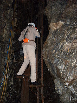
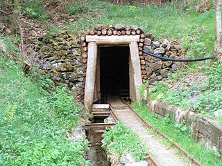
The former mine known as Grube Gotthold is located about 2 kilometres west of the village of Hohenleipisch in the German state of Brandenburg. The Lusatian Lower Seam (Unterflöz, 2nd Lusatian seam horizon, middle Miocene) reaches a thickness here of 2.7 to 4.0 metres. The pit was opened on 22 March 1912 and brown coal was initially mined underground. A narrow gauge pit railway transported the coal to the loading ramp of the Upper Lusatian Gravel and Sand Works (Oberlausitzer Kies- und Sandwerke, OKS) about 3 kilometres away in Biehla. An entry in the companies register on 17 January 1913 records the Gotthold Brown Coal Mine (Braunkohlengrube Gotthold). The first managers of the business, which had its head office in Elsterwerda and a share capital of initially 39,000 marks, were Paul Freitag and Franz Kotik. By 1913 the pit had reached its peak brown coal production of 20,860 tonnes. From 1914, open cast mining became increasingly important alongside underground mining operations. As well as brown coal the mine also extracted crystalline quartz sand. From 1916 to 1919 a steam excavator (Dampflöffelbagger) was used; it was replaced in 1920 by a bucket dredger (Eimerkettenbagger) with a maximum carrying capacity of 150 m3/h.
The extraction of quartz sand became increasingly important and, in the end, threatened the coal mining operation. In 1922 of the 23 employees in the mine, only one was a coal worker. In the same year, the narrow gauge railway, whose obvious lack of safety led to numerous complaints, was replaced by a cable railway.
During the Second World War almost all the young men employed in the mine were called up for military service and were initially replaced by French prisoners of war. From 1943, 15 Soviet prisoners of war from Stalag IV-B at Mühlberg worked here. Evcen when their working day ended they were sent to help in the strawberry fields of Hohenleipisch. In 1945 mining operations came to a standstill because the pumping station no longer worked and the pit slowly filled with water.
A devastating forest fire on the Liebenwerda Heath in 1947 destroyed a huge area of the adjacent forest as well as all the mining buildings and burned out the coal seam at Grube Gotthold, leading to the final closure of the mine. [1] [2]
From 1960, large parts of the adjacent forest of the old Liebenwerda District Heathland (Liebenwerdaer Amtsheide) were used as a military training area by the NVA. In the course of the expansion of this area, Grube Gotthold was placed out-of-bounds. It was planned to be used for water training for engineer and recce troops, but due to the geological circumstances of the mine, these plans were never put into action. [3]
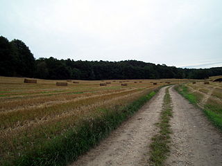
Today the terrain of the former brown coal pit is part of the Forsthaus Prösa Nature Reserve which was established in 1990. [4]
Düren is a Kreis (district) in the west of North Rhine-Westphalia, Germany. Neighboring districts are Heinsberg, Neuss, Rhein-Erft-Kreis, Euskirchen and Aachen.

Senftenberg is a town in Lower Lusatia, Brandenburg, Germany, capital of the Oberspreewald-Lausitz district.

Lake Berzdorf is located at the southern city limits of Görlitz in Upper Lusatia. It consists of the residual hole of the former Berzdorf open-cast lignite mine, which was flooded from 2002 to the beginning of 2013. The lake forms the southeastern corner of the Lusatian Lake District. With its volume of about 330 million cubic meters and a water depth of max. 72 meters on an area of 960 hectares, it is one of the largest lakes in Saxony. Its name derives from the small village Berzdorf, which was devastated in 1969/70.
Schwarzheide is a town in the Oberspreewald-Lausitz district, in Lower Lusatia, Brandenburg, Germany. It is situated on the river Schwarze Elster, 11 km southwest of Senftenberg, 110 km south of Berlin and 40 km north of Dresden. The little river Pössnitz runs through the eastern part of Schwarzheide.

Hohenleipisch is a municipality in the Elbe-Elster district, in Brandenburg, Germany.
Plessa is a municipality in the Elbe-Elster district, in Brandenburg, Germany.
The Geisel valley is a valley in Saxony-Anhalt, Germany, situated west of Merseburg, Saalekreis district. It is named after the River Geisel which rises in Mücheln and is a tributary of the Saale, just under 25 km (16 mi) long.
The Samson Pit or Samson Mine is an historic silver mine in Sankt Andreasberg in the Upper Harz region of central Germany.
The Kutschenberg is the highest hill in Brandenburg, Germany. It is part of the low hill range of the Kmehlener Berge and rises near Großkmehlen in the county of Oberspreewald-Lausitz. It is 201 m above sea level (NHN) and located only a few metres from the state border with Saxony.
The Roter Bär Pit in Sankt Andreasberg in the Upper Harz is an iron ore mine that was worked from about 1800 until the 1860s. Today it is operated as a show mine under the name of Roter Bär Pit Educational Mine by the Sankt Andreasberg Society for History and Archaeology. The name Roter Bär means "Red Bear".

Elsterwerda station is in the town of Elsterwerda in the German state of Brandenburg. It lies on the Berlin–Dresden railway. The station is known for a train crash in 1997, when a freight train with 22 petrol tankers derailed and exploded on the station premises.
The Upper Lusatian Heath and Pond Landscape is a natural region in Saxony. It runs from a line between Wittichenau and Kamenz for roughly 60 kilometres in an east-west direction as far as the River Neisse. Its width between the bordering natural regions of the Upper Lusatian Gefilde and Eastern Upper Lusatia to the south and the Muskau Heath and Upper Lusatian Mining Region to the north is between 15 and 20 kilometres.

Bertzit Tower is an investment ruin in the north of Kahla, which belongs to Plessa in the southern part of Brandenburg, itself part of the Elbe-Elster region.

The Caroline Pit in the Eberbächle, a side valley of the Brettenbach, is an old silver mine in Sexau in the Black Forest in Germany which is open to the public as a show mine. In 1987, volunteers began to uncover the pit and maintain it. It lies within the mining region of Sexau and Freiamt.
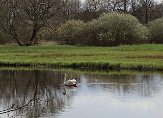
The Alte Röder Nature Reserve lies on the left bank of the Black Elster river between the village of Prieschka in the municipality of Bad Liebenwerda and the village of Würdenhain which belongs to Röderland. It is located within the Lower Lusatian Heath Nature Park, which covers an area of 484 km². The lowland valley of the Röder stream has been protected since 1981 and contains one of the most settled colonies of the Elbe Beaver, a species of beaver threatened by extinction. One of its main conservation aims is the preservation and development of this area as a habitat for the Elbe Beaver and other endangered species.

Elbe-Elster Land, also called the Elbe-Elster region (Elbe-Elster-Gebiet) is a region around the tripoint of the German states of Brandenburg, Saxony-Anhalt and Saxony. It is part of the North German Plain and is named after the two major rivers that have their confluence here: the Elbe and the Black Elster.

Ort der Vielfalt is an initiative launched in 2007 by the Federal Ministry of Family Affairs, Senior Citizens, Women and Youth, the Federal Ministry of the Interior and the Federal Government Commissioner for Migration, Refugees and Integration with the aim of strengthening the commitment of communities, towns and districts in Germany to cultural diversity. This initiative comes from the federal programmes Vielfalt tut gut. Jugend für Vielfalt, Toleranz und Demokratie and kompetent. für Demokratie – Beratungsnetzwerke gegen Rechtsextremismus. Since 1 January 2011, the Federal Programme Toleranz fördern – Kompetenz stärken has again been continuing the two federal programmes under one roof.

The area around Wiesloch, Germany, is a historical centre for mining, running between Roman times and the earlier 2000s. The area is situated on the eastern edge of the Upper Rhine Plain and contains large concentrations of carbonate-hosted lead-zinc ore deposits. Lime for cement is still actively mined in the vicinity, with most of the clay pits closed, and the last heavy metal mine operated until 1953 by Stolberger Zink. On top of the escarpment metals and lime have been mined, with clay and sand mined at the end of the valley floor where faulting has brought different layers closer to the surface.
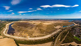
The Cottbuser Ostsee is an artificial lake under development on the grounds of the former open-pit lignite mine de:Tagebau Cottbus Nord near Cottbus, Brandenburg, Germany.

The Rheinisches Braunkohlerevier, often called the Rhenish mining area, is a lignite mining area or district in the Cologne Bay, on the northwestern edge of the Rhenish Slate Mountains. The mining of lignite using the open pit method has had a significant impact on the landscape here and led to the formation of several important industrial sites. The area includes the Zülpicher and Jülicher Börde, the Erft lowlands and the Ville, making it the largest lignite mining area in Europe. To a lesser extent clay, silica sand and loess are mined here. The area is the only active lignite mining area in what was West Germany during German partition and contains the mines with the largest surface area, greatest depth, and biggest annual output of coal.