Gmina Gnojno is a rural gmina in Busko County, Świętokrzyskie Voivodeship, in south-central Poland. Its seat is the village of Gnojno, which lies approximately 18 kilometres (11 mi) north-east of Busko-Zdrój and 35 km (22 mi) south-east of the regional capital Kielce.
Gmina Stopnica is a rural gmina in Busko County, Świętokrzyskie Voivodeship, in south-central Poland. Its seat is the village of Stopnica, which lies approximately 17 kilometres (11 mi) east of Busko-Zdrój and 55 km (34 mi) south-east of the regional capital Kielce.

Kołaczkowice is a village in the administrative district of Gmina Busko-Zdrój, within Busko County, Świętokrzyskie Voivodeship, in south-central Poland. It lies approximately 12 kilometres (7 mi) east of Busko-Zdrój and 47 km (29 mi) south-east of the regional capital Kielce.
Widuchowa is a village in the administrative district of Gmina Busko-Zdrój, within Busko County, Świętokrzyskie Voivodeship, in south-central Poland. It lies approximately 6 kilometres (4 mi) east of Busko-Zdrój and 49 km (30 mi) south of the regional capital Kielce.
Brzozówka is a village in the administrative district of Gmina Tuczępy, within Busko County, Świętokrzyskie Voivodeship, in south-central Poland. It lies approximately 6 kilometres (4 mi) west of Tuczępy, 17 km (11 mi) north-east of Busko-Zdrój, and 45 km (28 mi) south-east of the regional capital Kielce.
Chałupki is a village in the administrative district of Gmina Tuczępy, within Busko County, Świętokrzyskie Voivodeship, in south-central Poland. It lies approximately 4 kilometres (2 mi) west of Tuczępy, 18 km (11 mi) north-east of Busko-Zdrój, and 46 km (29 mi) south-east of the regional capital Kielce.
Dobrów is a village in the administrative district of Gmina Tuczępy, within Busko County, Świętokrzyskie Voivodeship, in south-central Poland. It lies approximately 5 kilometres (3 mi) north-east of Tuczępy, 25 km (16 mi) east of Busko-Zdrój, and 49 km (30 mi) south-east of the regional capital Kielce.
Góra is a village in the administrative district of Gmina Tuczępy, within Busko County, Świętokrzyskie Voivodeship, in south-central Poland. It lies approximately 2 kilometres (1 mi) east of Tuczępy, 23 km (14 mi) east of Busko-Zdrój, and 50 km (31 mi) south-east of the regional capital Kielce.
Januszkowice is a village in the administrative district of Gmina Tuczępy, within Busko County, Świętokrzyskie Voivodeship, in south-central Poland. It lies approximately 4 kilometres (2 mi) east of Tuczępy, 24 km (15 mi) east of Busko-Zdrój, and 52 km (32 mi) south-east of the regional capital Kielce.
Jarosławice is a village in the administrative district of Gmina Tuczępy, within Busko County, Świętokrzyskie Voivodeship, in south-central Poland. It lies approximately 4 kilometres (2 mi) south-east of Tuczępy, 24 km (15 mi) east of Busko-Zdrój, and 53 km (33 mi) south-east of the regional capital Kielce.
Kargów is a village in the administrative district of Gmina Tuczępy, within Busko County, Świętokrzyskie Voivodeship, in south-central Poland. It lies approximately 6 kilometres (4 mi) west of Tuczępy, 16 km (10 mi) east of Busko-Zdrój, and 46 km (29 mi) south-east of the regional capital Kielce.
Nieciesławice is a village in the administrative district of Gmina Tuczępy, within Busko County, Świętokrzyskie Voivodeship, in south-central Poland. It lies approximately 3 kilometres (2 mi) south-east of Tuczępy, 22 km (14 mi) east of Busko-Zdrój, and 51 km (32 mi) south-east of the regional capital Kielce.
Niziny is a village in the administrative district of Gmina Tuczępy, within Busko County, Świętokrzyskie Voivodeship, in south-central Poland. It lies approximately 6 kilometres (4 mi) east of Tuczępy, 26 km (16 mi) east of Busko-Zdrój, and 53 km (33 mi) south-east of the regional capital Kielce.
Podlesie is a village in the administrative district of Gmina Tuczępy, within Busko County, Świętokrzyskie Voivodeship, in south-central Poland. It lies approximately 2 kilometres (1 mi) north of Tuczępy, 21 km (13 mi) east of Busko-Zdrój, and 47 km (29 mi) south-east of the regional capital Kielce.
Rzędów is a village in the administrative district of Gmina Tuczępy, within Busko County, Świętokrzyskie Voivodeship, in south-central Poland. It lies approximately 5 kilometres (3 mi) east of Tuczępy, 25 km (16 mi) east of Busko-Zdrój, and 51 km (32 mi) south-east of the regional capital Kielce.
Sachalin is a village in the administrative district of Gmina Tuczępy, within Busko County, Świętokrzyskie Voivodeship, in south-central Poland. It lies approximately 4 kilometres (2 mi) north of Tuczępy, 22 km (14 mi) north-east of Busko-Zdrój, and 46 km (29 mi) south-east of the regional capital Kielce.
Sieczków is a village in the administrative district of Gmina Tuczępy, within Busko County, Świętokrzyskie Voivodeship, in south-central Poland. It lies approximately 2 kilometres (1 mi) north-west of Tuczępy, 20 km (12 mi) east of Busko-Zdrój, and 48 km (30 mi) south-east of the regional capital Kielce.
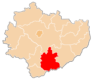
Tuczępy is a village in Busko County, Świętokrzyskie Voivodeship, in south-central Poland. It is the seat of the gmina called Gmina Tuczępy. It lies approximately 21 kilometres (13 mi) east of Busko-Zdrój and 49 km (30 mi) south-east of the regional capital Kielce.
Wierzbica is a village in the administrative district of Gmina Tuczępy, within Busko County, Świętokrzyskie Voivodeship, in south-central Poland. It lies approximately 3 kilometres (2 mi) north-east of Tuczępy, 23 km (14 mi) east of Busko-Zdrój, and 49 km (30 mi) south-east of the regional capital Kielce.