Guarello Island

Last updated
Guarello Island
Native name:
Isla Guarello
Navegando por Seno Contreras.JPG
Guerello Island seen from Contreras Sound
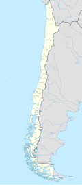
Chile location map.svg
Red pog.svg
Guarello Island
Geography
Coordinates 50°23′S75°20′W / 50.383°S 75.333°W / -50.383; -75.333 Coordinates: 50°23′S75°20′W / 50.383°S 75.333°W / -50.383; -75.333
Adjacent bodies of water Pacific Ocean
Administration
Region Magallanes
Additional information
NGA UFI=-883834

Guarello Island (Spanish: Isla Guarello) is an island in Madre de Dios Archipelago in Magallanes Region. Guarello Island is in a limestone area that also includes Madre de Dios Island. The island has the world's southernmost limestone mine and it has reserves for 100 years, and 600,000 tons of limestone with a millesimal fineness of 96% of Calcium carbonate are extracted each year. Half of the production is used in the steel mills of Huachipato which also owns the mines.

See also


Related Research Articles

Classification of indigenous peoples of the Americas Wikipedia list article

Classification of indigenous peoples of the Americas is based upon cultural regions, geography, and linguistics. Anthropologists have named various cultural regions, with fluid boundaries, that are generally agreed upon with some variation. These cultural regions are broadly based upon the locations of indigenous peoples of the Americas from early European and African contact beginning in the late 15th century. When indigenous peoples have been forcibly removed by nation-states, they retain their original geographic classification. Some groups span multiple cultural regions.

Department of Madre de Dios Departments of Peru

Madre de Dios is a department and region in southeastern Peru, bordering Brazil, Bolivia and the Peruvian departments of Puno, Cusco and Ucayali, in the Amazon Basin. Its capital is the city of Puerto Maldonado. It is also the third largest department in Peru, after Ucayali and Loreto. However, it is also the least densely populated department in Peru, as well as its least populous department.

Madre de Dios River River in Peru and Bolivia

The Madre de Dios River is a river shared by Bolivia and Peru which is homonymous to the Peruvian region it runs through. On Bolivian territory it receives the Beni River, close to the town of Riberalta, which later joins with the Mamore River to become the Madeira River after the confluence. The Madeira is a tributary to the Amazon River.

Madre de Dios may refer to:

Puerto Maldonado Place in Madre de Dios, Peru

Puerto Maldonado is a city in southeastern Peru in the Amazon rainforest 55 kilometres (34 mi) west of the Bolivian border, located at the confluence of the Tambopata and Madre de Dios rivers. The latter river joins the Madeira River as a tributary of the Amazon. This city is the capital of the Madre de Dios Region.

Joseph Ingraham

Joseph Ingraham (1762–1800) was an American sailor and maritime fur trader who discovered several islands of the Marquesas Islands while on his way to trade along the west coast of North America. He was also a prisoner in the American Revolutionary War and an officer in the United States Navy.

Madre de Dios Island is an uninhabited island in the Magallanes Region, Chile. It is located west of the Trinidad Channel and Concepción Channel. Madre de Dios Island is composed partly of limestone and has several natural caves. In one of those caves, called the "Cave of the Whales", skeletons of whales 2600 to 3500 years old have been discovered 10 to 30 meters above sea level. In another cave, named Cueva del Pacifico, rock art was discovered in 2006. Many other caves near the coast were used by the indigenous Kaweskar people for burial. One skull found dates back to 4500 years ago. Some caves were used as temporary camps. The island, along with 53 smaller nearby islands, was protected as a nature reserve in 2007.

Geology of Chile

The geology of Chile is a characterized by processes linked to subduction such as volcanism, earthquakes and orogeny. The buildings blocks of Chile's geology assembled during the Paleozoic Era. Chile was by then the southwestern margin of the supercontinent Gondwana. In the Jurassic Gondwana began to split and the ongoing period of crustal deformation and mountain building known as the Andean orogeny began. In the Late Cenozoic Chile definitely separated from Antarctica, the Andes experienced a great rise accomplained by a cooling climate and the onset of glaciations.

Madre de Dios Mine

Madre de Dios, located east the town of Máfil in Chile, is a placer deposit of gold that has been mined several times since its discovery in 1556. The bedrock of the Madre de Dios area is made of metamorphic and crystalline rocks of Paleozoic age all part of the Bahía Mansa Metamorphic Complex. These rocks are covered with thick layers of glacial gravel from the Tertiary. Gold eroded from the gravel have deposited in nearby streams, thus giving origin to the placer deposit. The deposit was discovered by Spaniards in 1556 but was not mined extensively until the late 19th century.

The southern coast of Chile presents a large number of fjords and fjord-like channels from the latitudes of Cape Horn to Reloncaví Estuary. Some fjords and channels are important navigable channels providing access to ports like Punta Arenas, Puerto Chacabuco and Puerto Natales.

Archipelagoes of Patagonia

The landmass known as Patagonia hosts a series of archipelagoes, all of them located on its western and southern coast. These archipelagoes, with the exception of Tierra del Fuego, lie in Chile and in the Pacific Ocean, covering about one third of Chile's coast.

ConcepciĆ³n Channel

Concepción Channel is an inside passage of the Chilean Patagonia. It extends from the point where Wide Channel and Trinidad Channel meet to the open sea. It is located at 50°30′S74°55′W and separates Madre de Dios Island and Duke of York Island, on the west side, from the Wilcock Peninsula and smaller islands, on the east side. Inocentes Channel is adjacent to the Concepción Channel.

Mission of Nahuel Huapi

The Mission of Nahuel Huapi was an intermittent Jesuit mission that existed in colonial times on the shores of Nahuel Huapi Lake, northern Patagonia. The exact locations of the missions are not known but it has been suggested, based on a Christian grave finding, that the mission of the early 18th century was located in Huemul Peninsula.

Madre de Dios Terrane is a distinct fragment of Earth's crust in southwestern Patagonia. Subduction made the Madre de Dios Terrane collide and accrete to Patagonia in the Mesozoic. This accretion is thought to have happened at a different location than today and the current location of the terrane is would be the result of displacement along dextral faults. The terrane is made up of three distinct units: