Sindhanur is a city and taluk headquarter of Sindhanur taluk of Raichur District in Karnataka. The river Tungabhadra covers the irrigation area by left bank canal. Most of the land in the field is composed of cultivable black soil. Paddy is cultivated using the Tungabhadra River water. Sindhanur is also known as the Paddy Granary of Raichur. With the availability of Tungabhadra river water, paddy rice is grown twice a year. Sindhanur is the place where the majority of tractor sales take place in Asia. as agricultural activities take place year-round. Sona Masuri and Basmati rice are grown in Sindhanur.Amba Matha also spelled as Amba Mutt is a village near Somalapura in the Sindhanur taluk. Amba Matha is a holy place, Sri Amba Devi Temple is located in the village.

Hassan is a city in the southern part of the Indian state of Karnataka. It is the headquarters of Hassan district. The city is situated midway between Bangalore and Mangalore on National Highway 75.

Hassan is one of the 31 districts of Karnataka, India. The district headquarter is Hassan. It was carved out from Mysore district in the year 1866, during the Commissioner's Rule of Mysore (1831-81).

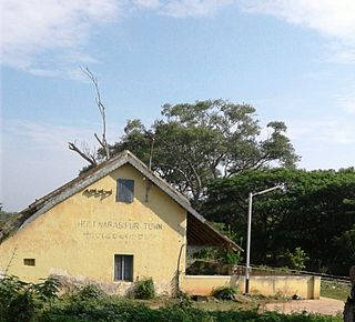
Holenarasipura is a town and taluk in Hassan district of Karnataka. The town is situated on the banks of the Hemavati, one of the tributaries of the Kaveri.
Arkalgud, also known as Arakalagudu is a panchayat town and is one among the eight taluks of Hassan district in the state of Karnataka, India. It is situated 30 km from Hassan, 181 km from Mangalore and 195 km from Bangalore. The river Hemavati forms the entire northern boundary of the Taluk; river Kaveri runs through a portion of the south. It is well connected by road to many towns and cities of Karnataka. Hassan Junction railway station is the nearest major railway station and Kannur International Airport is the nearest airport at 150 kilometres.
Narasimharajapura or NRpura is town and taluk headquarter in Chikkmagaluru district, Karnataka, India. It is situated in the Malenadu region of the district. In 1915, Yuvaraja Shri Narasimharaja Wodeyar visited Yedehalli and in his memory, the town was named after him. The taluk was ruled by Ganga, Kadamba, Santhara, Hoysala and Vijayanagara kings.

Sakleshpur, Sakleshpura or Sakleshapura is a hill station town and headquarters of Sakleshpur taluk in Hassan district in the Indian state of Karnataka.

Channarayapatna is a town and Taluk headquarters in Hassan district of Karnataka, India. It lies on the Bangalore-Mangalore National Highway-75 in Karnataka, India.It has number of temples like Channakeshava temple, Anjaneya temple, Tejigereyamma temple... etc. Famous Jain pilgrimage Shravanabelagola belongs to this taluk. Channarayapatna has major railway connection from Bengaluru to Mangaluru, Karwar and also Mysuru.
Alur also spelled as Alooru is a town and the taluk headquarters of Alur Taluk in Hassan district in the state of Karnataka, India. It is 14 km from Hassan City. Alur town is offset by 2 kms from NH-75. Alur has a railway station, named "Alur Halt", located on Mangalore-Hassan line. But no train stops at this station.
Arehalli is a village in the state of Karnataka in southern India.As per census 2011, the location code number of Arehalli is 615144. It is located in the Belur taluk of Hassan district in Karnataka, and is about 230 kilometres from the state capital Bangalore, and 146 kilometres from the chief port city of Mangalore. It is well connected by road through the city of Hassan. The nearest airport is Mangalore International Airport at 160 km, and the nearest major railway station is Hassan Junction railway station located at a distance of 46 km; Sakleshpura railway station is 17 km away.

Konanur is a mid level town in the southern state of Karnataka, India. It is located in the Arkalgud taluk of Hassan district in Karnataka.
Adike Bommanahalli is a village in the southern state of Karnataka, India. It is located in the Arkalgud taluk of Hassan district in Karnataka.
Agrahara (Arkalgud) is a village in the southern state of Karnataka, India. It is located in the Arkalgud taluk of Hassan district in Karnataka

Akkalavadi is a village in the southern state of Karnataka, India. It is located in the Arkalgud taluk of Hassan district in Karnataka.

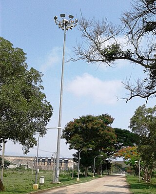
The Gorur Dam is constructed across the Hemavati river in 1979. The dam is located in Gorur village of Arkalgud Taluk, Hassan district, Karnataka.

Athini is a small village in Hassan district of Karnataka state, India.
Hampasandra is a village in the southern state of Karnataka, India. It is located in the Gauribidanur taluk of Chikkaballapura district in Karnataka. It is situated 15 km (9.3 mi) away from sub-district headquarter Gauribidanur and 60 km away from district headquarter Chikkaballapura.
Huduthi Nagasandra commonly known as H. Nagasandra is a village in the southern state of Karnataka, India. It is located in the Gauribidanur taluk of Chikkaballapura district in Karnataka. It is situated 7 km away from sub-district headquarter Gauribidanur and 42 km away from district headquarter Chikkaballapura.
Doddakurugodu is a village in the southern state of Karnataka, India. It is located in the Gauribidanur taluk of Chikkaballapura district in Karnataka. It is situated 9 km away from sub-district headquarter Gauribidanur and 43 km away from district headquarter Chikkaballapura.
State Highway 8, also known as SH-8, is a State highway connecting Hirisave of Hassan district and Chettalli of Kodagu district, in the South Indian state of Karnataka. It has a total length of 184 kilometres (114 mi).


