
Mongar is a town and the seat of Mongar District in eastern Bhutan. As of 2005 it had a population of 3502. Mongar is on the road from Thimphu to Trashigang. It is one of the oldest educational hubs of the country. It has a regional hospital and a good standard hotel, among other facilities. The important Yagang Lhakhang monastery is on the outskirts of the town. The post code for Mongar post office is 43001.
Lingmethang is a small town under Salling Geog in Mongar district, in the eastern part of Bhutan. It is located off of the Thimphu-Trashigang highway, to the west of Mongar City and, 7 km north of the town of Gyalpozhing. The town lies in a lush valley just west of the Kuri Chhu river, covering approximately 80 acres at an average elevation of 650 m. The population is approximately 1,190 people.

Dramitse is a town in Drametse Gewog in the east part of Mongar District, Eastern Bhutan. At the 2005 census, its population was 541. It is situated on a hill opposite the town of Trashigang.

Lhuentse Dzong is a dzong and Buddhist monastery in Lhuentse District in eastern Bhutan. It lies on the eastern side of the Kuri Chhu and is perched on a spur at the end of a narrow valley.

The Kuri Chhu, also known as the Lhozhag Xung Qu or Norbu Lag Qu, is a major river of eastern Bhutan, that has formed a scenic valley with high peaks and steep hills. Kuri Chhu is a tributary of the Manas River system, which is the largest river of Bhutan and a major tributary of the Brahmaputra River that drains most of eastern Bhutan.

Ura Gewog is a gewog of Bumthang District, Bhutan. Ura Gewog consists of ten major villages- Tangsibi, Shingnyeer, Shingkhar, Pangkhar, Somthrang, Beteng, Trabi, Tarshong, Toepa and Chari with total household of 301 and population of 2288, covering an area of around 265 sq. kilometer with some 82% of forest coverage. The Gewog is located in the southeastern part of Bumthang District, 48 km distance from Dzongkhag Offices. It is bordered by Chhokhor and Chhumig gewog to the west, Tang gewog to the north, Zhemgang and Mongar District to the south and Lhuentse District to the east. The altitude of the gewog is around 3100 meters above sea level.

Chali Gewog is a gewog of Mongar District, Bhutan. In 2002, the gewog contained 263 households and covered an area of 42 square kilometres.
Drametse Gewog is a gewog of Mongar District, Bhutan.
Jurmey Gewog is a gewog of Mongar District, Bhutan.
Kengkhar Gewog is a gewog of Mongar District, Bhutan.
Ngatshang Gewog is a gewog of Mongar District, Bhutan.
Saling Gewog is a gewog of Mongar District, Bhutan.
Thangrong Gewog is a gewog of Mongar District, Bhutan.

Tsakaling Gewog is a gewog of Mongar District, Bhutan.

Barshong Gewog is a gewog of Tsirang District, Bhutan.
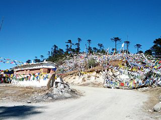
Thrumshing La, also called Thrumshingla Pass and Donga Pass,, is the second-highest mountain pass in Bhutan, connecting its central and eastern regions across the otherwise impregnable Donga range that has separated populations for centuries. It is located on a bend of the Lateral Road at the border of Bumthang District and Mongar District, along the border with Lhuntse District to the east. The Lateral Road bisects Thrumshingla National Park, named after the pass. The World Wildlife Fund also maintains operations in the park.

The valleys of Bhutan are carved into the Himalaya by Bhutan's rivers, fed by glacial melt and monsoon rains. As Bhutan is landlocked in the mountainous eastern Himalaya, much of its population is concentrated in valleys and lowlands, separated by rugged southward spurs of the Inner Himalaya. Despite modernization and development of transport in Bhutan, including a national highway system, travel from one valley to the next remains difficult. Western valleys are bound to the east by the Black Mountains in central Bhutan, which form a watershed between two major river systems, the Mo Chhu and the Drangme Chhu. Central valleys are separated from the east by the Donga Range. The more isolated mountain valleys protect several tiny, distinct cultural and linguistic groups. Reflecting this isolation, most valleys have their own local protector deities.
