Ha, Bhutan

Last updated
Ha
ཧཱ / ཧས
Haa
Bhutan location map.svg
Red pog.svg
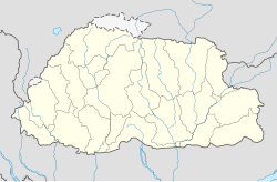
Ha
Location in Bhutan
Coordinates: 27°22′57″N89°17′06″E / 27.38250°N 89.28500°E / 27.38250; 89.28500
Country Flag of Bhutan.svg Bhutan
District Haa District
Time zone UTC+6 (BTT.00)

Ha, [1] also known as Haa or Has, is a Thromde or town, and the seat of Haa District in Bhutan. [2]

Contents

Post Office in Ha, Bhutan Ha Post Office DSC01413 527kb.jpg
Post Office in Ha, Bhutan

Ha is situated in Haa Valley in the west of Bhutan bordering Sikkim. The major economic activity is rice production, yak herding and trade with neighbouring China. Ha accommodates The Indian Military Training Team (also known as IMTRAT). IMTRAT is responsible for the training of the personnel of the Royal Bhutan Army (RBA) and the Royal Bodyguard of Bhutan (RBG). It is the oldest training team sent outside India to a friendly-foreign nation. [3] The place has a religious significance as Lhakhang Karpo [4] and other monasteries are situated there.

Climate

Climate data for Haa-Namjayling, elevation 2,720 m (8,920 ft), (1991–2017 normals)
MonthJanFebMarAprMayJunJulAugSepOctNovDecYear
Record high °C (°F)22.0
(71.6)
20.5
(68.9)
25.0
(77.0)
24.0
(75.2)
26.5
(79.7)
26.5
(79.7)
28.5
(83.3)
29.5
(85.1)
26.5
(79.7)
25.0
(77.0)
22.0
(71.6)
22.5
(72.5)
29.5
(85.1)
Mean daily maximum °C (°F)10.5
(50.9)
11.2
(52.2)
13.5
(56.3)
15.7
(60.3)
18.2
(64.8)
20.5
(68.9)
20.8
(69.4)
20.7
(69.3)
19.2
(66.6)
16.9
(62.4)
14.4
(57.9)
12.3
(54.1)
16.2
(61.1)
Daily mean °C (°F)2.6
(36.7)
4.1
(39.4)
7.2
(45.0)
10.2
(50.4)
13.5
(56.3)
16.5
(61.7)
17.5
(63.5)
17.1
(62.8)
15.4
(59.7)
11.2
(52.2)
7.1
(44.8)
4.3
(39.7)
10.6
(51.0)
Mean daily minimum °C (°F)−5.4
(22.3)
−3.0
(26.6)
0.8
(33.4)
4.7
(40.5)
8.7
(47.7)
12.5
(54.5)
14.1
(57.4)
13.5
(56.3)
11.6
(52.9)
5.4
(41.7)
−0.2
(31.6)
−3.7
(25.3)
4.9
(40.9)
Record low °C (°F)−14.5
(5.9)
−12.0
(10.4)
−7.0
(19.4)
−5.0
(23.0)
0.5
(32.9)
5.5
(41.9)
6.5
(43.7)
7.0
(44.6)
1.5
(34.7)
−5.5
(22.1)
−8.0
(17.6)
−11.5
(11.3)
−14.5
(5.9)
Average rainfall mm (inches)10.8
(0.43)
17.0
(0.67)
34.8
(1.37)
63.5
(2.50)
72.3
(2.85)
128.2
(5.05)
185.8
(7.31)
173.5
(6.83)
129.4
(5.09)
60.2
(2.37)
2.9
(0.11)
5.5
(0.22)
883.9
(34.8)
Average relative humidity (%)71.468.163.865.368.474.478.878.976.971.561.266.070.4
Source: National Center for Hydrology and Meteorology [5]

See also

References

  1. spelling as per officially approved Thrombde names, see the Ministry of Works and Human Settlements http://www.mowhs.gov.bt/publications/approved-thromde-and-boundaries/ Archived 2017-12-28 at the Wayback Machine
  2. National Geospatial-Intelligence Agency
  3. "Indian Military Training Team ( IMTRAT ) strengthens Indio-Bhutan ties". www.aviation-defence-universe.com. November 2018. Retrieved 2020-04-02.
  4. "Lhakhang Karpo & Nagpo". Little Bhutan. 2014-04-09. Retrieved 2020-04-13.
  5. "Climate Data Book of Bhutan, 2018" (PDF). National Center for Hydrology and Meteorology . Retrieved 18 February 2025.

Further reading