The Sharon plain is the central section of the Israeli coastal plain. The plain lies between the Mediterranean Sea to the west and the Samarian Hills, 15 km (9.3 mi) to the east. It stretches from Nahal Taninim, a stream marking the southern end of Mount Carmel in the north, to the Yarkon River in the south, at the northern limit of Tel Aviv, over a total of about 90 km (56 mi). The level of the Sharon plain is connected to the level of the Mediterranean Sea by the Sharon Escarpment.

Tulkarm or Tulkarem is a Palestinian city in the West Bank, the capital of the Tulkarm Governorate of the State of Palestine. The Israeli city of Netanya is to the west, and the Palestinian cities of Nablus and Jenin to the east. According to the Palestinian Central Bureau of Statistics, in 2017 Tulkarm had a population of 64,532. Tulkarm is under the administration of the Palestinian National Authority.

There are six main administrative districts of Israel, known in Hebrew as mekhozot and in Arabic as mintaqah. There are also 15 subdistricts of Israel, known in Hebrew nafot and in Arabic as qadaa. Each subdistrict is further divided into natural regions, which in turn are further divided into council-level divisions: whether they might be cities, municipalities, or regional councils.

Kfar Yona is a city in the Sharon subdistrict in the Central District of Israel. It is located between the cities Netanya and Tulkarm, about 8 km east of Netanya in the central junction between Highway 6 and Highway 4. The village was established in 1932 by Maurice Fischer and was declared a local council in the year 1940. Following developments in the fields of construction, industry and, education, the local council received city status on February 11, 2014. In 2024 the city has a jurisdiction of 11,550 dunams (~11.55 km2) and a population of 29,953.

Beit Lid is a Palestinian town in the Tulkarm Governorate in the northeastern West Bank, located a 10 kilometers southeast of Tulkarm and west of Nablus. According to the Palestinian Central Bureau of Statistics, the town had a population of 5,606 inhabitants in 2017. In 1922, it had 653 inhabitants, which rose to 1,807 in 1961.
The Gaza Subdistrict was one of the subdistricts of Mandatory Palestine. It was situated in the southern Mediterranean coastline of the British Mandate of Palestine. After the 1948 Arab-Israeli War, the district disintegrated, with Israel controlling the northern and eastern portions while Egypt held control of the southern and central parts – which became the Gaza Strip, under Egyptian military between 1948 and 1967, Israeli military rule between 1967 and 2005, part of the Palestinian National Authority after the Oslo Accords until 2007, and is currently ruled by the Hamas as a de facto separate entity from the Palestinian National Authority. The parts which Israel held since 1948 were merged into Israeli administrative districts, their connection with Gaza severed.

Qaffin is a Palestinian town located 22 kilometers (14 mi) northeast of Tulkarm in the Tulkarm Governorate in the northwestern West Bank. The town is an agricultural town. According to the Palestinian Central Bureau of Statistics, its population consisted over 8,387 inhabitants in 2007 and 10,690 in 2017. The built-up area of the town is 1,000 dunams.

Bat Hefer is a community settlement in the Sharon plain in Israel. Located east of Netanya and adjacent to two kibbutzim; Bahan and Yad Hana, it covers 1,000 dunams and falls under the jurisdiction of the Hefer Valley Regional Council. The village is between Highway 6 to the west and the Green Line on the east. In 2022 it had a population of 5,209.

Shufa is a Palestinian village in the Tulkarm Governorate in the eastern West Bank, located 6 kilometers South-east of Tulkarm. According to the Palestinian Central Bureau of Statistics, Shufa had a population of approximately 1,253 inhabitants in mid-year 2006 and 1,350 by 2017. 5.4% of the population of Shufa were refugees in 1997. The healthcare facilities for Shufa are at Kafr al-Labad or Saffarin where the facilities are designated as MOH level 2.

Ghabat Kafr Sur was a Palestinian village in the Tulkarm Subdistrict of Mandatory Palestine. It was depopulated during the 1948 Arab–Israeli War on May 15, 1948, under Operation Coastal Clearing. It was located 16 km southwest of Tulkarm.

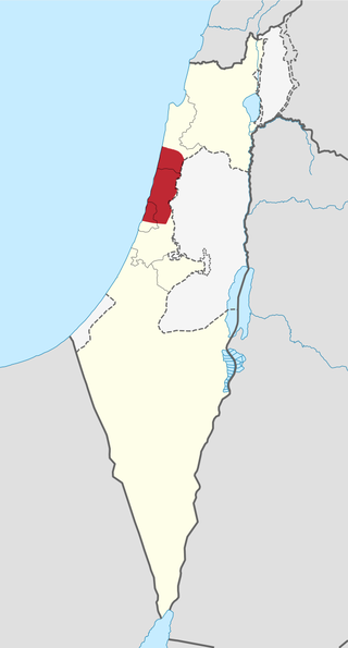
The Tulkarm Subdistrict was one of the subdistricts of Mandatory Palestine. It was located around the city of Tulkarm. After the 1948 Arab-Israeli War, the subdistrict disintegrated, the western part became part of the Central District of Israel and the eastern part, became a part of the Jordanian annexation of the West Bank from 1948 to 1967). Most of the eastern part is today the Tulkarm Governorate, part of the State of Palestine.
The Safed subdistrict is one of Israel's sub-districts in the Northern District. As the name suggests, the main settlement is the town of Safed.
The Kinneret Subdistrict is one of the subdistricts of Israel's Northern District. The largest city and the centre of the subdistrict is the city of Tiberias on the western coast of the Sea of Galilee.
The Jezreel subdistrict is one of Israel's sub-districts in Northern District.
The Acre Subdistrict, alternatively spelt as Akko Subdistrict or Akka Subdistrict, is one of Israel's sub-districts in the Northern District.
The Haifa Subdistrict is one of Israel's sub-districts in Haifa District. The Subdistrict is composed of mostly of the Northern half of the historical Mandatory Haifa Subdistrict.
The Hadera subdistrict is one of Israel's subdistricts in Haifa District. The district is composed of mostly of the Southern half of Mandatory Haifa Subdistrict.
The Petah Tikva Subdistrict is one of Israel's subdistricts in the Central District. The principal city of this subdistrict, as the name implies, is Petah Tikva.
The Rehovot subdistrict is one of Israel's subdistricts in Central District. The principal city of the subdistrict is, as the name implies, Rehovot.
The Ramla subdistrict is one of Israel's subdistricts in the Central District. There are three principal cities in the subdistrict: Ramla, Lod, and Modi'in-Maccabim-Re'ut.
