Related Research Articles
Castle Junction is a locality where the northern extent of the Banff–Windermere Highway intersects with the Trans-Canada Highway, the Bow River, and Bow Valley Parkway in Banff National Park, Alberta. It is named after the nearby Castle Mountain, clearly visible from the junction. The area is also referred to as Castle Mountain; however, the official location is approximately 1.6 km (1.0 mi) southwest of Castle Junction along the Canadian Pacific Railway.
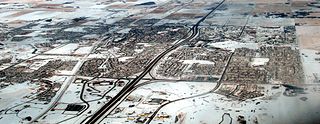
Airdrie is a city in Alberta, Canada within the Calgary Region. It is located north of Calgary within the Calgary–Edmonton Corridor at the intersection of Queen Elizabeth II Highway and Highway 567.

Aldersyde is a hamlet in Alberta, Canada within the Foothills County. Located between Highway 2 and Highway 2A south of Highway 7, the hamlet is approximately 8 kilometres (5.0 mi) southeast of Okotoks, 10 kilometres (6.2 mi) north of High River and 25 kilometres (16 mi) south of Calgary. A Canadian Pacific Railway line runs through the hamlet.
Balzac is a hamlet in Rocky View County, which is in the Calgary Metropolitan Region of the Canadian province of Alberta. It is located immediately west of Queen Elizabeth II Highway, at the intersection with Highway 566, 24 km (15 mi) north of Calgary city centre and 12 km (7.5 mi) south of Airdrie.
Swan Hills is a town in northern Alberta, Canada. It is in the eponymous Swan Hills, approximately 80 km (50 mi) north of Whitecourt and 62 km (39 mi) northwest of Fort Assiniboine. The town is at the junction of Highway 32 and Grizzly Trail, and is surrounded by Big Lakes County.
Glenbow is a locality in southern Alberta, in Rocky View County located northwest of the City of Calgary and east of the Town of Cochrane on Highway 1A. It is now part of the Glenbow Ranch Provincial Park. The Glenbow area is immediately west of Rocky View County's Bearspaw area.

Nordegg is a hamlet in west-central Alberta, Canada within Clearwater County. It is located in the North Saskatchewan River valley in the foothills of the Canadian Rockies, just east of the intersection of the David Thompson Highway and the Highway 734 spur of the Bighorn Highway. A former coal mining town, it was named after Martin Nordegg and the name probably means "North Corner" in a German dialect. The railway station name at the locality was called Brazeau rather than Nordegg at certain points in its history, but the local post office has always been named Nordegg. The name Brazeau is now obsolete.
De Winton is a hamlet in southern Alberta, Canada within the Foothills County. It is located just south of the City of Calgary and west of Highway 2A.
Cayley is a hamlet in southern Alberta, Canada within the Foothills County. It is also recognized as a designated place by Statistics Canada.

Father Lacombe High School is a Catholic senior high school in Calgary, Alberta, Canada, named after Father Albert Lacombe. It has classes for grades 10 to 12 and is located in the southeast quadrant community of Radisson Heights, Calgary.

Cadomin is a hamlet in the west-central Alberta, Canada within Yellowhead County. It is located along the McLeod River in the foothills of the Rocky Mountains, approximately 50 kilometres (31 mi) south of Hinton near the Bighorn Highway. It is served by a spur of the Canadian National Railway.

Wildwood is a hamlet in west-central Alberta, Canada within Yellowhead County. It is located on the Yellowhead Highway, approximately 112 kilometres (70 mi) west of Edmonton and 82 kilometres (51 mi) east of Edson. The Yellowhead Highway's intersection with Cowboy Trail is 9 kilometres (5.6 mi) east of the hamlet. The Lobstick River, which flows from Chip Lake to the west, runs through the hamlet.

Area codes 587, 825, and 368 are telephone area codes in the North American Numbering Plan (NANP) for the entire Canadian province of Alberta. They form an overlay plan over and in addition to the previously existing area code 403 of southern Alberta, and northern Alberta's 780. Telephone numbers in area code 587 were allocated starting in late 2008. The complex overlay involving four area codes in Alberta mandated ten-digit dialing throughout Alberta.
Gainford is a hamlet in Alberta, Canada within Parkland County. It is located approximately 86 kilometres (53 mi) west of Edmonton and has an elevation of 740 metres (2,430 ft).

Cherhill is a hamlet in Alberta, Canada within Lac Ste. Anne County. It is located along Highway 43, approximately 35 kilometres (22 mi) east of Mayerthorpe and 82 kilometres (51 mi) northwest of Edmonton.
Suffield is a hamlet in southern Alberta, Canada within Cypress County. It is located on the Trans-Canada Highway approximately 32 km (20 mi) northwest of Medicine Hat, and just south of CFB Suffield.
Chancellor is a hamlet in southern Alberta, Canada within Wheatland County. It is located approximately 26 kilometres (16 mi) north of Highway 1 and 86 kilometres (53 mi) east of Calgary.
Driftpile is a settlement in Drift Pile River 150, in northern Alberta, Canada. It is located on Highway 2, approximately 191 kilometres (119 mi) east of Grande Prairie.
Nojack is an unincorporated community in central Alberta within Yellowhead County, located on Highway 16, 138 kilometres (86 mi) west of Edmonton, at an elevation of 820 metres (2,690 ft). It was possibly named because of the lack of oil jacks in the area at the time, however Place Names of Alberta says "A hotel and service station were constructed on Hiway #16 approximately four kilometers south of MacKay, with a large amount of credit. The name which is a colloquial term meaning "no money" was chosen and has been perpetuated by local business establishments. The name was officially approved in 1974."
Balm is a locality in Alberta, Canada.
References
- ↑ "Haddock". Geographical Names Data Base . Natural Resources Canada.
- ↑ Place-names of Alberta. Ottawa: Geographic Board of Canada. 1928. p. 60.
- ↑ Harrison, Tracey (1994). Place Names of Alberta. Volume III: Central Alberta. Calgary, AB: University of Calgary Press. p. 111. ISBN 1-895176-44-1.
Coordinates: 53°48′50″N115°59′02″W / 53.814°N 115.984°W
| | This Central Alberta location article is a stub. You can help Wikipedia by expanding it. |