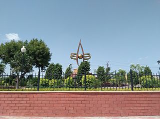
Uran is a coastal town in Raigad District's Navi Mumbai, Maharashtra state in Konkan division. It lies to the east of Mumbai across the Dharamtar Creek. Uran is primarily a fishing and agriculture village, which has developed into the special economic zone of Uran. The primary languages spoken are Agri and Koli which is a dialect of Marathi-Konkani.

Nathdwara is a city in the Rajsamand district of the state of Rajasthan, India. It is located in the Aravalli hills, on the banks of the Banas River and is 48 kilometres north-east of Udaipur. Shrinathji, is a swarup of lord Krishna which resembles his 7-year-old "infant" incarnation of Krishna. The deity was originally worshiped at Jatpura, Mathura and was shifted in the year 1672 from Govardhan hill, near Mathura along holy river Yamuna after being retained at Agra for almost six months. Literally, Nathdwara means 'Gateway to Shrinathji (God)'. Nathdwara is a significant Vaishnavite shrine pertaining to the Pushti Marg or the Vallabh Sampradaya or the Shuddha Advaita founded by Vallabha Acharya, revered mainly by people of Gujarat and Rajasthan, among others. Vitthal Nathji, son of Vallabhacharya institutionalised the worship of Shrinathji at Nathdwara. Today also the Royal king family of Nathdwara belongs to the lineage of vallabhacharya mahaprabhuji. They are called Tilkayat or tikaet of Nathdwara.
Mandleshwar is a town and nagar panchayat in the Khargone district of the India state of Madhya Pradesh. It is on the banks of Narmada River, 8 kilometres (5.0 mi) east of Maheshwar and 99 kilometres (62 mi) south of Indore. It is a "Pavitra nagri" as termed by the government of Madhya Pradesh, as it is an ancient town. It is the education centre of Maheshwar block, the location of the district court and district jail of Khargone, and is also the political centre of Maheshwar block.
Falna is a town and a tehsil in Pali District in Indian state of Rajasthan.
Badod is a city situated in Agar Malwa district in the state of Madhya Pradesh, India. Badod has tehsil headquarters as well as nagar parishad in Agar Malwa District. Both the Choti Kalisindh and Kachal rivers flow nearby the town.
Chandameta-Butaria is a town and a nagar panchayat in Chhindwara district in the state of Madhya Pradesh, India.
Devendranagar is a town and a nagar panchayat in Panna district in the state of Madhya Pradesh, India. Earlier before the merger it was part of Erstwhile Princely State of Ajaigarh.
Gangapur is a town and a municipal council in Aurangabad district in the state of Maharashtra, India.
Khanauri is a town and a nagar panchayat in Sangrur district in the state of Punjab, India. It is located at NH 52 at the border of Punjab and Haryana.
Nuapatna is a census town in Cuttack district in the Indian state of Odisha.the whole area have rich in cultural and commercial importance.
Obedullaganj is a town and a nagar panchayat in Raisen district in the Indian state of Madhya Pradesh. It is situated 70 km from its district headquarter Raisen and 36 km from its state capital city Bhopal.
Payal is a city in Ludhiana district in the Punjab, India.
Sanquelim or Sankhali is a town and municipal council in North Goa district in the Indian state of Goa.
Santokhgarh is a town and a Municipal Council, nagar panchayat in Una district in the Indian state of Himachal Pradesh.
Surendranagar is a Municipality in Surendranagar district in the Indian state of Gujarat.
Tirwa is a town in Kannauj district in the Indian state of Uttar Pradesh.
Pali is a census town in Raigad District in the Indian state of Maharashtra.
Boda is a town and a Nagar Parishad in Rajgarh district in the state of Madhya Pradesh, India.
Examba is a City and Municipal Council in the Belgaum district of the Indian state of karnataka.
The Hadgaon taluka or Hadgaon tehsil is a taluka in the Nanded district of the Indian state of Maharashtra. This tehsil includes one municipal council, Hadgaon, and 154 villages.


