
The Mohawk River is a 149-mile-long (240 km) river in the U.S. state of New York. It is the largest tributary of the Hudson River. The Mohawk flows into the Hudson in Cohoes, New York, a few miles north of the state capital of Albany. The river is named for the Mohawk Nation of the Iroquois Confederacy. A major waterway, in the early 19th century, the river's east-west valley provided the setting and water for development of the Erie Canal, as a key to developing New York. The largest tributary, the Schoharie Creek, accounts for over one quarter (26.83%) of the Mohawk River's watershed. Another main tributary is the West Canada Creek, which makes up for 16.33% of the Mohawk's watershed.

The Chenango River is a 90-mile-long (140 km) tributary of the Susquehanna River in central New York in the United States. It drains a dissected plateau area in upstate New York at the northern end of the Susquehanna watershed.

The West Branch Delaware River is one of two branches that form the Delaware River. It is approximately 90 mi (144 km) long, and flows through the U.S. states of New York and Pennsylvania. It winds through a mountainous area of New York in the western Catskill Mountains for most of its course, before joining the East Branch along the northeast border of Pennsylvania with New York. Midway or so it is empounded by the Cannonsville Dam to form the Cannonsville Reservoir, both part of the New York City water supply system for delivering drinking water to the City.

The Ashuelot River is a tributary of the Connecticut River, approximately 64 miles (103 km) long, in southwestern New Hampshire in the United States. It drains a mountainous area of 425 square miles (1,101 km2), including much of the area known as the Monadnock Region. It is the longest tributary of the Connecticut River within New Hampshire.

Schoharie Creek is a river in New York that flows north 93 miles (150 km) from the foot of Indian Head Mountain in the Catskills through the Schoharie Valley to the Mohawk River. It is twice impounded north of Prattsville to create New York City's Schoharie Reservoir and the Blenheim-Gilboa Power Project.

The Sacandaga River is a 64-mile-long (103 km) river in the northern part of New York in the United States. Its name comes from the Native American Sa-chen-da'-ga, meaning "overflowed lands".

The West Canada Creek is a 76-mile-long (122 km) river in upstate New York, United States. West Canada Creek is an important water way in Hamilton, Oneida, and Herkimer counties, draining the south part of the Adirondack Mountains before emptying into the Mohawk River near the Village of Herkimer. The name "Canada" is derived from an Iroquoian word for "village" (Kanata).
North Dome is a mountain located in Greene County, New York. The mountain is part of the Catskill Mountains. North Dome is flanked to the east by West Kill Mountain, and to the west faces Mount Sherrill.
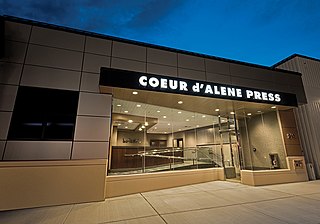
The Coeur d'Alene Press is a daily newspaper based in Coeur d'Alene, Idaho, United States. It is owned by the Hagadone Media Group and is the flagship property of the Idaho Hagadone News Network. The Press provides local coverage for Kootenai County, Idaho.
The Little Bog River is a short stream in Hancock County, Maine. From its source in Osborn, the river runs 5.4 miles (8.7 km) south to its confluence with Mill Brook in Eastbrook. Mill Brook flows west to Webb Pond. Via Mill Brook, Webb Pond, and Webb Brook, the Little Bog River is part of the Union River watershed.
The West Branch Pleasant River is a tributary of the Pleasant River in Washington County, Maine. From the confluence of Branch Brook and Bells Brook in southeast Columbia, the river meanders 2.3 miles (3.7 km) south to the estuary of the Pleasant River at Addison.

Nicholas Michael Hagadone is an American former professional baseball pitcher. He played in Major League Baseball (MLB) for the Cleveland Indians.

Trout Brook, also called Ball Brook, is a cold water tributary of the Quinapoxet River located in Holden, Massachusetts. Trout Brook is stocked with trout each spring by the Massachusetts Fisheries and Wildlife Division. As the Quinapoxet River is part of the water supply for Worcester, Massachusetts, both the Quinapoxet and all of its major tributaries including Trout Brook are monitored by the USGS for water quality.

The Canajoharie Creek is a river that flows into the Mohawk River in the Village of Canajoharie in the U.S. State of New York. The name "Canajoharie" is a Mohawk language term meaning "the pot that washes itself", referring to the "Canajoharie Boiling Pot", a 20-foot (6.1 m) wide and 10-foot (3.0 m) deep pothole in the Canajoharie Creek, just south of the village of Canajoharie. Bowmans Creek is one main tributary that enters the creek east of the Hamlet of Sprout Brook. The other main tributary is Brimstone Creek which enters the creek north-northwest of the Village of Ames.

The West Kill, an 11-mile-long (18 km) tributary of Schoharie Creek, flows through the town of Lexington, New York, United States, from its source on Hunter Mountain, the second-highest peak of the Catskill Mountains. Ultimately its waters reach the Hudson River via the Mohawk. Since it drains into the Schoharie upstream of Schoharie Reservoir, it is part of the New York City water supply system. It lends its name to both a mountain to its south and a small town midway along its length.
Charlotte Creek is a river located in Delaware County, New York. Charlotte Creek borders the southern border of Otsego County, New York for a few miles near the mouth. The creek converges with the Susquehanna River by Emmons, New York.
West Brook flows into the West Branch Delaware River by Walton, New York.
Red House Hill is a mountain in the Central New York Region of the State of New York, United States. It is located south-southwest of the Hamlet of Springfield Center, New York, west of Hutter Point and Six Mile Point of Otsego Lake, and southeast of Rum Hill. Mohican Brook flows eastward along the southern edge of the hill.

Bowmans Creek is a river in Montgomery County, New York. It begins west of the hamlet of Hessville and just south of the hamlet of Ripple Corners. It then flows in a mostly southeast direction for a few miles passing through the hamlet of Sprout Brook before flowing into the Canajoharie Creek just east of the hamlet of Sprout Brook.

Carr Mountain is a 3,453-foot-high (1,052 m) mountain in the southwestern part of the White Mountains in the towns of Wentworth and Warren, New Hampshire, United States. It is the highest of a set of mountains ringed by Interstate 93 to the east, New Hampshire Route 25 to the south and west, New Hampshire Route 118 to the northwest, and New Hampshire Route 112 to the north, and that are in the White Mountain National Forest.
