Fitch Glacier is a tributary glacier that flows south along the east side of the McGregor Range to enter Man-o-War Glacier in the Admiralty Mountains of northeastern Victoria Land, Antarctica. It was mapped by United States Geological Survey from surveys and U.S. Navy air photos taken in the years 1960–62. It was named by the Advisory Committee on Antarctic Names for Lieutenant E.E. Fitch, U.S. Navy, medical officer at Hallett Station, 1963.

Oberst Glacier is a glacier draining the west side of Balchen Mountain in the Sor Rondane Mountains. Mapped by Norwegian cartographers in 1957 from air photos taken by U.S. Navy Operation Highjump, 1946–47, and named Oberstbreen because of its association with Balchen Mountain. Bernt Balchen, a famous Norwegian polar aviator, achieved the rank of colonel in the U.S. Army Air Force in World War II.
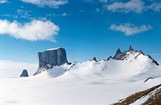
Ormeryggen are three major hills forming the central portion of Linnormen Hills, standing southeast of Skavlho Mountain in the Payer Mountains of Queen Maud Land. Photographed from the air by the German Antarctic Expedition (1938–39). Mapped by Norwegian cartographers from surveys and air photos by the Norwegian Antarctic Expedition (1956–60) and named Ormeryggen.
Mount Nils is a prominent, ice-covered mountain standing close west of Rayner Glacier and 3 nautical miles (6 km) south of Mount Christensen, Enderby Land. It was plotted from air photos taken by ANARE in 1956 and 1957 and was named by the Antarctic Names Committee of Australia (ANCA) for Captain Nils Larsen, master of the Norwegian exploration ship January 1930.
Jeanne Hill is a hill, 195 metres (640 ft) high, standing 0.25 nautical miles (0.5 km) northwest of Mount Guéguen and overlooking Port Charcot on Booth Island, in the Wilhelm Archipelago, Antarctica. It was discovered by the French Antarctic Expedition, 1903–05, under Dr. Jean-Baptiste Charcot, and named by him for his sister.
Mount Dzhalil' is a small mountain, 2,510 metres (8,230 ft) high, in the Linnormen Hills of the Payer Mountains, in Queen Maud Land. It was mapped from air photos and surveys by the Sixth Norwegian Antarctic Expedition, 1956–60. It was remapped by the Soviet Antarctic Expedition, 1960–61, and named after Musa Dzhalil', the Soviet poet.
Isingen Mountain is a large icecapped mass, through which protrude several rock peaks, between Ising Glacier and Rogstad Glacier in the Sverdrup Mountains of Queen Maud Land, Antarctica. It was photographed from the air by the Third German Antarctic Expedition (1938–39). It was mapped by Norwegian cartographers from surveys and air photos by the Norwegian–British–Swedish Antarctic Expedition(1949–52) and from air photos by the Norwegian expedition (1958–59) and named Isingen.
Molly Hill is a hill between Evermann Cove and Johnson Cove on western Bird Island, South Georgia. The name derives from the black-browed albatross or "mollymawk" which breeds on the hill in large numbers. According to the UK Antarctic Place-Names Committee, the name has been in local usage since at least 1963.
Flogeken Glacier is a deeply entrenched glacier, flowing northwest between Mount Grytoyr and Langfloget Cliff, in the Mühlig-Hofmann Mountains of Queen Maud Land, Antarctica. it was mapped by Norwegian cartographers from surveys and air photos by the Sixth Norwegian Antarctic Expedition (1956–60) and named Flogeken.
Gårekneet Ridge is a rock ridge 3 nautical miles (6 km) south of Garenevkalven Nunatak in the Payer Mountains of Queen Maud Land, Antarctica. It was photographed from the air by the Third German Antarctic Expedition (1938–39), mapped by Norwegian cartographers from surveys and air photos by the Sixth Norwegian Antarctic Expedition (1956–60) and named Gårekneet.
Hålishalsen Saddle is an ice saddle between the Kurze Mountains and the interior ice plateau close southward, in Queen Maud Land, Antarctica. It was mapped by Norwegian cartographers from surveys and air photos by the Sixth Norwegian Antarctic Expedition (1956–60) and named Hålishalsen.
Hålisrimen Peak is a peak, 2,655 metres (8,710 ft) high, rising 2 nautical miles (4 km) northwest of Halisstonga Peak in the Kurze Mountains of Queen Maud Land, Antarctica. It was mapped by Norwegian cartographers from surveys and air photos by the Sixth Norwegian Antarctic Expedition (1956–60) and named Hålisrimen.
The Linnormen Hills are hills extending southwest–northeast and rising close east of Skavlhø Mountain in the Payer Mountains of Queen Maud Land, Antarctica. They were photographed from the air by the Third German Antarctic Expedition (1938–39), and were mapped by Norwegian cartographers from survey and air photos by the Sixth Norwegian Antarctic Expedition (1956–60) and named Linnormen.
Medhovden Bluff is a high ice-covered bluff with a steep, eastern rock face, forming the northeastern end of Risemedet Mountain in the Gjelsvik Mountains of Queen Maud Land, Antarctica. It was mapped by Norwegian cartographers from surveys and air photos by the Sixth Norwegian Antarctic Expedition (1956–60) and was named "Medhovden".
The Martin Hills are an isolated range of predominantly ice-covered hills, or peaks, in Antarctica, nearly 4 nautical miles (7 km) long, lying about 50 nautical miles (90 km) south of the Pirrit Hills. The feature was positioned by the U.S. Ellsworth–Byrd Traverse Party on December 10, 1958, and was named by the Advisory Committee on Antarctic Names for Larry R. Martin, Scientific Leader at Byrd Station in 1962.
Horten Peak is a small rock peak, 2,470 metres (8,100 ft) high, rising south of the summit of Risemedet Mountain in the Gjelsvik Mountains of Queen Maud Land, Antarctica. It was mapped by Norwegian cartographers from surveys and air photos by the Sixth Norwegian Antarctic Expedition (1956–60) and named by them.
Tønnesen Glacier is a broad glacier flowing north between Risemedet Mountain and Festninga Mountain, separating the Gjelsvik Mountains and the Mühlig-Hofmann Mountains in Queen Maud Land. It was mapped by Norwegian cartographers from surveys and air photos by the Norwegian Antarctic Expedition (1956–60) and named for J. Tønnesen, a meteorologist with the expedition.
Langskavlen Glacier is a short, steep glacier flowing from the north side of Skavlhø Mountain in the Payer Mountains of Queen Maud Land, Antarctica. It was mapped by Norwegian cartographers from surveys and air photos by the Sixth Norwegian Antarctic Expedition (1956–60) and named Langskavlen.