A site of special scientific interest (SSSI) in Great Britain, or an area of special scientific interest (ASSI) in the Isle of Man and Northern Ireland, is a conservation designation denoting a protected area in the United Kingdom and Isle of Man. SSSI/ASSIs are the basic building block of site-based nature conservation legislation and most other legal nature/geological conservation designations in the United Kingdom are based upon them, including national nature reserves, Ramsar sites, Special Protection Areas, and Special Areas of Conservation. The acronym "SSSI" is often pronounced "triple-S I".

Chesil Beach in Dorset, England is one of three major shingle beach structures in Britain. Its name is derived from the word chessil, meaning "gravel" or "shingle". It runs for a length of 29 kilometres (18 mi) from West Bay to the Isle of Portland and in places is up to 15 metres (50 ft) high and 200 metres (660 ft) wide. Behind the beach is the Fleet, a shallow tidal lagoon. Both are part of the Jurassic Coast and a UNESCO World Heritage Site, and together form an SSSI and Ramsar Site. Owners of the land designated as Chesil & The Fleet SSSI include the Crown Estate, the Ministry of Defence and the National Trust.

Poole Harbour is a large natural harbour in Dorset, southern England, with the town of Poole on its shores. The harbour is a drowned valley (ria) formed at the end of the last ice age and is the estuary of several rivers, the largest being the Frome. The harbour has a long history of human settlement stretching to pre-Roman times. The harbour is extremely shallow, with one main dredged channel through the harbour, from the mouth to Holes Bay.

The Isle of Purbeck is a peninsula in Dorset, England. It is bordered by water on three sides: the English Channel to the south and east, where steep cliffs fall to the sea; and by the marshy lands of the River Frome and Poole Harbour to the north. Its western boundary is less well defined, with some medieval sources placing it at Flower's Barrow above Worbarrow Bay. John Hutchins, author of The History and Antiquities of the County of Dorset, defined Purbeck's western boundary as the Luckford Lake stream, which runs south from the Frome. According to writer and broadcaster Ralph Wightman, Purbeck "is only an island if you accept the barren heaths between Arish Mell and Wareham as cutting off this corner of Dorset as effectively as the sea." The most southerly point is St Alban's Head.

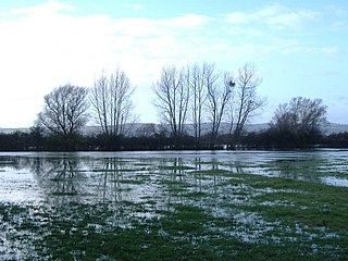
Walmore Common is a 57.78-hectare (142.8-acre) nature reserve on the flood-plain of the River Severn, west of the city of Gloucester in England and north of the village of Chaxhill. It was notified as a biological Site of Special Scientific Interest in 1966. The site is listed in the 'Forest of Dean Local Plan Review' as a Key Wildlife Site (KWS).

Newtown River is a large natural inland harbour located on the Isle of Wight's northwestern coast, named after the nearby village of Newtown. It is sometimes also referred to as Newtown Creek.

Broadmoor to Bagshot Woods and Heaths is a 1,696.3-hectare (4,192-acre) biological Site of Special Scientific Interest (SSSI) in Berkshire and Surrey that extend from a minority of the parish of Crowthorne including around Broadmoor Hospital in the west to Bagshot south-east, Bracknell north-east, and Sandhurst, south. It is part of the Thames Basin Heaths Special Protection Area. Two nature reserves which are managed by the Surrey Wildlife Trust are in the SSSI, Barossa nature reserve and Poors Allotment. Broadmoor Bottom, which is part of Wildmoor Heath, also falls within the SSSI; this reserve is managed by the Berkshire, Buckinghamshire and Oxfordshire Wildlife Trust.

The Hampshire Basin is a geological basin of Palaeogene age in southern England, underlying parts of Hampshire, the Isle of Wight, Dorset, and Sussex. Like the London Basin to the northeast, it is filled with sands and clays of Paleocene and younger ages and it is surrounded by a broken rim of chalk hills of Cretaceous age.
Thursley Common is a national nature reserve in Surrey, England, and has also been designated as a Ramsar wetland. It is also part of a Site of Special Scientific Interest called Thursley, Hankley and Frensham Commons.
Lune Forest is a Site of Special Scientific Interest covering an extensive area of moorland in the Teesdale district of west Durham, England. In the north, where it adjoins the Upper Teesdale and Appleby Fells SSSIs, it extends from Mickle Fell eastward almost as far as Harter Fell, above the hamlet of Thringarth. Its southern limit is marked by the River Balder, upstream from Balderhead Reservoir, where it shares a boundary with Cotherstone Moor SSSI to the south. Grains o' th' Beck Meadows and Close House Mine SSSIs are entirely surrounded by Lune Forest, but do not form part of it.

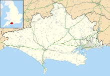
Dorset is a county located in the middle of the south coast of England. It lies between the latitudes 50.512°N and 51.081°N and the longitudes 1.682°W and 2.958°W, and occupies an area of 2,653 km2. It spans 90 kilometres (56 mi) from east to west and 63 kilometres (39 mi) from north to south.
Castle Down is a windswept plateau of maritime heath in the northern part of the island of Tresco, Isles of Scilly. The area has a number of designations including Castle Down (Tresco) Site of Special Scientific Interest (SSSI); is part of the Isles of Scilly Area of Outstanding Natural Beauty; part of the Isles of Scilly Heritage Coast; and part of Plantlife's Isles of Scilly Important Plant Area. The Castle Down Site of Special Scientific Interest is entirely owned by the Duchy of Cornwall. There are a number of Schedule Ancient Monument's ranging in age from Bronze Age cairns to castles built in the 16th and 17th centuries to protect the anchorage of New Grimsby harbour.

Ferndown Common is a Site of Special Scientific Interest (SSSI) on the edge of Ferndown in Dorset, England. It is currently owned by the Wimborne Estate and leased to the Amphibian and Reptile Conservation Trust (ARC), who manage it to preserve the site's rare wildlife. The site was notified as an SSSI in 1984.

Parley Common is a Site of Special Scientific Interest (SSSI) on the edge of Ferndown in Dorset, England. The majority land owner is the Canford Estate, but among the other owners are the Diocese of Salisbury, Dorset County Council, East Dorset District Council and a few private individuals. Most of the site is managed by the Amphibian and Reptile Conservation Trust (ARC); East Dorset Countryside Management Service manage the area owned by East Dorset District Council and Dorset Countryside manage the area owned by Dorset County Council. The site was notified as an SSSI in 1983.

The Dorset Heaths form an important area of heathland within the Poole Basin in southern England. Much of the area is protected.

Hartland Moor is a Site of Special Scientific Interest (SSSI) on the south side of Poole Harbour near the town of Wareham in Dorset, England. It consists of lowland heathland.

Tadnoll and Winfrith Heath is a nature reserve of the Dorset Wildlife Trust, near the village of Winfrith Newburgh in Dorset, England. There is heathland and wetland in the reserve.
Chasewater and the Southern Staffordshire Coalfield Heaths is a Site of Special Scientific Interest in Staffordshire, England. It is located between Brownhills and Hednesford. The protected area includes Brownhills Common and the Chasewater Reservoir. It also includes Biddulph's Pool and No Man's Bank.
Turners Puddle Heath is a Site of Special Scientific Interest north of Wool, near Bovington in Dorset, England. This protected area is located between the River Piddle and the River Frome. This protected area is within the Dorset Heathlands Ramsar site.
The Flits is a Site of Special Scientific Interest (SSSI) near Holywell, six miles west of Hereford in Herefordshire, England. This protected area is also a National Nature Reserve.


