
Kingswood is a town and civil parish in the South Gloucestershire district of the ceremonial county of Gloucestershire, England. The town is situated 3 miles (4.8 km) east-northeast of Bristol.

Stroud District is a local government district in Gloucestershire, England. The district is named after its largest town of Stroud. The council is based at Ebley Mill in Cainscross. The district also includes the towns of Berkeley, Dursley, Nailsworth, Stonehouse and Wotton-under-Edge, along with numerous villages and surrounding rural areas. Over half of the district lies within the Cotswolds Area of Outstanding Natural Beauty.

No Man's Heath is an area of the civil parish of Newton Regis, in the North Warwickshire district, in the county of Warwickshire, England, about 6 miles (9.7 km) northeast of Tamworth. It is near the boundaries of four English counties: Derbyshire, Leicestershire, Warwickshire and Staffordshire. Nearby in the late 19th century were Netherseal Colliery and Netherseal Hall. Today a small village exists here, also called No Man's Heath, which is the northernmost settlement in Warwickshire. No-Mans-Heath was formerly an extra-parochial tract, in 1858 No Mans Heath became a separate civil parish, on 24 March 1888 the parish was abolished and merged with Newton Regis. In 1881 the parish had a population of 70. The county boundary which used to divide the village between Leicestershire and Warwickshire has been re-drawn on 1 April 1965 to place the whole village in Warwickshire.

Stone is a small village in the parish of Ham and Stone, Gloucestershire, England. It stands on the A38 road, just south-west of its crossing of the Little Avon River, roughly halfway between Bristol and Gloucester at grid reference ST684953. It is adjacent to the county boundary with South Gloucestershire. The part of the community just north-east of the river is called Woodford. In 2019 it had an estimated population of 527.
Littleton-upon-Severn is a village and former civil parish, now in the parish of Aust, in the South Gloucestershire district, in the ceremonial county of Gloucestershire, England, near the mouth of the River Severn and is located to the west of Thornbury. Historically it belonged to the Hundred of Langley and Swinehead. In 1931 the parish had a population of 179. On 1 April 1935 the parish was abolished and merged with Aust.
Batheaston is a village and civil parish 2 miles (3.2 km) east of the English city of Bath, on the north bank of the River Avon. The parish had a population of 2,735 in 2011. The northern area of the parish, on the road to St Catherine, is an area known as Northend.

Tormarton is a village and civil parish in the South Gloucestershire district, in the ceremonial county of Gloucestershire, England. The village is about half a mile north of the M4 motorway; the A46 road towards Bath passes a similar distance west of the village to join the motorway at junction 18. The parish includes the small village of West Littleton, south of the motorway. The parish population at the 2021 census was 323. The Cotswold Way footpath passes through the village.
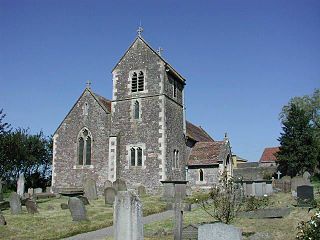
Alkington is a civil parish in the district of Stroud, Gloucestershire. It had a population of 638 in the 2001 census, increasing to 688 at the 2011 census. There is no Alkington village, the parish consists of various hamlets, including Woodford, Newport and Lower Wick.

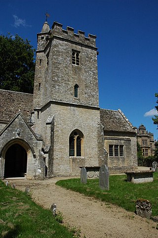
Arlingham is a village and civil parish in the Stroud District of Gloucestershire, England. The 2021 Census recorded a parish population of 533. The parish contains the hamlets of Milton End, Overton and Priding. The next parish to the east is Fretherne with Saul.
Rodborough is a large village and civil parish in the district of Stroud, Gloucestershire, in South West England. It is directly south of the town of Stroud, north of the town of Nailsworth and north-west of the town of Minchinhampton. The parish includes the settlements of Bagpath, Butterrow, Kingscourt, Lightpill and Rooksmoor, and is adjacent to the Stroud suburb of Dudbridge. The population taken at the 2011 census was 5,334.
Meysey Hampton is a village and civil parish in Gloucestershire, England, approximately 30 miles (48 km) to the south-east of Gloucester. It lies in the south of the Cotswolds, an Area of Outstanding Natural Beauty.

Filkins is a village in the civil parish of Filkins and Broughton Poggs, in the West Oxfordshire district, in the county of Oxfordshire, England. It is about 2.5 miles (4 km) southwest of Carterton.

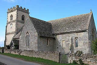
Hamfallow is a civil parish in the district of Stroud, Gloucestershire. There is no village centre, the parish consists of farms and hamlets such as Abwell, Breadstone, Halmore, Mobley and Wanswell.

Maisemore is a village and civil parish in Gloucestershire, England. It lies on the A417 road 2.5 miles (4 km) northwest of Gloucester, on the west bank of the River Severn. In the 2001 census the parish had a population of 488, reducing to 458 at the 2011 census.
Filkins and Broughton Poggs is a civil parish in West Oxfordshire, on the Oxfordshire county boundary with Gloucestershire. The parish includes the villages of Filkins and Broughton Poggs, which were separate civil parishes until they were merged in 1954. The population in the 2011 Census was 434.

Clapton, also known as Clapton-on-the-Hill, is a small village and civil parish in the district of Cotswold, in the county of Gloucestershire, England. In 2019 it had a population of 110. It is very difficult to park and turn around in Clapton due to the narrow roads.
Westonbirt with Lasborough is a civil parish in the district of Cotswold, in the county of Gloucestershire, England. It includes the villages of Lasborough and Westonbirt. As of 2019, it has a population of 293.

Sudeley is a civil parish in the district of Tewkesbury, in the county of Gloucestershire, England. The parish includes the village of Charlton Abbots.
Leigh is a village and civil parish in the district of Tewkesbury, in the county of Gloucestershire, England. As of 2019, it has a population of 325.

Hucclecote is a civil parish in the Tewkesbury district, in the county of Gloucestershire, England. As of 2019, it has a population of 2,703. The parish doesn't include the Gloucester suburb of Hucclecote.

