
Grosmont is a village and civil parish situated in Eskdale in the North York Moors National Park, within the boundaries of the county of North Yorkshire, England.

Angram Grange is a small civil parish in the former Hambleton District of North Yorkshire, England, about 7 miles south-east of Thirsk. According to the 2001 census it had a population of 17. In 2015 the population was estimated at 20.

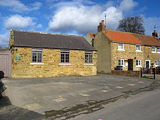
Hood Grange is a hamlet and civil parish in the former Hambleton District of North Yorkshire, England. The population was less than 100 in the 2011 Census, so details are included in the civil parish of Sutton-under-Whitestonecliffe. The population of the parish was estimated at 10 in 2015. It is located near Thirsk at the foot of Sutton Bank, south of the larger village of Sutton-under-Whitestonecliffe and next to Hood Hill, which is to the south. It is notable for consisting of only a single household after its population decreased rapidly in the late 19th century. Hood Grange has existed as a civil parish since 1866, prior to which the area was part of Kilburn. A monastery known as Hood Abbey existed here from before 1138 until its dissolution in the 16th century.

Huby is a village and civil parish in the former Hambleton District of North Yorkshire, England, about nine and a half miles north of York and five miles south-east of Easingwold. The village has a small shop, post office, fish and chip shop, a Chinese takeaway, a pub, motel rooms, a Methodist church, a sports ground complete with a pavilion, a B&B motel and a village hall.

Felixkirk is a village and civil parish in the former Hambleton District of North Yorkshire, England. The village is situated about three miles north-east of Thirsk. The population of the civil parish was estimated at 100 in 2014.
Sutton-under-Whitestonecliffe is a village and civil parish in North Yorkshire, England. Historically part of the North Riding of Yorkshire, it is situated on the A170 at the foot of Sutton Bank, about three miles east of Thirsk.
Willerby is a village and civil parish located on the western outskirts of the city of Kingston upon Hull in the East Riding of Yorkshire, England.
High Leven is a village of Ingleby Barwick in North Yorkshire, England. It is in the borough of Stockton-on-Tees, on top of the River Leven's dell. It has a public house called The Fox Covert and a co-operative food store, open every day 05:00 to 24:00, with an ATM and petrol station.
Girsby is a village and civil parish in the former Hambleton District of North Yorkshire, England. The village lies on high ground on the eastern bank of the River Tees. The population of the parish was estimated at 40 in 2015. The population as of the 2011 census remained less than 100. Details are included in the civil parish of Over Dinsdale.

Kirby Sigston is a denucleated village and civil parish in North Yorkshire, England, approximately 4 miles (6.4 km) east of Northallerton. The parish is situated on the Cod Beck river, and also includes the hamlet of Jeater Houses, east of the village on the A19 road, on the boundary with Thimbleby.

Hutton Bonville is a hamlet and civil parish in the Hambleton District of North Yorkshire, England. The population of the civil parish as of the 2011 census was less than 100. Details are included in the civil parish of Danby Wiske with Lazenby. It is on its own road and near the A167, 6 miles (9.7 km) north of Northallerton.
Ripon Racecourse is a thoroughbred horse racing venue located in Ripon, North Yorkshire, England and is nicknamed the Garden Racecourse.
Swinefleet is a village and civil parish in the East Riding of Yorkshire, England. It is situated approximately 2 miles (3.2 km) south-east of the town of Goole on the A161 road from Goole to Crowle. It lies on the south bank of the River Ouse. According to the 2011 UK census, Swinefleet parish had a population of 787, an increase on the 2001 UK census figure of 748. The main centre of population is at the extreme north of the parish, close to the River Ouse. The southern part of the parish is part of Swinefleet and Reedness Moors, and is characterised by drainage ditches and a few farm buildings.
Reedness is a village and civil parish in the East Riding of Yorkshire, England. It is situated approximately 3 miles (4.8 km) east of the town of Goole and lies on the south bank of the River Ouse.

Swainby is a village in the Hambleton District of North Yorkshire, England. It is situated on the A172 road, 8 miles (13 km) north-east from Northallerton and 5 miles (8 km) south-east from the small market town of Stokesley.

Restronguet Passage is a coastal hamlet in Cornwall, England, United Kingdom. It is situated on the south bank of Restronguet Creek one mile north of Mylor Bridge and five miles (8 km) south of Truro.

The Hambleton Hills are a range of hills in North Yorkshire, England. They form the western edge of the North York Moors but are separated from the moors by the valley of the River Rye. They are the eastern boundary of the low-lying Vale of Mowbray which they abut with a precipitous escarpment.
Dairycoates is an area of Kingston upon Hull, East Riding of Yorkshire, England, a former hamlet.

Gormire Lake is a natural lowland lake that lies at the foot of Whitestone Cliff, a western escarpment of the Hambleton Hills in the North York Moors National Park. The lake is 1.2 miles (2 km) east of the village of Sutton-under-Whitestonecliffe in North Yorkshire, England. Gormire has no inflow or major outflow of water. It is thought to be fed by an underground spring and drained by a limestone channel so the water finds a way out through the base of the cliff face to the east of the lake. The lake is also known as the White Mere, Lake Gormire, or more simply, Gormire. The name Gormire translates as filthy swamp.

Scawton is a village and former civil parish in North Yorkshire, England. The hamlet lies just east of Sutton Bank, north of the A170 road, and 5 miles (8 km) west of Helmsley, in the Hambleton Hills. The wider parish was the setting for the Battle of Old Byland, on Scawton Moor to the south. The road through the village used to link the two abbeys at Byland and Rievaulx, with the church, and possibly the village pub, being instigated by the monks for the use of travellers. In 1961 the parish had a population of 84.
