Related Research Articles

Mount Pirongia is an extinct stratovolcano located in the Waikato region of New Zealand's North Island. It rises to 959 m (3,146 ft) and is the highest peak in the Waikato region. Pirongia's many peaks are basaltic cones created by successive volcanic eruptions between the late Pliocene and early Pleistocene, about 2.5 million years ago. In the adjacent picture, the characteristic profile of the mountain can be seen, along with a prominent accessory cone to the right.

The Bombay Hills are a range of hills to the south of Auckland, New Zealand. Though only a small and seemingly insignificant range of hills, they lie at the southern boundary of the Auckland region, and serve as a divide between Auckland and the Waikato region. There is a 19th-century settlement, Bombay, on the old main road south of Auckland, the Great South Road.

Ecological restoration is the process of assisting the recovery of an ecosystem that has been degraded, damaged, or destroyed. It is distinct from conservation in that it attempts to retroactively repair already damaged ecosystems rather than take preventative measures. Ecological restoration can reverse biodiversity loss, combat climate change, and support local economies. The United Nations named 2021-2030 the Decade on Ecosystem Restoration.

Dendroconche scandens, synonym Microsorum scandens, commonly called fragrant fern, is a species of fern within the family Polypodiaceae. This species is native to parts of New Zealand and Australia, as well as some offshore islands. It has been introduced to South Africa and Zimbabwe. An example occurrence in New Zealand's North Island is in the Hamilton Ecological District where it is associated with a number of other ferns including Icarus filiforme and Lomaria discolor.

The Kopuatai Peat Dome is a large peatland complex on the Hauraki Plains in the North Island of New Zealand. It consists of two raised domes, one in the north and the other in the south, that are up to three metres higher at the center than at the edge. The 10,201 hectares wetland contains the largest intact raised bog in New Zealand and was listed under the Ramsar Convention in 1989 as a Wetland of International Importance. Most of the wetland is ombrotrophic, meaning it receives water and nutrient inputs solely from rain and is hydrologically isolated from the surrounding canals and rivers. Locally, a popular misconception persists that water flows from the nearby Piako River into the bog and that the wetland acts as a significant store for floodwater.

Hymenophyllum demissum is a species of fern in the family Hymenophyllaceae. H. demissum is found in New Zealand, with a specific example occurrence being in North Island's Hamilton Ecological District in a Nothofagus-podocarp forest in association with other fern species understory plants, crown fern, Blechnum discolor being an example.

Alseuosmia is a genus of five species of flowering plants in the family Alseuosmiaceae, growing in New Zealand's North Island. Species members are characteristically small evergreen shrubs. An example occurrence of species representative Alseuosmia macrophylla is in the habitat of the Hamilton Ecological District, where Blechnum discolor and B. filiforme are understory elements with a Nothofagus truncata and Dacrydium cupressinum overstory.

Coprosma spathulata is a shrub that is native to New Zealand. An example occurrence of this species is within the Hamilton Ecological District in the North Island within a forest dominated by Nothofagus and rimu, where understory associates include Blechnum discolor and Doodia media.
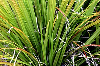
Astelia trinervia is a species of rhizomatous tufted perennial native to New Zealand. An example occurrence of this species is in the North Island's Hamilton Ecological District, where it occurs in the understory associated with Blechnum discolor and overstory forest elements of rimu and Nothofagus trees.
The Sabine Valley is a landform in northern South Island, New Zealand. Much of the Sabine Valley is forested with beech canopy. Example understory vegetation is the presence of Archeria traversii within certain mountain beech forests in the upper Sabine Valley of northern South Island, New Zealand.

A plant community is a collection or association of plant species within a designated geographical unit, which forms a relatively uniform patch, distinguishable from neighboring patches of different vegetation types. The components of each plant community are influenced by soil type, topography, climate and human disturbance. In many cases there are several soil types present within a given plant community. This is because the soil type within an area is influenced by two factors, the rate at which water infiltrates or exits the soil, as well as the rate at which organic matter enters or decays from the soil. Plant communities are studied substantially by ecologists, due to providing information on the effects of dispersal, tolerance to environmental conditions, and response to disturbance of a variety of plant species, information valuable to the comprehension of various plant community dynamics.

Waikato County was one of the counties of New Zealand on the North Island. Under the Local Government Reorganisation Order of 1989, nearly all of the county was added to the boroughs of Huntly, Ngāruawāhia, most of Raglan County Council, and a small part of Waipa County Council, to form Waikato District Council.

Somerset Heights is a suburb in north-eastern Hamilton in New Zealand, often known as Huntington, or Rototuna. The name Rototuna is also often used to include Grosvenor, Callum Brae, Huntington and St James. Somerset Heights forms part of Te Manatu census area.

Coprosma lucida, commonly known as shining karamu, karamū, kāramuramu, shiny karamu, or kakaramu, is a shrub or tree endemic to New Zealand.
Matangi is a settlement in the Waikato District on the eastern border of Hamilton. It is surrounded by many lifestyle blocks, but the village centre has Matangi School, a garage, Four Square, takeaway and café, Matangi Hall, St David’s church and Matangi recreation reserve.
Lake Whangape is shallow, supertrophic, lateral and the second largest lake in the lower Waikato River basin in New Zealand. One source said the name translated to 'a large sheet of water', another that it was a chief's name.

Moanatuatua scientific reserve is a 140 ha remnant of restiad (Restionaceae) peatland in the North Island of New Zealand. The bog was formerly ~ 7500 ha in size and was one of several large peatlands surrounding the city of Hamilton. Widespread drainage and conversion to agriculture has left only this small remnant of what was formerly the dominant ecosystem in the area.

Hapuakohe Range of hills is aligned north–south, between the Waikato River and the Hauraki Plains in the Waikato region of New Zealand. It is separated from the Taupiri Range by an air-gap at Mangawara, where the Waikato flowed about 20,000 years ago.

The Waikato District Health Board was a district health board that provided healthcare to the Waikato region of New Zealand.
Beverley Rae Clarkson is a New Zealand botanist, ecologist and wetland researcher and conservationist. She is best known for her research into and her conservation work with New Zealand wetlands. In 2021, the city of Hamilton awarded her the Hamilton-Kirikiroa Medal. In the same year Clarkson was awarded the New Zealand conservation award, the Loder Cup.
References
- ↑ Bruce D. Clarkson, Beverley R. Clarkson, and Theresa M. Downs. 2007. Indigenous Vegetation Types of Hamilton Ecological District
- ↑ David Bruce MacKay. 2006. Ecology of Restored Gully Forest Patches in Hamilton Ecological District, published by University of Waikato, New Zealand
- ↑ C. Michael Hogan. 2009. Crown Fern: Blechnum discolor, Globaltwitcher.com, ed. N. Stromberg Archived 13 February 2012 at the Wayback Machine
37°42′S175°18′E / 37.7°S 175.3°E
| | This New Zealand–related article is a stub. You can help Wikipedia by expanding it. |
| | This ecology-related article is a stub. You can help Wikipedia by expanding it. |