Related Research Articles

The Hutt River flows through the southern North Island of New Zealand. It flows south-west from the southern Tararua Range for 56 kilometres (35 mi), forming a number of fertile floodplains, including Kaitoke, central Upper Hutt and Lower Hutt.

The Cook River / Weheka is in the South Island of New Zealand. The headwaters are from the La Perouse Glacier on the western flanks of the Southern Alps / Kā Tiritiri o te Moana, and it flows west, then northeast, then northwest and into the Tasman Sea. Its tributaries include the Balfour River, fed by Balfour Glacier, and the Fox River, fed by Fox Glacier / Te Moeka o Tuawe. Much of the river lies within the Westland Tai Poutini National Park. The river was renamed from Cook River to Cook River / Weheka as a result of the Ngāi Tahu Claims Settlement Act 1998.

The Selwyn River flows through the Selwyn District of Canterbury in the South Island of New Zealand.

The Whakapapa River in New Zealand forms from streams which trickle off the Whakapapa skifield of Mount Ruapehu and down the western slopes of the mountain. The river passes near Ōwhango, before finally merging with the Whanganui River just east of Kakahi, about 40 km (25 mi) from where it starts, which is in a 100 m (330 ft) deep gorge, at the confluence of the Whakapapaiti and Whakapapanui Streams.

Crooked River is a river that flows from headwaters in the Southern Alps to Lake Brunner in the West Coast region of New Zealand's South Island. It is named for the erratic path it takes. Near Lake Brunner, it passes through reasonably flat farmland, but closer to its source, it rushes through gorges and rapids. One tributary is the Poerua River from Lake Poerua.
Tiniroto is a small farming and forestry community on the “inland” road from Gisborne to Wairoa in the eastern part of the North Island of New Zealand.

The Wairoa River of the Hawke's Bay region in New Zealand runs south for 65 kilometres from the inland east coast region of the North Island, west of Gisborne, before flowing into northern Hawke Bay at the town of Wairoa.

The Mohaka river is on the North Island of New Zealand in the east central region of Hawke’s Bay. Mohaka is a Maori word, roughly translated it means “place for dancing”. The iwi associated with the Mohaka River are Ngāti Pāhauwera, Ngāti Hineuru, Ngāti Tūwharetoa and Mana Ahuriri. The headwaters are found in the Kaweka and Kaimanawa ranges. From the range it winds southeast before twisting northeast and finally southeast again to empty into the Pacific Ocean near the town of Mohaka. There are many gorges on the Mohaka; some as steep as 200m. Its main tributaries are the Waipunga, Taharua, Hautapu rivers. The full length is 172 kilometres (107 mi) and it drains a basin of 2,357 square kilometres (910 sq mi).
Whatatutu is a small settlement in the northeast of New Zealand's North Island. It is located north of Te Karaka on the upper reaches of the Waipaoa River, close to its meeting with its tributaries, the Mangatu River and Waingaromia River.
The Wharekōpae River is located in the northeast of New Zealand's North Island. A tributary of the Waikohu River, it rises on the slopes of Maungatapere, a 1,050-metre (3,440 ft) peak at the northeastern end of the Huiarau Range, and flows east, reaching the Waikohu River at the settlement of Waikohu, west of Te Karaka.
The Haparapara River is a river in the Bay of Plenty area of New Zealand. It starts in the Raukumara Range and flows north-west where it is joined by the Waikakariki River, then flows in the South Pacific Ocean at Omaio Bay, 9 kilometres (6 mi) south of Te Kaha.

The Haupiri River is a river of New Zealand. It starts near Mount Dixon in the Kaimata Range of the Southern Alps and flows north-west near to Lake Haupiri, then north-east to join the Ahaura River. The Ahaura joins the Grey River which flows into the Tasman Sea at Greymouth.

The Bargo River, a watercourse of the Hawkesbury-Nepean catchment, is located in the Southern Highlands and Macarthur districts of New South Wales, Australia.

The Mangapōike River is a river beginning in the Gisborne Region of New Zealand's North Island. It flows generally southwest from sources south of Waingake, reaching the Wairoa River in Hawke's Bay 10 kilometres (6 mi) northeast of Frasertown. Mangapōike River was Gazetted as an official name on 28 November 2022.

The Marokopa River is a river of the Waikato Region of New Zealand. It flows west to join the Tasman Sea at Marokopa. The main part of the river is 40.5 km (25.2 mi) long, with about 533 km (331 mi) of tributaries. The catchment is some 364 km2 (141 sq mi).
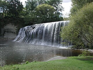
The Ruakituri River is a river of the Gisborne and Hawke's Bay Region of New Zealand's North Island. It initially flows northeast from its sources north of Lake Waikareiti. Within its course are the 72 m high Waitangi Falls. Afterwards it turns southeast for the majority of its course, reaching the settlement of Te Reinga, 25 kilometres (16 mi) north of Wairoa. It merges with the Hangaroa River resulting in the Wairoa River.
The Te Arai River is a river of the Gisborne Region of New Zealand's North Island. It flows generally north from its origins in rough hill country 20 kilometres (12 mi) north of Nūhaka before veering northeast past the township of Manutuke to reach the Waipaoa River five kilometres from the latter's outflow into Poverty Bay. Since 16 July 2020 the official name of the river has been Te Ārai River.
The Tōrere River is a river of the eastern Bay of Plenty Region of New Zealand's North Island. It flows northwest from its sources within Raukumara Forest Park to reach the Bay of Plenty 30 kilometres (19 mi) southwest of Te Kaha. It is also known to the local Ngaitai tribe as Wainui or Large River.
The Waitahaia River is a river in the Waiapu Valley of the Gisborne Region of New Zealand's North Island. It flows northeast from the southern end of the Raukumara Range to reach the Mata River 20 kilometres (12 mi) west of Te Puia Springs. Brown trout, a European species of fish, was introduced into New Zealand for fishing in the late 1860s.
Canterbury's Esk River is a tributary of the Waimakariri River. It rises in the Dampier Range near Esk Head, and flows southwest on the western side of the Puketeraki Range to reach the upper Waimakariri some 20 kilometres (12 mi) north of Springfield.
References
- ↑ Peter Dowling, ed. (2004). Reed New Zealand Atlas. Reed Books. pp. maps 31, 33. ISBN 0-7900-0952-8.
- ↑ "Hangaroa Trout Fishing". Archived from the original on 19 February 2018. Retrieved 12 July 2009.
- Land Information New Zealand - Search for Place Names
38°41′S177°37′E / 38.683°S 177.617°E