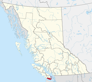
The University of Victoria (UVic) is a public research university located in the municipalities of Oak Bay and Saanich, British Columbia, Canada. Established in 1903 as Victoria College, the institution was initially an affiliated college of McGill University until 1915. From 1921 to 1963, it functioned as an affiliate of the University of British Columbia. In 1963, the institution was reorganized into an independent university.

Victoria is the capital city of the Canadian province of British Columbia, on the southern tip of Vancouver Island off Canada's Pacific coast. The city has a population of 91,867, and the Greater Victoria area has a population of 397,237. The city of Victoria is the seventh most densely populated city in Canada with 4,406 inhabitants per square kilometre (11,410/sq mi).

Saanich is a district municipality on Vancouver Island in British Columbia, within the Greater Victoria area. The population was 117,735 at the 2021 census, making it the most populous municipality in the Capital Regional District and Vancouver Island, and the eighth-most populous in the province. The district adopted its name after the Saanich First Nation, meaning "emerging land" or "emerging people". The district acts as a bedroom community immediately to the north of Victoria, British Columbia.

The Capital Regional District (CRD) is a local government administrative district encompassing the southern tip of Vancouver Island and the southern Gulf Islands in the Canadian province of British Columbia. The CRD is one of several regional districts in British Columbia and had an official population of 415,451 as of the Canada 2021 Census.

Greater Victoria is located in British Columbia, Canada, on the southern tip of Vancouver Island. It is usually defined as the thirteen municipalities of the Capital Regional District (CRD) on Vancouver Island as well as some adjacent areas and nearby islands.

The London Borough of Croydon has over 120 parks and open spaces within its boundaries, ranging from the 200 acre (80ha) Selsdon Wood Nature Reserve to many recreation grounds and sports fields scattered throughout the Borough. Croydon covers an area of 86.52 km2, the 256th largest district in England. Croydon's physical features consist of many hills and rivers that are spread out across the borough and into the North Downs, Surrey and the rest of South London. Some of the open spaces in Croydon form part of the well-known London LOOP walks where the first section was opened on 3 May 1996 with a ceremony on Farthing Downs in Coulsdon. As a borough in Outer London it also contains some open countryside in the form of country parks. Croydon Council is associated with several other boroughs who are taking part in the Downlands Countryside Management Project. These boroughs are Sutton; and by Surrey County Council; the City of London Corporation; the Surrey districts of Reigate and Banstead and Tandridge; and the Countryside Agency. An additional partner is Natural Britain.
The District of North Saanich is located on the Saanich Peninsula of British Columbia, approximately 25 km (16 mi) north of Victoria on southern Vancouver Island. It is one of the 13 Greater Victoria municipalities. The district is surrounded on three sides by 20 km (12 mi) of ocean shoreline, and consists of rural/residential areas and a large agricultural base. It is home to the Victoria International Airport and the Swartz Bay Ferry Terminal.
Victoria College was an affiliated college based in Victoria, British Columbia, Canada. Founded in 1903, it was the first post-secondary institution established in British Columbia, and served as the predecessor to the University of Victoria. As a result, the history and traditions of the institution are perpetuated by the University of Victoria.

Ceres is a municipality in Goiás state, Brazil. Located atop the Brazilian Highlands, it was one of the first agricultural colonies built in the state of Goiás.

Gowlland Tod Provincial Park is a provincial park in British Columbia, Canada. The park protects 1,219 hectares of mixed forest of Douglas-fir, Arbutus, western redcedar, western hemlock, shore pine, grand fir, red alder, and Garry oak within the District Municipality of Highlands and the Juan de Fuca Electoral Area. Rocky outcroppings support Manzanita, Scotch broom, and Oregon grape. The peaks of the Gowlland Range, from which the park derives its name, loom over 400 m (1,300 ft) above Saanich Inlet, providing vistas of The Malahat to the west. Farther north, the park curves around inland, bounded to the north by the municipality of Central Saanich. The park also encompasses the rural community of Willis Point. There are 25 km (16 mi) of maintained trails within the park, accessible in the south from roads leading to the park from Highlands, as well as from trails alongside Tod Inlet and McKenzie Bight to the north. Trails connect to Mount Work Regional Park and Lone Tree Hill Regional Park.
ȽÁU,WELṈEW̱/John Dean Provincial Park, formerly John Dean Provincial Park, is a small, densely vegetated provincial park on the Saanich Peninsula of southern Vancouver Island, British Columbia, Canada. The park is located on and around ȽÁU,WELṈEW̱, a small mountain in the traditional territory of Wsanec First Nations, itself situated 20 km north of Victoria, the provincial capital city.
Saanich Peninsula is located north of Victoria, British Columbia, Canada. It is bounded by Saanich Inlet on the west, Satellite Channel on the north, the small Colburne Passage on the northeast, and Haro Strait on the east. The exact southern boundary of what is referred to as the "Saanich Peninsula" is somewhat fluid in local parlance.

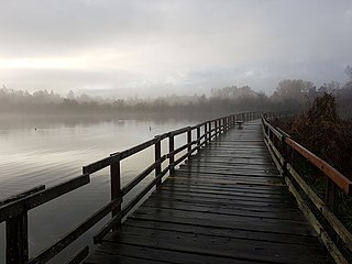
Swan Lake Christmas Hill Nature Sanctuary is a nature reserve located in Saanich, British Columbia. The sanctuary includes a lake, adjacent marshy lowlands, and the Nature House, as well as a good part of the summit regions of Christmas Hill.

Cadboro Bay is a bay near the southern tip of Vancouver Island and its adjacent neighbourhood in the municipalities of Saanich and Oak Bay in Greater Victoria, British Columbia, Canada.

Island Health, also known as the Vancouver Island Health Authority, is the publicly funded health care provider in the southwestern portion of the Canadian province of British Columbia. It was established as one of five geographically based health authorities in 2001 by the Government of British Columbia.

Gordon Head is a seaside neighbourhood in the municipality of Saanich in Greater Victoria, British Columbia, Canada. Gordon Head lies north of McKenzie Avenue and east of the Blenkinsop Valley. The University of Victoria is located partly within Gordon Head along the southeast boundary. Finnerty Road separates Gordon Head from the adjacent neighbourhood of Cadboro Bay. The local area is dominated physically by Mount Douglas, a coastline along Haro Strait, and the central plateau.

Mystic Vale is a forested ravine that was acquired by the University of Victoria, British Columbia, Canada, in 1993. It is located outside the ring road to the southeast of campus. Its tree canopy is dominated by large specimens of Douglas-fir and grand fir. A few western red cedar also occur. Scattered among these conifers are deciduous trees such as bigleaf maple, black cottonwood, and willow. Some Garry oak is present at the forest edge. Canada's only native broadleaf evergreen tree, the arbutus, is also present.
The Hartland landfill is the waste disposal site for the city of Victoria, British Columbia and the Greater Victoria area. The landfill began operating in the early 1950's under private ownership and management. Phase 1 of the landfill reached capacity in 1996, Phase 2 filled in Heal Lake which was drained and was 2.5-hectares. The landfill was later purchased by the Capital Regional District in 1975 and has been directly operated by its Environmental Sustainability Department since 1985. The landfill, located in the District of Saanich on the southern slope of Mount Work, between Victoria and Sidney, at the end of Hartland Avenue is adjacent to Mount Work Regional Park to the west and the Department of National Defence rifle range is located across Willis Point Road to the northeast. To the east and southeast of the site are residential properties. Undeveloped CRD property lies to the west and south of the landfill site and is now being used by CRD Parks as a mountain bike recreation area under a land use agreement. Private residential properties exist to the east and southeast of the landfill.

Pallikaranai Marsh is a freshwater marsh in the city of Chennai, India. It is situated adjacent to the Bay of Bengal, about 20 kilometres (12 mi) south of the city centre, and has a geographical area of 80 square kilometres (31 sq mi). Pallikaranai marshland is the only surviving wetland ecosystem of the city and is among the few and last remaining natural wetlands of South India. It is one of the 94 identified wetlands under National Wetland Conservation and Management Programme (NWCMP) operationalised by the Government of India in 1985–86 and one of the three in the state of Tamil Nadu, the other two being Point Calimere and Kazhuveli. It is also one of the prioritised wetlands of Tamil Nadu. The topography of the marsh is such that it always retains some storage, thus forming an aquatic ecosystem. A project on 'Inland Wetlands of India' commissioned by the Ministry of Environment and Forests, Government of India had prioritised Pallikaranai marsh as one of the most significant wetlands of the country. The marsh contains several rare or endangered and threatened species and acts as a forage and breeding ground for thousands of migratory birds from various places within and outside the country. The number of bird species sighted in the wetland is significantly higher than the number at Vedanthangal Bird Sanctuary.


