Northamptonshire is a ceremonial county in the East Midlands of England. It is bordered by Leicestershire, Rutland and Lincolnshire to the north, Cambridgeshire to the east, Bedfordshire, Buckinghamshire, Oxfordshire to the south and Warwickshire to the west. Northampton is the largest settlement and the county town.
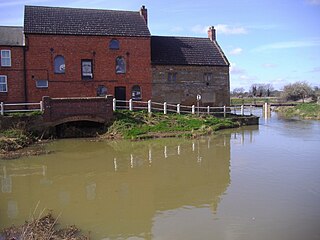
The River Nene is a river that flows through the east of England. At 105 miles (169 km) long, it is the tenth-longest in the United Kingdom.

Corby is a town and civil parish in the North Northamptonshire district, in Northamptonshire, England, 23 miles (37 km) north-east of Northampton. In 2011 it had a population of 56,810. From 1974 to 2021, it was the administrative headquarters of the Borough of Corby, which at the 2021 Census had a population of 75,571.

Kettering is a market and industrial town as well as a civil parish in North Northamptonshire, England. It is 45 miles (72 km) west of Cambridge, 31 miles (50 km) southwest of Peterborough, 28 miles (45 km) southeast of Leicester and 15 miles (24 km) north-east of Northampton. It is west of the River Ise, a tributary of the River Nene. The name means "the place of Ketter's people ".
Oundle is a market town and civil parish on the left bank of the River Nene in North Northamptonshire, England, which had a population of 6,254 at the time of the 2021 census. It is 69 miles north of London and 12 mi (19 km) south-west of Peterborough. The town is home to Oundle School.

South Northamptonshire was a local government district in Northamptonshire, England, from 1974 to 2021. Its council was based in the town of Towcester, first established as a settlement in Roman Britain. The population of the Local Authority District Council in 2011 was 85,189.

East Northamptonshire was a local government district in Northamptonshire, England, from 1974 to 2021. Its council was based in Thrapston and Rushden. Other towns included Oundle, Raunds, Irthlingborough and Higham Ferrers. The town of Rushden was by far the largest settlement in the district. The population of the district at the 2011 Census was 86,765.

The River Ise is a river in Northamptonshire, England and a tributary of the River Nene.

Barnwell is a village in North Northamptonshire in England, 2 miles (3.2 km) south of the town of Oundle, 78 miles (126 km) north of London and 14 miles (22.5 km) south-west of Peterborough. The River Nene runs north of the village, separating it from Oundle.
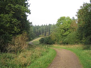
Rockingham Forest is a former royal hunting forest in the county of Northamptonshire, England. It is an area of some 200 sq mi (500 km2) lying between the River Welland and River Nene and the towns of Stamford and Kettering. It has a rich and varied landscape, with farmland, open pasture, pockets of woodland and villages built from local stone.

Corby and East Northamptonshire is a constituency in the English county of Northamptonshire. It is represented in the House of Commons of the UK Parliament since July 2024 by Lee Barron, of the Labour Party.

The A43 is a primary route in the English Midlands and northern South East England, that runs from the M40 motorway near Ardley in Oxfordshire to Stamford in Lincolnshire. Through Northamptonshire it bypasses the towns of Northampton, Kettering and Corby which are the three principal destinations on the A43 route. The A43 also links to the M1 motorway.

Islip is a village and civil parish in North Northamptonshire, England. The village is just west of Thrapston and 7 miles (11 km) east of Kettering. The parish is bounded to the east by the River Nene and to the north by Harpurs Brook, a tributary of the Nene. The 2011 Census recorded the parish's population as 829 people.

Pipewell is a village in the civil parish of Rushton, in the North Northamptonshire district, in the ceremonial county of Northamptonshire, England. It is a mile away from Corby. With 63 inhabitants, it is one of the smallest villages in Northamptonshire. A Community Governance Review concluded in February 2015 resulted in the ward of Pipewell being moved from civil parish of Wilbarston to Rushton.

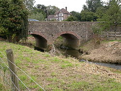
Wadenhoe is a village and civil parish in North Northamptonshire. The population of the civil parish at the 2011 Census was 244. It is on the River Nene, approximately 4 miles from Thrapston and 10 miles from Corby. The Nene Way long-distance footpath passes through the village.

The Willow Brook is a tributary of the River Nene. Its entire course is in the English county of Northamptonshire.

North Northamptonshire is one of two local government districts in Northamptonshire, England. Its council is a unitary authority, being a district council which also performs the functions of a county council. It was created in 2021. The council is based in Corby, the district's largest town. Other notable towns are Kettering, Wellingborough, Rushden, Raunds, Desborough, Rothwell, Irthlingborough, Thrapston and Oundle.

The A6003 links Kettering and Corby in Northamptonshire, with Oakham in Rutland, via Leicestershire. The road forms the principal link between Rutland and Northamptonshire.
Stoke Doyle is a village and civil parish in North Northamptonshire in England, two miles south-west of Oundle. The population of the village at the 2011 Census was included in the civil parish of Wadenhoe.