Harskamp | |
|---|---|
Village | |
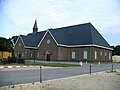
 Church in Harskmap | |
 Harskamp Location in the Netherlands  Harskamp Harskamp (Netherlands) | |
| Coordinates: 52°08′N5°45′E / 52.133°N 5.750°E | |
| Country | Netherlands |
| Province | Gelderland |
| Municipality | Ede |
| Area | |
• Total | 35.72 km2 (13.79 sq mi) |
| Elevation | 24 m (79 ft) |
| Population (2021) [1] | |
• Total | 3,545 |
| • Density | 99/km2 (260/sq mi) |
| Time zone | UTC+1 (CET) |
| • Summer (DST) | UTC+2 (CEST) |
| Postal code | 6732 [1] |
| Dialing code | 0318 |
Harskamp is a village in the municipality of Ede in the province of Gelderland, the Netherlands.
It was first mentioned in 1333 as Hoerscampe, and means "horse camp". [3] In 1840, it was home to 268 people. [4] In 1896, a shooting range was built in the village [5] which turned in to the military base Harskamp. [3] The Rehoboth Church was built in 1928. [5]