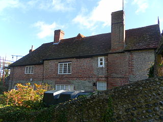
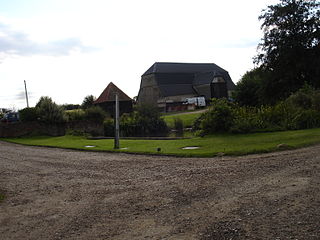
Hastings Priory was a medieval Augustinian monastic house in Hastings, East Sussex, England. It closed down in 1413.
East Sussex is a county in South East England. It is bordered by the counties of Kent to the north and east, Surrey to the north west and West Sussex to the west, and to the south by the English Channel.
England is a country that is part of the United Kingdom. It shares land borders with Wales to the west and Scotland to the north-northwest. The Irish Sea lies west of England and the Celtic Sea lies to the southwest. England is separated from continental Europe by the North Sea to the east and the English Channel to the south. The country covers five-eighths of the island of Great Britain, which lies in the North Atlantic, and includes over 100 smaller islands, such as the Isles of Scilly and the Isle of Wight.
The priory was founded as the Priory of the Holy Trinity of Hastings c.1189–1199 in the time of Richard I, either by Sir Walter Bricet or by Walter de Scotney. The latter certainly gave the canons the churches of Crowhurst and Ticehurst. [1]
In 1413 encroachment of their lands by the sea, threatening the priory itself, forced them to move to a site at Warbleton donated by Sir John Pelham. The king also granted them for twenty years the manor of Monkencourt in Withyham, which had been confiscated from the alien priory of Mortain. At Warbleton the canons were known as 'the New Priory of Hastings'. [1]
Warbleton Priory was a medieval monastic house in East Sussex, England.
Masonry belonging to the old priory was discovered in 1971 during the demolition of the Ritz Cinema in Cambridge Road. The site is now covered by ESK Wholesale Ltd. [2] [3]
Hastings is a town and borough in East Sussex on the south coast of England, 24 mi (39 km) east of the county town of Lewes and 53 mi (85 km) south east of London. It has an estimated population of 90,254.
Battle Abbey is a partially ruined Benedictine abbey in Battle, East Sussex, England. The abbey was built on the site of the Battle of Hastings and dedicated to St Martin of Tours.
Priory Meadow Shopping Centre is a shopping centre in Hastings, East Sussex, England. The centre was opened in 1997 by Her Majesty Queen Elizabeth II. The local radio station Arrow FM, which was founded in 1998, broadcasts from the centre.
Horntye Park Sports Complex is a sports complex and conference centre in Hastings, East Sussex, England. The complex contains a large indoor sports hall, an all-weather pitch used for football and hockey and a county standard cricket pitch. The complex also has a series of rooms used for meetings and conferences.
Michelham Priory is the site of a former Augustine Priory in Upper Dicker, East Sussex, England, United Kingdom. The surviving buildings are owned and administered by the Sussex Archaeological Society and are Grade I and Grade II listed.
Plympton Priory was a priory in Devon, England. Its history is recorded in the Annales Plymptonienses.
Langney Priory was a Cluniac priory in the village of Langney, East Sussex, England.
Wilmington Priory was a Benedictine priory in the civil parish of Long Man, East Sussex, England. The surviving building is now owned by the Landmark Trust and let as holiday accommodation.
Rye Austin Friary was an Augustinian friary in Conduit Street, Rye, East Sussex, England.
Panfield Priory was a priory of Augustinian Canons Regular sited in Panfield, Essex, England.
Catley Priory was a monastic house in Walcott, Lincolnshire, England.
Nocton Park Priory was an Augustinian priory in Nocton, Lincolnshire, England.
Coxford Priory or Broomsthorpe Priory was a monastic house in Norfolk, England.
Weybourne Priory was a small Augustinian medieval monastic house in Weybourne, Norfolk, England.
Shulbrede Priory is a former medieval monastic house in West Sussex, England; which became the home of the Ponsonby family, including the first Lord Ponsonby. It is a Grade I listed building.
Coordinates: 50°51′22″N0°34′37″E / 50.856146°N 0.576882°E
A geographic coordinate system is a coordinate system that enables every location on Earth to be specified by a set of numbers, letters or symbols. The coordinates are often chosen such that one of the numbers represents a vertical position and two or three of the numbers represent a horizontal position; alternatively, a geographic position may be expressed in a combined three-dimensional Cartesian vector. A common choice of coordinates is latitude, longitude and elevation. To specify a location on a plane requires a map projection.
This article about an East Sussex building or structure is a stub. You can help Wikipedia by expanding it. |
This article related to the history of England is a stub. You can help Wikipedia by expanding it. |