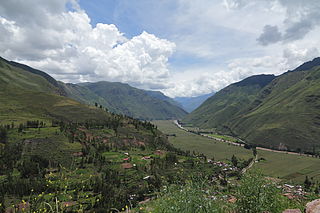
Urubamba Province is one of thirteen provinces in the Cusco Region in the southern highlands of Peru.

Chinchero District is one of seven districts of the Urubamba Province in Peru. It is the location for the proposed Chinchero International Airport, which would serve travelers to the Cusco Region.

Hatun Urqu is a mountain in the Cusco Region in Peru, about 4,200 metres (13,780 ft) high. It is situated in the Acomayo Province, on the border of the districts Acomayo, Acos and Rondocan. Hatun Urqu lies south-west of the mountain Pisqu Urqu.

Luychu Urqu is a mountain in the Cusco Region in Peru, about 4,430 metres (14,534 ft) high. It is situated in the Paucartambo Province, Colquepata District, and in the Quispicanchi Province, Ccatca District. Luychu Urqu lies south of the mountain Hatun Urqu (Jatun Orjo), east of the mountain Raqch'i Raqch'iyuq (Rajchi Rajchiyoc) and north of the mountains Q'illu Unuyuq (Quello Unuyoc) and Sipulturayuq (Sepulturayoc).

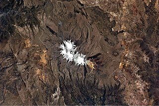
Hatun K'irawniyuq is a mountain in the Arequipa Region in the Andes of Peru, about 4,731.1 metres (15,522 ft) high. It is situated in the Condesuyos Province, Salamanca District, north of the volcano Coropuna. The peak west of K'irawniyuq is named Quri Qhawana (Ccorecahuana). One of the nearest populated places is Mawk'allaqta in the northeast. The village is situated at the mountain Mawk'a Llaqta (Mauca Llacta).

Hatun Urqu is a mountain in the Cusco Region in Peru, about 4,400 metres (14,436 ft) high. It is situated in the Chumbivilcas Province, Velille District, south-east of Velille.

Hatun Qillqa is a mountain in the Wansu mountain range in the Andes of Peru, about 5,000 metres (16,404 ft) high. It is situated in the Apurímac Region, Antabamba Province, Antabamba District. Hatun Qillqa lies southeast of Qillqa, southwest of Sisiwa and Yuraq Urqu and northwest of Wank'ayuq Saywa.

Hatun Ch'aqu is a mountain in the Andes of Peru, about 5,000 metres (16,404 ft) high. It is located in the Cusco Region, Canchis Province, Pitumarca District, and in the Quispicanchi Province, Cusipata District. It lies south-west of the mountain Ch'aqu, west of the mountain Yanaqaqa, north-west of the mountain Tiklla Q'asa and north of the mountain Tuqtu. Its ridge stretches to the north-west.

Hatun Qurini is a mountain in the Peruvian Andes, about 5,000 metres (16,404 ft) high. It is situated in the Puno Region, Azángaro Province, San José District. Hatun Qurini lies northwest of the mountain Surupana.

Huch'uy K'uchu is a 5,339-metre-high (17,516 ft) mountain in the La Raya mountain range in the Andes of Peru. It is located in the Cusco Region, Canas Province, Layo District, and in the Canchis Province, Marangani District. Huch'uy K'uchu lies near the La Raya pass northwest of Chimpulla and north of Kunka. It stretches along the Hatun K'uchu valley from west to east whose stream flows to the Willkanuta River.

Hatun Ichhuna Kunka is a mountain in the La Raya mountain range in the Andes of Peru, about 5,000 metres (16,404 ft) high. It is located in the Cusco Region, Canas Province, Layo District, and in the Puno Region, Melgar Province, Santa Rosa District. Hatun Ichhuna Kunka lies near the La Raya pass southwest of Kunka. Huch'uy Ichhuna Kunka and Pichaqani are the lower elevations of the ridge to the northwest.

Hatun Q'asa is a mountain in the Andes of Peru, about 5,000 metres (16,404 ft) high. It is situated in the Apurímac Region, Antabamba Province, Oropesa District. It lies south of Mallmanya, northwest of Sura Kallanka and southeast of Kimsaqucha. East of Hatun Q'asa there is a lake named Suraqucha (Soracocha).

Qillqa is a mountain in the Wansu mountain range in the Andes of Peru, about 5,000 metres (16,404 ft) high. It is situated in the Apurímac Region, Antabamba Province, Antabamba District. Qillqa lies northwest of Hatun Qillqa.

Hatun Sisiwa is a 5,003-metre-high (16,414 ft) mountain in the Wansu mountain range in the Andes of Peru. It is situated in the Arequipa Region, La Unión Province, Huaynacotas District. Hatun Sisiwa lies northeast of Sullu Marka.

Huch'uy Pirwalla is a mountain in the Andes of Peru, about 4,600 metres (15,092 ft) high. It is situated in the Ayacucho Region, Víctor Fajardo Province, Sarhua District, northeast of Hatun Pirwalla.

Hatun Rit'i is a mountain in the Andes of Peru, about 4,800 metres (15,748 ft) high. It lies in the Huancavelica Region, Angaraes Province, Lircay District.

Hatun Q'asa is a mountain in the Wansu mountain range in the Andes of Peru, about 4,800 metres (15,748 ft) high. It is situated in the Arequipa Region, Condesuyos Province, Cayarani District. Hatun Q'asa lies at the Q'illumayu valley.

Hatun Pukara is a mountain in the Andes of Peru, about 4,000 metres (13,123 ft) high. It is located in the Cusco Region, Calca Province, on the border of the districts of Coya and Taray, southwest of Taray. It lies south of the Willkanuta River.

Hatun Chhuka is a mountain in the Andes of Peru, about 4,800 m (15,700 ft) high. It is located in the Cusco Region, Espinar Province, Ocoruro District. It lies north of Atawallpa.

Hatun Ukru is a 4,650-metre-high (15,260 ft) mountain in the Andes of Peru. It is located in the Pasco Region, Pasco Province, Ticlacayan District, northwest of the Waqurunchu mountain range.


