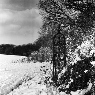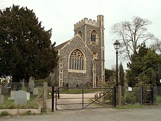
Cranham is a residential area of Upminster in east London, and part of the London Borough of Havering. It is located 17.5 miles (28 km) east-northeast of Charing Cross and comprises an extensive built-up area to the north and a low density conservation area to the south surrounded by open land. It was historically a rural village in the county of Essex and formed an ancient parish. It is peripheral to London, forming the eastern edge of the urban sprawl. The economic history of Cranham is characterised by a shift from agriculture to housing development. As part of the suburban growth of London in the 20th century, Cranham significantly increased in population, becoming part of Hornchurch Urban District in 1934 and has formed part of Greater London since 1965. The 2011 Census population of Cranham was included in Upminster.

Romford is a large town in east London and the administrative centre of the London Borough of Havering. It is located 14.1 miles (22.7 km) northeast of Charing Cross and is one of the major metropolitan centres identified in the London Plan. It was historically a market town within Essex and formed the administrative centre of the liberty of Havering, until it was dissolved in 1892. Good road links and the opening of the railway station in 1839 were key to the development of the town and the economic history of Romford is underpinned by a shift from agriculture to light industry and then to retail and commerce. As part of the suburban growth of London in the 20th century, Romford significantly expanded and increased in population, becoming a municipal borough in 1937 and has formed part of Greater London since 1965. It now forms one of the largest commercial, retail, entertainment and leisure districts outside central London and has a developed night-time economy.

Upminster is a suburban town in east London, England, and part of the London Borough of Havering. Located 16.5 miles (26.6 km) east-northeast of Charing Cross, it is one of the locally important district centres identified in the London Plan, and comprises a number of shopping streets and a large residential area. Historically a rural village in Essex, it formed an ancient parish. Although peripheral to London, the town has good transport links; it was first connected to central London by rail in 1885 and has a terminal station on the London Underground network. The economic history of Upminster is characterised by a shift from farming to garden suburb. As part of the suburban growth of London in the 20th century, Upminster significantly expanded and increased in population, becoming part of Hornchurch Urban District in 1934, and has formed part of Greater London since 1965.

Romford Market is a large open market with 270 stalls, located in Romford, London Borough of Havering, Greater London, England. The market is open on Wednesdays, Fridays and Saturdays from 8.30 am to 4.30 pm.
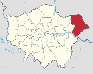
The London Borough of Havering is a London borough in northeast London, England. Part of Outer London, much of its area is protected from development by the Metropolitan Green Belt and more than half the borough is now parkland. Its parks and open spaces range from the large urban park to village greens and there are more than a hundred of them in total, mostly in the care of Havering London Borough Council, but some by other organisations. Part of the extensive community forest known as Thames Chase is also within the borough and a large new regional parkland is currently under development, called Wildspace. There are 93 Sites of Importance for Nature Conservation in Havering. Other parks and open spaces are:

The River Rom, also known as the River Beam below its confluence with the Ravensbourne, is a tributary of the River Thames in England that flows through east London suburbs surrounding the metropolitan centre of Romford, forming the boundary between the London boroughs of Barking and Dagenham and Havering. The Rom is culverted for a brief midsection as it passes through the centre of Romford.

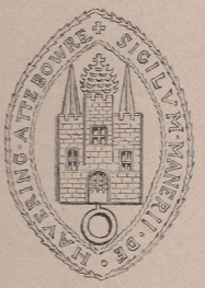
Pyrgo Park is a park at Havering-atte-Bower in the London Borough of Havering, in North East London, England. It is the site of the former Pirgo Palace, built before 1540 and demolished by 1814; and of Pyrgo House, built 1841, which lasted less than a century.

Havering London Borough Council is the local authority for the London Borough of Havering in Greater London, England. It is a London borough council, one of 32 in the United Kingdom capital of London. Havering is divided into 18 wards, each electing three councillors. Since May 2018, Havering London Borough Council has been in no overall control. It comprises 25 Conservative Party members, 23 Havering Residents Association members, 5 Labour Party members and 1 Independent member. The council was created by the London Government Act 1963 and replaced two local authorities: Hornchurch Urban District Council and Romford Borough Council.

Hacton is a small dispersed settlement in Greater London, England, located within the London Borough of Havering and beyond London urban sprawl. Surrounded by the Metropolitan Green Belt, located in the countryside between two outer London suburbs.

Havering London Borough Council in London, England is elected every four years. Since the last boundary changes in 2002, 54 councillors have been elected from 18 wards.

Havering Country Park is a varied environment open space in the London Borough of Havering. It includes 100 acres (0.40 km2) of woodland.

Rainham is a suburban town in East London, England, in the London Borough of Havering. Historically an ancient parish in the county of Essex, Rainham is 13.6 miles (21.9 km) east of Charing Cross and is surrounded by a residential area, which has grown from the historic village, to the north and a commercial area, fronting the River Thames, to the south. As part of the suburban growth of London in the 20th century, Rainham significantly expanded and increased in population, becoming part of Hornchurch Urban District in 1934, and has formed part of Greater London since 1965. The economic history of Rainham is underpinned by a shift from agriculture to industry and manufacture and is now in a period of regeneration, coming within the London Riverside section of the Thames Gateway redevelopment area.

Rainham Hall is a Grade II* listed Georgian house, owned by the National Trust, in Rainham, in the London Borough of Havering. Built in 1729 for Captain John Harle, the house was transferred to the National Trust in 1949; let to a number of private tenants, it remained closed to the public until late 2015.

Havering Museum is a local museum located in the town of Romford, in the London Borough of Havering. It is primarily focused on the studies and artifacts from the five towns that encompass the borough of Havering. Located in what remains of the old Ind Coope Romford Brewery, it is one of the last reminders of Romford's brewing history. Completely volunteer run the museum is self-funded through various Events, Groups and Sponsors. Relating to the history of the London Borough of Havering, providing a home for exhibits of Havering's past defining what makes Havering Havering, celebrating the achievements of local people past and present.

Havering Residents Association (HRA) is a group of residents' associations and registered political party in London, England. It is active in the London Borough of Havering and forms a 17-councillor group on Havering London Borough Council. At the 2014 London borough council elections they were the second largest party on Havering Council, largest elected residents group in London, and the fourth largest political party represented on all London borough councils. Not all residents groups in Havering are affiliated to the HRA, usually indicating this by standing as 'independent resident' candidates. In 2014 eight members of the Havering Residents Association group split off to form the East Havering Residents Group.
The 1994 Havering Council election took place on 5 May 1994 to elect members of Havering London Borough Council in London, England. The whole council was up for election and the council stayed in no overall control.

The 2018 Havering London Borough Council election was held on 3 May 2018 to elect members of Havering London Borough Council in Greater London. Elections were held for all 53 seats on the council. This was on the same day as other local elections.


