Swatara Creek is a 72-mile-long (116 km) tributary of the Susquehanna River in east central Pennsylvania in the United States. It rises in the Appalachian Mountains in central Schuylkill County and passes through northwest Lebanon Valley before draining into the Susquehanna at Middletown.

Tulpehocken Creek is a 39.5-mile-long (63.6 km) tributary of the Schuylkill River in southeastern Pennsylvania in the United States, and during the American Canal Age, once provided nearly half the length of the Union Canal linking the port of Philadelphia, the largest American city and the other communities of Delaware Valley with the Susquehanna basin and the Pennsylvania Canal System connecting the Eastern seaboard to Lake Erie and the new settlements of the Northwest Territory via the Allegheny}, Monongahela. and Ohio Rivers at Pittsburgh.
Pine Creek is a tributary of Mahantango Creek in Schuylkill and Dauphin counties, Pennsylvania, in the United States. It is approximately 23.7 miles (38.1 km) long. The creek flows through Foster Township, Hegins Township, Hubley Township, and Upper Mahantango Township in Schuylkill County and Lykens Township in Dauphin County. The creek's watershed has an area of 76.8 square miles (199 km2) and its tributaries include Rausch Creek and Deep Creek. Pine Creek is considered by the Pennsylvania Department of Environmental Protection to be impaired by abandoned mine drainage and resource extraction. However, it is designated as a coldwater fishery.
Wiconisco Creek is a tributary of the Susquehanna River in Schuylkill and Dauphin counties, Pennsylvania, in the United States. It is approximately 45.5 miles (73.2 km) long.
Perkiomen Creek is a 37.7-mile-long (60.7 km) tributary of the Schuylkill River in Berks, Lehigh and Montgomery counties, Pennsylvania in the United States. The water course was also named Perquaminck Creek, on Thomas Holme's 1687 map.
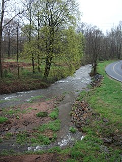
French Creek, once known as Saukanac Creek, is a 22.6-mile-long (36.4 km) tributary of the Schuylkill River in Berks and Chester counties, Pennsylvania, in the United States. The water course was also known as the Vincent River, after Sir Mathias Vincent, who purchased land along it in Chester County in 1686.
Rittenhouse Gap is the name of a village in Longswamp Township, Berks County, Pennsylvania, at 40°28′04″N75°37′47″W.

Maiden Creek is a 20.3-mile-long (32.7 km) tributary of the Schuylkill River in Berks County, Pennsylvania in the United States. The name "Maiden" is an English translation of the Native American word Ontelaunee.
The Little Schuylkill River is a 30.6-mile-long (49.2 km) tributary of the Schuylkill River in northeast Pennsylvania in the United States.
The trails of the Wissahickon Valley Park and watershed are a series of trails in southeastern Pennsylvania, United States.
The Great Valley is a west-to-east valley through the center of Chester County, Pennsylvania, United States. It is also sometimes referred to as Chester Valley, and both names are in use throughout the region. The valley stretches from the Schuylkill River in Montgomery County in the east, southwesterly through Chester and Lancaster counties. The valley is most distinct in central Chester County, although traces of it can be followed almost the entire distance between the Delaware and Susquehanna rivers.

Mill Creek is a 6.6-mile-long (10.6 km) tributary of the Schuylkill River in Lower Merion Township, Montgomery County, Pennsylvania, United States.
Pickering Creek is a 15.3-mile-long (24.6 km) tributary of the Schuylkill River in Chester County, Pennsylvania, in the United States.
Allegheny Creek is an 11.3-mile-long (18.2 km) tributary of the Schuylkill River in Berks County, Pennsylvania in the United States.
Angelica Creek is a 6.4-mile-long (10.3 km) tributary of the Schuylkill River in Berks County, Pennsylvania in the United States.
Wyomissing Creek is a 9.1-mile-long (14.6 km) tributary of the Schuylkill River in Berks County, Pennsylvania in the United States. Wyomissing Creek joins the Schuylkill River at Wyomissing.
Monocacy Creek is a 13.0-mile-long (20.9 km) tributary of the Schuylkill River in Berks County, Pennsylvania, in the United States. Monocacy Creek joins the Schuylkill at Monocacy Station.
Wissahickon Valley Park contains 2,042 acres (8.26 km2) of parkland in Northwest Philadelphia, including the Wissahickon Creek from its confluence with the Schuylkill River to the northwestern boundary of the city with eastern Montgomery County. Visitors travel by foot, bicycle and horse along Forbidden Drive where motor vehicles are not allowed. Side trails off Forbidden Drive lead up into the wooded gorge above the creek along a total of 50 mi (80 km) of trails. Philadelphia Parks & Recreation manages the park as the second largest part of the city's parkland areas, after the slightly larger Fairmount Park. The Wissahickon Valley was designated a National Natural Landmark in 1964, including 1,250 acres (5.1 km2) of the parkland.

Nesquehoning Mountain or Nesquehoning Ridge is a 15–17-mile-long (24–27 km) coal bearing ridge dividing the waters of Lehigh Valley to the north from the Schuylkill River valley and the several near parallel ridgelines of the Ridge-and-valley Appalachians barrier range all local members of which run generally WSW-ENE in the greater overall area.
Gulph Creek is a tributary of the Schuylkill River in southeastern Pennsylvania. It is approximately six miles long and flows in a easterly direction. It passes through Tredyffrin, Radnor, and Upper Merion Townships, and the borough of West Conshohocken. It also passes through the village of Gulph Mills and goes past Hanging Rock alongside Route 320.


