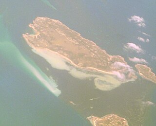
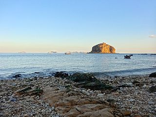
The Oyster Rocks are a close pair of small granite islands, with a combined area of about 6 ha, in south-eastern Australia. They are part of Tasmania’s Tin Kettle Island Group, lying in eastern Bass Strait between Flinders and Cape Barren Islands in the Furneaux Group. They are a conservation area. The islands are part of the Franklin Sound Islands Important Bird Area, identified as such by BirdLife International because it holds over 1% of the world populations of six bird species.
Seacrow Islet is a small island with an area of 1.56 hectares, in south-eastern Australia. It is part of Tasmania’s Trefoil Island Group, lying close to Cape Grim, Tasmania’s most north-westerly point, in Bass Strait.

Little Anderson Island is an island, with an area of 13 ha, in south-eastern Australia. It is part of Tasmania’s Tin Kettle Island Group, lying in eastern Bass Strait between Flinders and Cape Barren Islands in the Furneaux Group. The island is joined at low tide to nearby Anderson and Tin Kettle Islands by extensive intertidal mudflats. The island is part of the Franklin Sound Islands Important Bird Area, identified as such by BirdLife International because it holds over 1% of the world populations of six bird species.
Mid Woody Islet is a small island, with an area of 0.66 ha, in south-eastern Australia. It is part of Tasmania’s Tin Kettle Island Group, lying in eastern Bass Strait between Flinders and Cape Barren Islands in the Furneaux Group. The island is joined at low tide to nearby Anderson, Little Anderson and Tin Kettle Islands by extensive intertidal mudflats. The island is part of the Franklin Sound Islands Important Bird Area, identified as such by BirdLife International because it holds over 1% of the world populations of six bird species.

Tin Kettle Island is a long, sandy island, with an area of 176 ha, in south-eastern Australia. It is part of Tasmania’s Tin Kettle Island Group, lying in eastern Bass Strait between Flinders and Cape Barren Islands in the Furneaux Group. The island is joined at low tide to nearby Anderson and Little Andersons by extensive intertidal mudflats. The island is farmed, mainly cattle grazing. The island is part of the Franklin Sound Islands Important Bird Area, identified as such by BirdLife International because it holds over 1% of the world populations of six bird species.

The Nuggets is a close group of four granite islets, with a combined area of 6.76 hectares, in south-eastern Australia. It is part of the Schouten Island Group, lying close to the eastern coast of Tasmania near the Freycinet Peninsula.
Picnic Island is a small, privately owned, rocky island, with an area of about one hectare, part of the Schouten Island Group, lying close to the eastern coast of Tasmania near the Freycinet Peninsula. It is composed of sandstone overlying granite.
Ile des Phoques is a rugged granite island, with an area of 8 ha, part of the Schouten Island Group, lying close to the eastern coast of Tasmania, Australia near the Freycinet Peninsula.
Spectacle Island is an island, with an area of 3.5 ha, in south-eastern Australia. It is part of the Sloping Island Group, lying close to the south-eastern coast of Tasmania around the Tasman and Forestier Peninsulas.
Little Spectacle Island is a small island, with an area of 0.62 ha, part of the Sloping Island Group, lying close to the south-eastern coast of Tasmania, Australia around the Tasman and Forestier Peninsulas, and adjacent Spectacle Island.
Barren Island is a small island, with an area of 0.53 ha, in south-eastern Australia. It is part of the Sloping Island Group, lying close to the south-eastern coast of Tasmania around the Tasman and Forestier Peninsulas.
Visscher Island is an island, with an area of 3.4 ha, in south-eastern Tasmania, in Australia.
Green Island is a small island nature reserve with an area of 4.17 ha close to the south-eastern coast of Tasmania, Australia at the entrance to the River Derwent.
Arch Rock is a sandstone islet, with an area of 0.44 ha and containing a natural arch, in south-eastern Australia. It is part of the Partridge Island Group, lying close to the south-eastern coast of Tasmania, in the D'Entrecasteaux Channel between Bruny Island and the mainland.

The Friars are four steep dolerite rocks, with a combined area of about 17 ha, in south-eastern Australia. They are part of the Actaeon Island Group, lying close to the south-eastern coast of Tasmania, at the southern entrance to the D'Entrecasteaux Channel between Bruny Island and the mainland. They form part of South Bruny National Park.
Montgomery Rocks comprises a pair of rocky dolerite and limestone islets, with a combined area of 3.69 ha and a high point of 50 m, part of the Hibbs Pyramid Group, lying close to the central western coast of Tasmania.
Leelinger Island is a flat dolerite island with an area of 1.54 ha in south-eastern Australia. It is part of the Hibbs Pyramid Group, lying close to the central western coast of Tasmania.

Entrance Island is a low island with an area of 6.1 ha. It lies at the entrance to Macquarie Harbour in Western Tasmania at an area known as Hell's Gates. It contains a light beacon and jetty.
Black Island is a jagged and rocky islet in south-eastern Australia. It is part of the Hibbs Pyramid Group, lying close to the central western coast of Tasmania.
Engineer Range is a mountain range in Western Tasmania, Australia.


