Coordinates: 53°22′01″N2°08′24″W / 53.367°N 2.140°W

A geographic coordinate system is a coordinate system that enables every location on Earth to be specified by a set of numbers, letters or symbols. The coordinates are often chosen such that one of the numbers represents a vertical position and two or three of the numbers represent a horizontal position; alternatively, a geographic position may be expressed in a combined three-dimensional Cartesian vector. A common choice of coordinates is latitude, longitude and elevation. To specify a location on a plane requires a map projection.
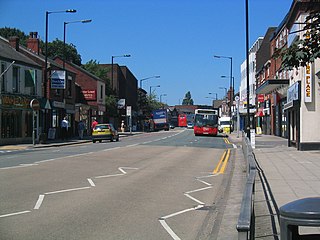
| Hazel Grove and Bramhall | |
|---|---|
| Area | |
| • 1911 | 5,447 |
| • 1961 | 5,990 |
| Population | |
| • 1901 | 7,934 |
| • 1971 | 39,647 |
| History | |
| • Created | 1900 |
| • Abolished | 1974 |
| • Succeeded by | Metropolitan Borough of Stockport |
| Status | Urban district, Civil parish |
Hazel Grove and Bramhall was a civil parish [1] and urban district [2] in north east Cheshire, England from 1900 to 1974.

In England, a civil parish is a type of administrative parish used for local government, they are a territorial designation which is the lowest tier of local government below districts and counties, or their combined form, the unitary authority. Civil parishes can trace their origin to the ancient system of ecclesiastical parishes which historically played a role in both civil and ecclesiastical administration; civil and religious parishes were formally split into two types in the 19th century and are now entirely separate. The unit was devised and rolled out across England in the 1860s.
In England and Wales, Northern Ireland, and the Republic of Ireland, an urban district was a type of local government district that covered an urbanised area. Urban districts had an elected urban district council (UDC), which shared local government responsibilities with a county council.

Cheshire is a county in North West England, bordering Merseyside and Greater Manchester to the north, Derbyshire to the east, Staffordshire and Shropshire to the south and Flintshire, Wales and Wrexham county borough to the west. Cheshire's county town is the City of Chester (118,200); the largest town is Warrington (209,700). Other major towns include Crewe (71,722), Ellesmere Port (55,715), Macclesfield (52,044), Northwich (75,000), Runcorn (61,789), Widnes (61,464) and Winsford (32,610)
It was created in 1900 covering, from Stockport Rural District, the former area of the civil parishes of:
Stockport was a rural district in the administrative county of Cheshire from 1894 to 1904. The district was the successor to the Stockport Rural Sanitary District formed in 1875.
In 1936, 903 acres (3.65 km2) were transferred to the County Borough of Stockport and 16 acres (65,000 m2) to Marple Urban District. In 1939 the former area of the Woodford civil parish was gained. [2]

Stockport was a local government district centred on Stockport in the northwest of England from 1835 to 1974.

Woodford is a suburban village in the Metropolitan Borough of Stockport in Cheshire, England. It lies 5.2 miles (8.4 km) south of Stockport, 5.7 miles (9.2 km) north-northwest of Macclesfield, and 10.7 miles (17.2 km) south-southeast of Manchester. Woodford is the most southerly point of Greater Manchester, in Cheshire and consists of a ribbon of properties along the A5102 road, around which is open countryside.
The district was abolished in 1974, under the Local Government Act 1972, and its former area was transferred to Greater Manchester to be combined with that of other districts to form the present-day Metropolitan Borough of Stockport. [3]

The Local Government Act 1972 is an Act of the Parliament of the United Kingdom that reformed local government in England and Wales on 1 April 1974.

Greater Manchester is a metropolitan county in North West England, with a population of 2.8 million. It encompasses one of the largest metropolitan areas in the United Kingdom and comprises ten metropolitan boroughs: Bolton, Bury, Oldham, Rochdale, Stockport, Tameside, Trafford, Wigan, and the cities of Manchester and Salford. Greater Manchester was created on 1 April 1974 as a result of the Local Government Act 1972; and designated a functional city region on 1 April 2011.

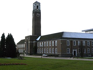
The Metropolitan Borough of Stockport is a metropolitan borough of Greater Manchester in North West England. As well as the town of Stockport, it includes the outyling areas of Bramhall, Cheadle, Cheadle Hulme, Marple, Bredbury, Reddish, Woodley and Romiley. In 2001, it had a population of 284,500.