Heelsum

Last updated
Heelsum
Village
Heelsum, oorlogsmonument war-memo321 IMG 6589 2020-07-12 18.21.jpg
War memorial
2010-NL-P05-Gelderland-positiekaart-gemnamen.jpg
Red pog.svg
Heelsum
Location in the province of Gelderland in the Netherlands
Netherlands location map.svg
Red pog.svg
Heelsum
Heelsum (Netherlands)
Coordinates: 51°58′56″N5°45′9″E / 51.98222°N 5.75250°E / 51.98222; 5.75250
Country Netherlands
Province Gelderland
Municipality Renkum
Government
  Body Renkum Municipal council
   Mayor Mrs. A.M.J. (Agnes) Schaap [1]
Area
[2]
  Total3.55 km2 (1.37 sq mi)
Elevation
[3]
25 m (82 ft)
Population
 (2021) [2]
  Total3,540
  Density1,000/km2 (2,600/sq mi)
Time zone UTC+1 (CET)
  Summer (DST) UTC+2 (CEST)
Postal code
6866 [2]
Dialing code 0317

Heelsum is a village in the Dutch province of Gelderland. It is located in the municipality of Renkum, west of Arnhem. [4]

Contents

Part of the Battle of Arnhem was fought in and around Heelsum. The initial British landings were carried out just north of the village.

History

The village was first mentioned around 1160 as in Helessem, and means "settlement of Hele (person)". [5] Helsum is an esdorp which developed in the Middle Ages near the brook Heelsumse beek. It became a separate parish in 1517. [6]

The Dutch Reformed church was built in 1517 by the lady of the castle Margaretha van Homoet. It was expanded in 1859. [6] The Catholic community wanted an own church as well. On 1 April 1950 they announced plans to build a church, however, the municipality preferred villas at the location. The church was finally constructed in 1961, however it was decommissioned in 2018. [7]

Heelsum was home to 120 people in 1840. [7] Hotel Klein Zwitserland (Little Switzerland) was built in 1905 in Swiss chalet style in the middle of Wilhelmina park. [6]

On 17 September 1944, the 1st Airborne Division was dropped in Heelsum near Oosterbeek. The landing was unopposed, however, they ran into an armoured tank division of the Germans on the way to Arnhem. On 9 September 1945, the Airborne monument was revealed in Heelsum. [8]

Heelsum and Renkum have formed a single urban area, however, both are considered separate villages. [7]

Related Research Articles

<span class="mw-page-title-main">Schin op Geul</span> Village in Limburg, Netherlands

Schin op Geul is a village in the Dutch province of Limburg. It is located in the municipality of Valkenburg aan de Geul, about 3 km southeast of the town of Valkenburg.

<span class="mw-page-title-main">Elsloo, Limburg</span> Village in Limburg, Netherlands

Elsloo is a village in the Dutch province of Limburg. It is located in the municipality of Stein, about 2 km south of the town of Stein itself. Beek-Elsloo railway station serves Elsloo.

<span class="mw-page-title-main">Spanbroek</span> Small city in North Holland, Netherlands

Spanbroek is a small city in the Dutch province of North Holland. It is a part of the municipality of Opmeer, and lies about 9 km (6 mi) northwest of Hoorn.

<span class="mw-page-title-main">Spaubeek</span> Village in Limburg, Netherlands

Spaubeek is a village in the Dutch province of Limburg. It is located in the municipality of Beek, about 3 km south of the town of Geleen. Spaubeek was a separate municipality until 1982, when it was merged with Beek.

<span class="mw-page-title-main">Oosterbeek</span> Place in Gelderland, Netherlands

Oosterbeek is a village in the eastern part of Netherlands. It is located in the municipality of Renkum in the province of Gelderland, about 5 km (3.1 mi) west of Arnhem.

<span class="mw-page-title-main">Wolfheze</span> Village in Gelderland, Netherlands

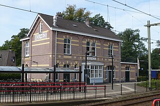
Wolfheze is a village in the Dutch province of Gelderland. It is located in the municipality of Renkum, 10 km northwest of the city of Arnhem.

<span class="mw-page-title-main">Elkerzee</span> Hamlet in Zeeland, Netherlands

Elkerzee is a hamlet in the Dutch province of Zeeland. It is a part of the municipality of Schouwen-Duiveland, and lies about 1 km south of Scharendijke.

<span class="mw-page-title-main">Nieuwerkerke</span> Hamlet in Zeeland, Netherlands

Nieuwerkerke is a hamlet in the Dutch province of Zeeland. It is a part of the municipality of Schouwen-Duiveland, and lies about 3 km southwest of Brouwershaven.

<span class="mw-page-title-main">Weiwerd</span> Former village in Groningen, Netherlands

Weiwerd is a former village in the Dutch province of Groningen. It is a part of the municipality of Eemsdelta, and lies about 27 km east of Groningen.

<span class="mw-page-title-main">Doorwerth</span> Place in Gelderland, Netherlands

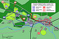
Doorwerth is a village in the eastern Netherlands. It is located in the municipality of Renkum, Gelderland, about 8 km west of Arnhem and about 100 km southeast of Amsterdam.

<span class="mw-page-title-main">Herveld</span> Village in Gelderland, Netherlands

Herveld is a village in the Dutch province of Gelderland. It is located in the municipality of Overbetuwe.

<span class="mw-page-title-main">Galder, Netherlands</span> Village in North Brabant, Netherlands

Galder is a village in the Dutch province of North Brabant. It is located in the municipality of Alphen-Chaam 8 km south of the city of Breda.

<span class="mw-page-title-main">Noordhoek, Moerdijk</span> Village in North Brabant, Netherlands

Noordhoek is a village in the Dutch province of North Brabant. It is located in the municipality of Moerdijk, about 5 km west of Zevenbergen.

<span class="mw-page-title-main">De Horst, Berg en Dal</span> Village in Gelderland, Netherlands

De Horst is a village in the Dutch province of Gelderland. It is located in the municipality of Berg en Dal, about 2 km east of Groesbeek.

<span class="mw-page-title-main">Bears, Friesland</span> Village in Friesland, Netherlands

Bears or Beers is a small village in the Dutch province of Friesland. It is located in the municipality Leeuwarden, about 8 km southwest of Leeuwarden. Bears has a population of about 133 in January 2017.

Offenbeek is a village in the Dutch province of Limburg. It is located in the municipality of Beesel, east of the village of Reuver.

<span class="mw-page-title-main">Wahlwiller</span> Village in Limburg, Netherlands

Wahlwiller is a village in the Dutch province of Limburg. It is located in the municipality of Gulpen-Wittem. The village is located south of the Selzerbeek.

<span class="mw-page-title-main">Ubachsberg</span> Village in Limburg, Netherlands

Ubachsberg is a village in the Dutch province of Limburg. It is located in the municipality of Voerendaal.

<span class="mw-page-title-main">Lemiers</span> Village in Limburg, Netherlands

Lemiers is a village in the Dutch province of Limburg. It lies directly north-west of Vaals.

<span class="mw-page-title-main">Breedeweg</span> Village in Gelderland, Netherlands

Breedeweg is a village in the Dutch province of Gelderland. It is located in the municipality of Berg en Dal, about 1 km south of Groesbeek.

References

  1. Mayor Schaap
  2. 1 2 3 "Kerncijfers wijken en buurten 2021". Central Bureau of Statistics. Retrieved 14 April 2022. two entries
  3. "Postcodetool for 6866AA". Actueel Hoogtebestand Nederland (in Dutch). Het Waterschapshuis. Retrieved 14 April 2022.
  4. ANWB Topografische Atlas Nederland, Topografische Dienst and ANWB, 2005.
  5. "Heelsum - (geografische naam)". Etymologiebank (in Dutch). Retrieved 14 April 2022.
  6. 1 2 3 Ronald Stenvert & Sabine Broekhoven (2000). "Heelsum" (in Dutch). Zwolle: Waanders. ISBN   90 400 9406 3 . Retrieved 14 April 2022.
  7. 1 2 3 "Heelsum". Plaatsengids (in Dutch). Retrieved 14 April 2022.
  8. "Heelsum, 'Airborne-monument'". 4 en 5 Mei (in Dutch). Retrieved 14 April 2022.