The geography of France consists of a terrain that is mostly flat plains or gently rolling hills in the north and west and mountainous in the south and the east. Metropolitan France has a total size of 551,695 km2 (213,011 sq mi). It is the third largest country in Europe after Russia and Ukraine.
Gütersloh is a Kreis (district) in the north-east of North Rhine-Westphalia, Germany. Neighboring districts are Osnabrück, Herford, district-free Bielefeld, Lippe, Paderborn, Soest and Warendorf.

USS Bogue (CVE-9) was the lead ship in the Bogue class of escort carriers in the United States Navy during World War II. She was originally classified AVG-9, but was changed to ACV-9, 20 August 1942; CVE-9, 15 July 1943; and CVHP-9, 12 June 1955. Aircraft operating from Bogue, plus her escorts, sank eleven German and two Japanese submarines, making her the most successful anti-submarine carrier in World War II.
The Canton of Brantôme is a canton of the Dordogne department, in France. The lowest point is 63 m, and the highest point is 251 m. At the French canton reorganisation which came into effect in March 2015, the canton of Brantôme was expanded from 11 to 42 communes :

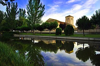
Calzada de los Molinos is a municipality located in the province of Palencia, Castile and León, Spain. According to the 2004 census (INE), the municipality has a population of 378 inhabitants.

Kőszegpaty is a village in Vas county, Hungary.

Słoja is a village in the administrative district of Gmina Szudziałowo, within Sokółka County, Podlaskie Voivodeship, in north-eastern Poland, close to the border with Belarus. It lies approximately 4 kilometres (2 mi) north of Szudziałowo, 13 km (8 mi) south-east of Sokółka, and 41 km (25 mi) north-east of the regional capital Białystok.

Pirəqanım is a village in the Ismailli Rayon of Azerbaijan. The village forms part of the municipality of Müdrəsə. According to Azerbaijan's State Statistics Committee, only two people lived in the village as of 2014.

Tądów Górny is a village in the administrative district of Gmina Warta, within Sieradz County, Łódź Voivodeship, in central Poland. It lies approximately 8 kilometres (5 mi) north of Warta, 20 km (12 mi) north of Sieradz, and 57 km (35 mi) west of the regional capital Łódź.
This is a list of the extreme points and extreme elevations in Wales.

Wólka Kokosia is a village in the administrative district of Gmina Dobre, within Mińsk County, Masovian Voivodeship, in east-central Poland. It lies approximately 3 kilometres (2 mi) north-west of Dobre, 18 km (11 mi) north of Mińsk Mazowiecki, and 47 km (29 mi) east of Warsaw.

Przybynów is a village in the administrative district of Gmina Żarki, within Myszków County, Silesian Voivodeship, in southern Poland. It lies approximately 4 kilometres (2 mi) north-west of Żarki, 8 km (5 mi) north of Myszków, and 51 km (32 mi) north-east of the regional capital Katowice.
SM UB-20 was a German Type UB II submarine or U-boat in the German Imperial Navy during World War I. The U-boat was ordered on 30 April 1915 and launched on 26 September 1915. She was commissioned into the German Imperial Navy on 10 February 1916 as SM UB-20. The submarine sank 13 ships in 15 patrols for a total of 10,230 gross register tons (GRT). UB-20 was mined and sunk on 28 July 1917 at 51°25′N3°20′W. Thirteen crew members died in the event.

Sairé is a municipality located in the state of Pernambuco, Brazil. Located at 110.7 km away from Recife, capital of the state of Pernambuco. Has an estimated population of 14.194 inhabitants.
Miila is a village in Rägavere Parish, Lääne-Viru County, in northeastern Estonia.

Rumah District is a district of the Hadhramaut Governorate, Yemen. As of 2003, the district had a population of 6,357 inhabitants.
Mount Deryugin is a mountain, 2,635 metres (8,650 ft) high, on Vindegga Spur in the Liebknecht Range, Humboldt Mountains, in Queen Maud Land. It was discovered and plotted from air photos by the Third German Antarctic Expedition, 1938–39. It was mapped from air photos and surveys by the Sixth Norwegian Antarctic Expedition, 1956–60, remapped by the Soviet Antarctic Expedition, 1960–61, and named after Soviet zoologist K.M. Deryugin.
Zakharov or Zakharova is the name of several rural localities in Russia:


