Fulda is a city in Hesse, Germany; it is located on the river Fulda and is the administrative seat of the Fulda district (Kreis). In 1990, the town hosted the 30th Hessentag state festival.

Fulda is a Kreis (district) in the north-east of Hesse, Germany. Neighboring districts are Hersfeld-Rotenburg, Wartburgkreis, Schmalkalden-Meiningen, Rhön-Grabfeld, Bad Kissingen, Main-Kinzig, Vogelsbergkreis.

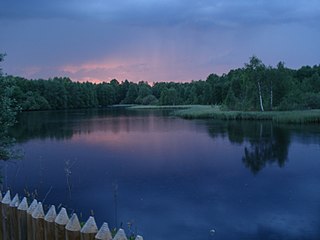
The Fulda is a river of Hesse and Lower Saxony, Germany. It is one of two headstreams of the Weser. The Fulda is 220.4 kilometres (137.0 mi) long.

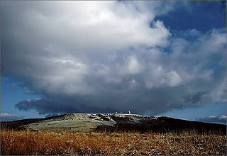
The Wasserkuppe (help·info) is a mountain within the German state of Hesse. The elevation, which is a large plateau formation, is the highest peak in the Rhön Mountains. Between the First and Second World Wars great advances in sailplane development took place on the mountain during the interwar period. Near the summit there is still an airfield used by gliding clubs and pilots of light aircraft.

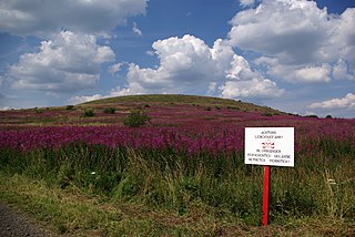
The Rhön Mountains are a group of low mountains in central Germany, located around the border area where the states of Hesse, Bavaria and Thuringia come together. These mountains, which are at the extreme southeast end of the East Hesse Highlands, are partly a result of ancient volcanic activity. They are separated from the Vogelsberg Mountains by the river Fulda and its valley. The highest mountain in the Rhön is the Wasserkuppe which is in Hesse. The Rhön Mountains are a popular tourist destination and walking area.

The Ellenbogen is an 814-metre high extinct volcano in the Thuringian Rhön in the district of Landkreis Schmalkalden-Meiningen, Thuringia, Germany.

Gersfeld is a town in the district of Fulda, in Hesse, Germany. It is situated on the Fulda River, in the Rhön Mountains, 20 km (12.43 mi) southeast of Fulda. It belonged to the abbey-principality of Fulda before secularisation in 1803. It then belonged to the Principality of Nassau-Orange-Fulda between 1803 and 1806, to France between 1806 and 1810, and then later to the Grand Duchy of Frankfurt between 1810 and 1813. After the Battle of Leipzig, it was occupied by the Allied troops of the Sixth Coalition between 1813 and 1815. After that, it was ceded to the Kingdom of Bavaria in 1815. During the Austro-Prussian War, it was occupied by Prussia before its annexation in the newly established Hesse Nassau province. It was finally incorporated in the state of Hesse in 1945.

Fulda station is an important transport hub of the German railway network in the east Hessian city of Fulda. It is used by about 20,000 travellers each day. It is classified by Deutsche Bahn as a category 2 station. It is a stop for Intercity-Express, Intercity services and regional services. The original station was opened as part of the Frankfurt–Bebra railway in 1866. This was destroyed during the Second World War and rebuilt after the war. The station was adapted in the 1980s for the Hanover–Würzburg high-speed railway.

Ehrenberg is a municipality in the district of Fulda, in Hesse, Germany.
At 927.9 m above sea level (NN) the Dammersfeldkuppe in Bavaria is the second highest mountain after the Wasserkuppe in the Rhön, a low mountain range straddling the states of Bavaria, Hesse and Thuringia in Germany.

The Himmeldunkberg or Himmeldunk is a 887.9 m above sea level (NN) m high, extinct volcano in the High Rhön in Germany. It straddles the Bavarian-Hessian state border.
The East Hesse Highlands describes a heavily wooded range of hills lying mainly in the German state of Hesse, but also extending a little way into Lower Saxony to the north, Thuringia to the east and Bavaria to the southeast. The region is sandwiched between the West Hesse Depression to the west, the Weser Uplands to the north, the Thuringian Basin to the northeast, the northwestern edge of the Thuringian Forest to the east, the Spessart to the south and the Wetterau to the southwest.

The Feldberg is a mountain in the Rhön highlands in the German state of Hesse. It is 815.2 m above sea level (NN).
The Central Rhön is a 5th level natural region which, together with the Southern High Rhön, forms the High Rhön. The region has several mountains over 900 metres high, including: the Wasserkuppe and Heidelstein. Other summits over 900 metres are regarded as subpeaks due to their low isolation and prominence.
The Red Moor is a raised bog in the Hessian part of the Rhön Mountains in Germany. It lies within the eponymous nature reserve in the Rhön Biosphere Reserve and is part of the Europe-wide conservation system, Natura 2000. The Red Moor has an area of 50 hectares and is the second largest raised bog in the High Rhön after the Black Moor (66.4 hectares). For 175 years, until 1984, peat was cut here. The interior of the raised bog is severely damaged, especially as a result of the many years of peat cutting. Its perimeters are however still largely undisturbed areas that are better and more typically developed than the Black Moor, 8 kilometres away. In 1979 large-scale renaturalisation measures began.

The Long Rhön is a ridge in the Central Rhön which forms part of the High Rhön within the Rhön Mountains. The Long Rhön is an elongated basalt plateau in the centre, roughly 800 metres above sea level, which is only occasional interrupted by mountain peaks. Its highest mountain is the Heidelstein. A majority of the area is part of the Long Rhön Nature Reserve. In this area of the Rhön is the Black Moor.
The Fulda–Gersfeld Railway, also called the Rhön Railway, is a railway line in the state of Hesse, Germany. It connects Fulda in the west with Gersfeld, in the Rhön Mountains, in the east. The line was opened by the Prussian state railways on October 1, 1888, and as of November 2014 is operated by the Hessische Landesbahn using Alstom Coradia LINT 41 trainsets.