Hermann Haack

Last updated
Prof. Hermann Haack (1957) Bundesarchiv Bild 183-45132-0001, Prof. Hermann Haack.jpg
Prof. Hermann Haack (1957)

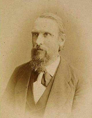
Hermann Otto Haack (Friedrichswerth, 29 October 1872 - Gotha 22 February 1966) was a German geographer and cartographer.

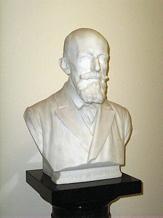
His father ran a post office in Friedrichswerth. Haack attended the local elementary school from 1878 to 1883. By chance he met Bernhard Perthes, [1] who supported him financially and enabled him to study in Halle, where he started in 1893 to study geography and cartography. Later he moved to the Georg-August-Universität Göttingen, where he became a student of the geographer Hermann Wagner (1840-1929). On his recommendation, Haack was subsequently transferred to Friedrich Wilhelm University Berlin where he became an assistant to Ferdinand von Richthofen. In 1896 Haack successfully completed his studies with his Thesis Über die mittlere Höhe von Süd Amerika (About the middle elevation of South America).

After completing his military service in 1897, Haack took up a permanent position with Justus Perthes Publishers in Gotha, where he had worked from time to time as a student. The first major project in which Haack was involved was with his former teacher Richard Lüddecke's Deutsche Schulatlas. After his early death in 1888, his task was taken over by Hermann Habenicht.

Helbigs Reisewege in Nordost-Honduras. - Vereinfacht dargestellt nach der Karte Entwurf einer topographischen Ubersicht von Nordost-Honduras mit der Mosquitia. In: Petermanns Geographische Mitteilungen, 101. Jahrgang, Gotha, VEB Hermann Haack, 1957, Heft 2, Tafel 15. Helbigs Reisen in Honduras.PNG
Helbigs Reisewege in Nordost-Honduras. – Vereinfacht dargestellt nach der Karte Entwurf einer topographischen Übersicht von Nordost-Honduras mit der Mosquitia. In: Petermanns Geographische Mitteilungen, 101. Jahrgang, Gotha, VEB Hermann Haack, 1957, Heft 2, Tafel 15.

From 1898, Haack was responsible for the development of Perthes' school wall maps. Three editions were made of each map (geographical, historical, physical). Very strong colours ensured that the essential map content was easily recognizable in the classrooms, even from a distance. He further developed the existing colour symbolism for physical maps: green = soil; red = cities; blue = body of water; brown = mountains. This 'physical colouring', developed by the cartographer Emil von Sydow in the 19th century, has hardly lost any importance for school lessons to this day. Haack also played an important role in a complete revision of Stielers Handatlas. The tenth edition was published from 1920 to 1944 in several editions containing over 250 maps, which were still engraved in copper.

In 1903 Haack founded the magazine Geographischer Anzeiger. When he founded the 'Verband Deutscher Schulgeographen' (Association of German School Geographers) in 1912, it functioned as the association's magazine. In 1944 Haack withdrew into private life. After the end of World War II, the Soviet occupation forces returned Haack to the Geographical Institute, where he worked almost to the end of his life. After the expropriation without compensation by the city council of Gotha in January 1953, the now public Justus Perthes Publishers was renamed "VEB Hermann Haack Geographic Cartographic Institute Gotha" in October 1955. Until 1989, 'Haack Gotha' was the GDR's monopoly publishing house for cartographic school publications (mainly atlases and wall maps). From 1948 to 1954, Haack was editor-in-chief of Petermanns Geographische Mitteilungen. He was considered a confidant of the occupying power and later in the GDR, as he had been a 'correspondence member of the Geographical Society of the USSR' since 1932.

Gotha, Emminghausstrasse 18 Gotha-Emminghausstrasse 18-CTH.JPG
Gotha, Emminghausstraße 18

Literature

Related Research Articles

<span class="mw-page-title-main">Justus Perthes</span>

Johann Georg Justus Perthes was a German publisher and founder of the publishing house that bears his name.

<span class="mw-page-title-main">Gotha</span> Town in Thuringia, Germany

Gotha is the fifth-largest city in Thuringia, Germany, 20 kilometres west of Erfurt and 25 km east of Eisenach with a population of 44,000. The city is the capital of the district of Gotha and was also a residence of the Ernestine Wettins from 1640 until the end of monarchy in Germany in 1918. The House of Saxe-Coburg and Gotha originating here spawned many European rulers, including the royal houses of the United Kingdom, Belgium, Portugal and Bulgaria.

<i>Stielers Handatlas</i>

Stielers Handatlas, formally titled Hand-Atlas über alle Theile der Erde und über das Weltgebäude, was the leading German world atlas of the last three decades of the 19th and the first half of the 20th century. Published by Justus Perthes of Gotha it went through ten editions from 1816 to 1945. As with many 19th century publications, an edition was issued in parts; for example, the eighth edition was issued in 32 monthly parts.

<span class="mw-page-title-main">August Heinrich Petermann</span> German cartographer (1822–1878)

Augustus Heinrich Petermann was a German cartographer.

<span class="mw-page-title-main">Heinrich Berghaus</span> German geographer and cartographer

Heinrich Karl Wilhelm Berghaus was a German geographer and cartographer who conducted trigonometric surveys in Prussia and taught geodesy at the Bauakademie in Berlin. He taught cartography and produced a pioneering and influential thematic atlas which provided maps of flora, fauna, climate, geology, diseases and a range of other information. He was a friend of Alexander von Humboldt and produced some of the maps used in his publications. A nephew Hermann Berghaus also worked in cartography.

<span class="mw-page-title-main">Adolf Stieler</span> German cartographer and publisher

Adolf Stieler was a German cartographer and lawyer who worked most of his life in the Justus Perthes Geographical Institute in Gotha. Although he studied law and would serve in government for his entire career, he maintained an interest in cartography and published many famous works. His Handatlas was the leading German world atlas until the middle of the 20th century.

<span class="mw-page-title-main">Emil von Sydow</span> German military officer, geographer and cartographer

Emil von Sydow was a German military officer, geographer and cartographer born in Freiberg, Saxony.

<span class="mw-page-title-main">Duke Philipp of Württemberg</span>

Philipp, Duke of Württemberg was a German prince, head of the Roman Catholic cadet branch of the dynasty which ruled the Kingdom of Württemberg.

<span class="mw-page-title-main">Ernst Behm</span> German geographer and statistician

Ernst Behm was a German geographer and statistician who was a native of Gotha.

<span class="mw-page-title-main">Hermann Wagner (geographer)</span> German geographer and cartographer

Hermann Wagner was a German geographer and cartographer who was a native of Erlangen. He was the son of anatomist Rudolf Wagner (1805–1864) and brother to economist Adolph Wagner (1835–1917).

<span class="mw-page-title-main">Heinrich Theodor Menke</span> German geographer

Heinrich Theodor Menke was a German geographer, who was born and lived in Bremen. He is remembered for his work in historical geography.

<span class="mw-page-title-main">Folke Bergman</span> Swedish explorer and archaeologist

Folke Bergman was a Swedish explorer and archaeologist.

<span class="mw-page-title-main">Max Eckert-Greifendorff</span> German geographer

Max Eckert was a German geographer.

<span class="mw-page-title-main">Hermann Berghaus</span>

Hermann Berghaus was a German cartographer.

<span class="mw-page-title-main">World Map 1:2,500,000</span>

The World Map 1:2,500,000 is an internationally standardized and edited map series. The Russian term Карта Мира or in transcription Karta Mira is now commonly used to describe this series, even outside the Soviet Union or Russia. The Karta Mira consists of a total of 224 main sheets and 38 overlap sheets. They depict the entire earth according to a uniform scale, coloring and drawing system. The Karta Mira 1956–1975 was produced by cartographers from Bulgaria, Czechoslovakia, the German Democratic Republic (GDR), Hungary, Poland, Romania and the Soviet Union.

Justus Perthes Publishers was established in 1785 in Gotha, Germany. Justus Perthes was primarily a publisher of geographic and historic atlases and (educational) wall maps. He published Petermann’s Geographische Mitteilungen (1855-2004), after having started with publishing the French Almanach de Gotha (1785-1944). In 2016 the publisher was discontinued.

<span class="mw-page-title-main">Ernestine Gymnasium, Gotha</span> Secondary school in Germany

The Ernestine Gymnasium is a humanistic and modern gymnasium in Gotha, Germany, the successor of the Illustrious Gymnasium, founded in 1524, which in 1853 was merged with the recently founded Real-Gymnasium Ernestinum, named in honour of Ernest I, Duke of Saxe-Coburg and Gotha. The merged school continued to be known as the Ernestinum. Until 1947, when it was closed, it was considered the oldest gymnasium in the German-speaking world. It was re-founded in 1991, shortly after German reunification.

Horst Förster was a German conductor, choirmaster, violinist and university teacher. In 1952, he was appointed the youngest General Music Director of the GDR in the Landestheater Eisenach. Afterwards, he was chief conductor of the Philharmonisches Staatsorchester Halle and the Singakademie Halle (1956–1964) as well as the Dresden Philharmonic (1964–1966).

<span class="mw-page-title-main">Paul Langhans</span>

Paul Max Harry Langhans was a German geographer and cartographer.

<span class="mw-page-title-main">Werner Horn (cartographer)</span>

Werner Friedrich Hermann Horn was a German geographer and cartographer.

References