Koewacht is a village on the border between the Netherlands and Belgium.

Heeswijk is a Dutch village. It is located in the province of North Brabant, in the south of the Netherlands.
Linne is a village in the Dutch province of Limburg. It is a part of the municipality of Maasgouw, and lies about 6 km southwest of Roermond.

Vlodrop is a village in the south-eastern part of The Netherlands in the municipality of Roerdalen. The village is situated near the German border, about 8 km southeast of Roermond.

Zoutelande is a village in the southwestern Netherlands. It is located in the municipality of Veere, Zeeland, between Dishoek and Westkapelle on the former island Walcheren. On 1 January 2005 it had 1,556 inhabitants. Originally, Zoutelande was mainly an agricultural village. The village's character changed slowly into a tourist resort as the demand for beach recreation rose from about the middle of the 19th century.

Buggenum is a village in the Dutch province of Limburg. It was a part of the municipality of Haelen until 2007, when it merged into the municipality of Leudal. It lies about 5 km north of Roermond.

Horn is a village in the Dutch province of Limburg. It is a part of the municipality of Leudal, and lies about 5 km northwest of Roermond.

Kerkwerve is a village in the Dutch province of Zeeland. It is a part of the municipality of Schouwen-Duiveland, and lies about 24 km southwest of Hellevoetsluis.
Oude Niedorp is a village in the Dutch province of North Holland. It is a part of the municipality of Hollands Kroon, and lies about 6 kilometres (3.7 mi) northeast of Heerhugowaard.
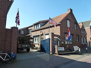
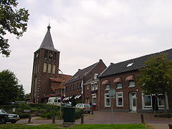
Montfort is a small city in the Dutch province of Limburg. Montfort has about 3,000 inhabitants. It lies about 8 km south of Roermond. It received city rights in 1271 and is renowned for the ruins of Castle Montfort, built in the 13th century.

Bath is a small village and a former municipality in the Dutch province of Zeeland, lying on the north shore of the Western Scheldt. It is now located in the municipality of Reimerswaal, about 10 km southwest of Bergen op Zoom.

Groede is a village in the Dutch province of Zeeland. It is located about 5 km north of Oostburg in the municipality of Sluis.

Oudkarspel is a village in the Dutch province of North Holland. It is located in the municipality of Dijk en Waard, north of Noord-Scharwoude.

Geulle is a village in the Dutch province of Limburg. It is located in the municipality of Meerssen, about 8 km southwest of Geleen.

Grathem is a village in the Dutch province of Limburg. It is located in the municipality of Leudal, about 10 km west of Roermond.

Maasniel is a neighbourhood of Roermond in the Dutch province of Limburg. It is located east of the city centre.

Neer is a village in Limburg, Netherlands. It is located in the municipality of Leudal, on the river Maas about 8 km north of Roermond.

Schimmert is a village in the Dutch province of Limburg. It is located in the municipality of Beekdaelen.

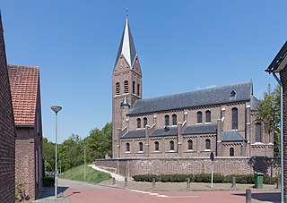
Halsteren is a town in the Dutch province of North Brabant. It is located in the municipality of Bergen op Zoom, about 1 km north of that city. Halsteren has an old church from the 14th century and a new church, built in 1919. A little village called Polder was located between Halsteren and Tholen in the Middle Ages.

Veen is a village in the Dutch province of North Brabant. It is located in the municipality of Altena, about 20 km northwest of 's-Hertogenbosch. It is infamous for its New Year's Eve tradition during which scrap cars are burnt, and in 2020 even firemen were attacked with fireworks.