Maasniel | |
|---|---|
Neighbourhood and former village | |
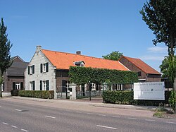 Veterinarian in Maasniel | |
 Coat of arms | |
 Maasniel Location in the Netherlands  Maasniel Location in the province of Limburg in the Netherlands | |
| Coordinates: 51°11′57″N6°0′49″E / 51.19917°N 6.01361°E | |
| Country | Netherlands |
| Province | Limburg |
| Municipality | Roermond |
| Area | |
• Total | 1.01 km2 (0.39 sq mi) |
| Elevation | 27 m (89 ft) |
| Population (2021) [1] | |
• Total | 3,610 |
| • Density | 3,600/km2 (9,300/sq mi) |
| Time zone | UTC+1 (CET) |
| • Summer (DST) | UTC+2 (CEST) |
| Postal code | 6042 [1] |
| Dialing code | 0475 |
Maasniel is a neighbourhood of Roermond in the Dutch province of Limburg. It is located east of the city centre.
Maasniel used to be a separate village. It was a separate municipality until 1959, when it was merged with Roermond. [3]