
Rauschenberg is a town in the north of Marburg-Biedenkopf district in Hesse, Germany.

Georg Ludwig Hartig was a German forester. Along with Heinrich Cotta he helped establish scientific forestry in Prussia, serving as the chief forester from 1811 and giving lectures on forestry at the University of Berlin from 1838 where he served as a professor. He established the goals of sustainable forestry and wrote several influential textbook for foresters.

Battenberg is a small town in the district of Waldeck-Frankenberg in the state of Hesse, Germany. It is located on the river Eder, a tributary of the Fulda, which flows into the Weser, and lies at the southeastern edges of the Rothaar Mountains. The closest larger cities are Marburg, Siegen, and Kassel, and the town is approximately equally far away from Frankfurt am Main, Cologne, and Dortmund.

Hatzfeld (Eder) is a small town in Waldeck-Frankenberg district in Hesse, Germany.

Dautphetal is a municipality in Hesse, Germany, and is among the six larger municipalities of the 22 in Marburg-Biedenkopf district.

Gladenbach [German pronunciation:[ˈɡlaːdn̩ˌbax] ] is a town in Hesse, Germany, in the west of Marburg-Biedenkopf district.
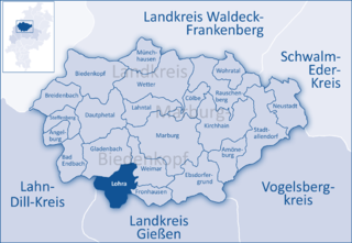
Lohra is a municipality in Marburg-Biedenkopf district in the administrative region of Gießen in Hesse, Germany.

Wohratal is a municipality in Marburg-Biedenkopf district in Hessen, Germany.
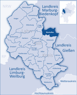
Bischoffen is a municipality in the Lahn-Dill-Kreis in Hesse, Germany.
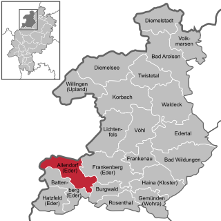
Allendorf (Eder) (German:[ˈaləndɔʁf] ) is a municipality which situated in the north west of Hesse, Germany. The municipality is within the Waldeck-Frankenberg district in a rural region called the upper Eder Valley. The Burgwald range is located west of Allendorf while the Breite Struth hills are in Allendorf's east.
Heinrich Ludwig Julius Heppe was a German Calvinist theologian and church historian.

The Gladenbach Uplands, named after their central town of Gladenbach, is a range of hills up to 609 m high in the Rhine Massif in Germany, on the junction of the Rothaar Mountains, Westerwald (southwest), (Eastern) Hintertaunus and West Hesse Highlands in the east. It lies in Central Hesse within the districts of Marburg-Biedenkopf, Lahn-Dill and Gießen within the so-called Lahn-Dill-(Dietzhölze-) loop. Small parts of the Upper Lahn Valley in the northwest belong, together with the town of Bad Laasphe, also to the district of Siegen-Wittgenstein, North Rhine-Westphalia.
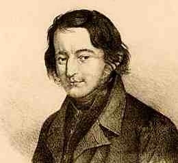
Friedrich Ludwig Weidig was a German Protestant theologian, pastor, activist, teacher and journalist. Initially working as a teacher in Butzbach, he then spent a short time as a pastor in Ober-Gleen, a district of Giessen. In what is now Hesse and the Middle Rhine, he was one of the main figures of the Vormärz and a pioneer of the 1848 Revolution.
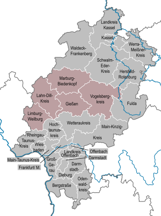
The region of Middle Hesse is one of three planning regions in the German state of Hesse, alongside North and South Hesse. Its territory is identical with that of the administrative province of Gießen and covers the counties of Limburg-Weilburg, Lahn-Dill-Kreis, Gießen, Marburg-Biedenkopf and Vogelsbergkreis. The Middle Hesse Regional Assembly, which decides on the regional plan, currently consists of 31 members chosen by the five counties and the three towns with special status: Gießen, Marburg and Wetzlar. The regional assembly has tasked the governing president (Regierungspräsident) with delivering regional management. The Mid-Hesse Regional Management Association was founded on 22 January 2003.
Gerhard Menk was a German historian and archivist.

Friedrich Uhlhorn was an honorary professor at the Philipps-Universität Marburg, whose scientific focus was on the history of the State of Hesse and was also known for his work outside Hesse. His special scientific interest was mainly focused on the problems of historical cartography. In collaboration with Edmund Ernst Stengel, he published the Geschichtlichen Atlas von Hessen, which is considered his major work. He also wrote the article Die deutschen Territorien. A: The West, which deals with the West German regional history. Likewise he was responsible as editor for the Hessisches Jahrbuch für Landesgeschichte by Bruno Gebhardt.

The Kreuztal–Cölbe railway is a 88-kilometre-long main line in Hesse and North Rhine-Westphalia, Germany. It branches off the Ruhr–Sieg railway at Kreuztal and runs via Erndtebrück, Bad Laasphe and Biedenkopf to Cölbe. Operationally, the line is now divided into two parts. The Kreuztal–Erndtebrück section is operated together with the Erndtebrück–Bad Berleburg railway as the Rothaar-Bahn and the subsequent section to Cölbe, now operated by the Kurhessenbahn, is called the Obere Lahntalbahn. Trains at the eastern end of the line run to/from Marburg (Lahn).
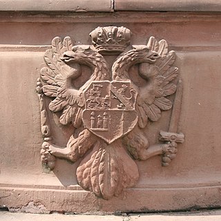
The Burgraviate of Friedberg was a territory within the Holy Roman Empire. It emerged during the Late Middle Ages from the Burgmannschaft of Reichsburg Friedberg in Hesse. Notably, the Burgraviate featured a cooperative constitutional structure and was endowed with manorial privileges by the Emperor, which were reaffirmed multiple times until its dissolution in 1806. The Burgraviate established its territory, which, in addition to overseeing the neighboring Reichsstadt Friedberg and the Freigericht Kaichen, included a narrow strip of land in the southern Wetterau. Consequently, Friedberg Castle can be regarded as the sole reichsständische castle since its inclusion in the Reichsmatrikel in 1431. According to its self-perception, the Kayserliche und des heiligen Reichs-Burg Friedberg, as it was called, was a prominent institution of the Imperial Knighthood and directly subordinate to the king or emperor.


