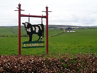
Hessilhead is in Beith, North Ayrshire, Scotland. Hessilhead used to be called Hazlehead or Hasslehead. The lands were part of the Lordship of Giffen, and the Barony of Hessilhead, within the Baillerie of Cunninghame and the Parish of Beith. The castle was situated at grid reference NS380532.

The Barony of Giffen and its associated 15th-century castle were in the parish of Beith in the former District of Cunninghame, now North Ayrshire. The site may be spelled Giffen or Giffin and lay within the Lordship of Giffin, which included the Baronies of Giffen, Trearne, Hessilhead, Broadstone, Roughwood and Ramshead; valued at £3,788 9s 10d. The Barony of Giffen comprised a number of properties, including Greenhills, Thirdpart, Drumbuie, Nettlehirst and Balgray, covering about half of the parish of Beith. Giffen was a hundred merk land, separated from the Barony of Beith, a forty-pound land, by the Powgree Burn which rises on Cuff hill. The Lugton Water or the Bungle Burn running through Burnhouse may have been the Giffen barony boundary with that of the adjacent barony and lands of Aiket castle.
Silverwood in the Parish of Kilmarnock lies in East Ayrshire, Scotland. This was once a small estate with a mansion house; it is now a farm. The plantation nearby is named after it.

The Barony of Aiket with its castle, lay within the old feudal bailiary of Cunninghame. The barony lands equate to the extant Parish of Dunlop, East Ayrshire, Scotland.

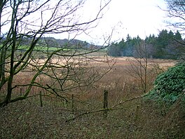
Loch Brand or Loch of Boghall was a loch situated in a depression between the Grange Estate, Crummock, Hill of Beith Castle site and Boghall in the Parish of Beith, North Ayrshire, Scotland. The loch was fed by the Grange Burn and surface runoff, such as from the old rig and furrows indicated by Roy's Maps of the mid 17th century. The loch was drained by the Boghall Burn that runs passed the 'Court Hill' and into Powgree Burn at Gateside.

Lambroughton Loch or Wheatrig Loch was situated in a low-lying area between the farms and dwellings of Hillhead, Lambroughton, Wheatrig, Titwood and Lochridge mainly in the Parish of Dreghorn, North Ayrshire. The loch was mainly fed by the Lochridge Burn, the Garrier Burn and surface runoff, such as from the old rig and furrows indicated by Roy's maps of the mid-18th century. The loch outflow was via the Lochridge Burn that runs into the Garrier Burn, passes the site of the old Lochend habitation and into the Bracken Burn near Little Alton. The rivulet or watercourse is known as the Garrier Burn beyond this point.

Halket Loch' also known as Halkhead or Halketh, was situated in the mid-Ayrshire clayland near Lugton. It is visible as a surface depression in pastureland, sometimes partially flooded, situated in a low-lying area close to farms and dwellings of East, North and Middle Halket and Craighead in the Parish of Dunlop, East Ayrshire, Scotland. The loch was natural, sitting in a hollow created by glaciation. The loch waters drained via the Glazert Water that joins the Annick Water.
Littlestane Loch, was situated in the mid-Ayrshire clayland near Stanecastle, Irvine, North Ayrshire, Scotland. It is nowadays (2011) only visible as an area of permanent water in the Scottish Wildlife Trust Sourlie Nature Reserve. The loch was natural, sitting in a hollow created by glaciation. The loch waters outflow was via the Red Burn that flows into the River Garnock. The site of Littlestane Loch site is partly built over and much of the site is now public open space lying within the Parish of Girdle Toll.

Fail Loch or Faile Loch was situated in a low-lying area near the old monastery of Fail in the Parish of Tarbolton, South Ayrshire, Scotland. The old Lochlea Loch lies nearby and its waters still feed into Fail Loch via the Mill Burn.

Knockewart Loch or Loch Jargon was situated in a hollow lying area beneath Knockewart Hill in the Parish of Ardrossan, North Ayrshire, Scotland. The old loch has become largely drained and overgrown since the late 19th century.

The Blae Loch is a small freshwater loch situated in a hollow in a low-lying area beneath Blaelochhead Hill in the Parish of Beith, North Ayrshire, Scotland.

The Galrigs Loch was a substantial freshwater loch situated in low lying area between Newfield and Dundonald in South Ayrshire, Scotland. It was drained in the early 18th century.

Clevens Loch was a substantial freshwater loch situated in a low-lying area below Clevance Farm and Langholm Farm in Dundonald parish, South Ayrshire, Scotland.

The Loch of Trabboch or Dalrympleston Loch (NS440211) was situated in a low-lying area below the old Castle of Trabboch, once held by the Boyd family in the Parish of Stair, East Ayrshire, Scotland.
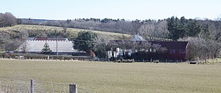
The Loch of Stair was a typical Ayrshire post-glacial 'Kettle Hole', situated in a low-lying area below the farm of Loch Hill, in the Parish of Stair, East Ayrshire, Scotland. This freshwater loch was drained in the 19th century, leaving a wetland area which still periodically floods.

Lindston Loch was a small freshwater loch situated within a glacial 'kettle hole.' The loch lies in the South Ayrshire Council Area, Parish of Dalrymple, Scotland.

Carcluie Loch is a small freshwater loch in the South Ayrshire Council Area, lying in a glacial Kettle Hole, Parish of Dalrymple, Scotland.

The remains of the old castle of Kersland lie about 1.5 miles to the north-east of the town of Dalry in North Ayrshire, Scotland, in the old Barony of Kersland. The River Garnock lies nearby.

The Lands of Tour and Kirkland (NS416406) formed a small estate close to the old Kirktoun and St Maurs-Glencairn collegiate church about 1 km south-east of Kilmaurs, East Ayrshire, Parish of Kilmaurs, Scotland. The word 'Tour' in Scots refers to a 'tower' and 'kirk' to a parish church.
Dalmusternock (NS455417) was a dower house built and occupied by William Mure after his marriage and prior to inheriting the family seat of Rowallan Castle. The property is located near Fenwick, in the Barony of Rowallan, lying 3 miles north of Kilmarnock and 18 miles south of Glasgow, Parish of Fenwick, East Ayrshire, Scotland. The estate is recorded as Dalmunsternoch circa 1654; Dalmasternock circa 1747; Dalmusterknok 1775