
The Sydney Harbour Tunnel is a twin-tube road tunnel in Sydney, Australia. The tunnel was completed and opened to traffic in August 1992 to provide a second vehicular crossing of Sydney Harbour to alleviate congestion on the Sydney Harbour Bridge. It is one of two transportation tunnels under the harbour, the other being a set of rail tunnels for the Sydney Metro.

CityLink is a network of tollways in Melbourne, Victoria, Australia, linking the Tullamarine, West Gate and Monash Freeways and incorporating Bolte Bridge, Burnley Tunnel and other works. In 1996, Transurban was awarded the contract to augment two existing freeways and construct two new toll roads – labelled the Western and Southern Links – directly linking a number of existing freeways to provide a continuous, high-capacity road route to, and around, the central business district. CityLink uses a free-flow tolling electronic toll collection system, called e-TAG. CityLink is currently maintained by Lendlease Services.
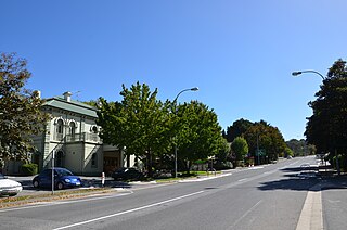
The town of Crafers is in the Adelaide Hills to the south-east of Adelaide, South Australia, considered to be an outer suburb of Adelaide.
South Eastern Freeway is a 73 km (45 mi) freeway in South Australia (SA). It is a part of the National Highway network linking the state capital cities of Adelaide, SA, and Melbourne, Victoria, and is signed as route M1. It carries traffic over the Adelaide Hills between Adelaide and the River Murray, near Murray Bridge, where it is connected via the Swanport Bridge to the Dukes Highway, which is the main road route to Victoria.

The O-Bahn Busway is a guided busway that is part of the bus rapid transit system servicing the northeastern suburbs of Adelaide, South Australia. The O-Bahn system was conceived by Daimler-Benz to enable buses to avoid traffic congestion by sharing tram tunnels in the German city of Essen.
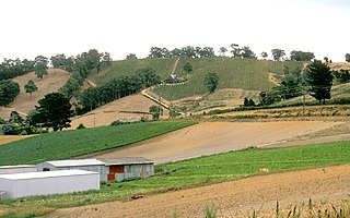
The Adelaide Hills region is located in the southern Mount Lofty Ranges east of the city of Adelaide in the state of South Australia. The largest town in the area, Mount Barker is one of Australia's fastest-growing towns. Before British colonisation of South Australia, the area was inhabited by the Peramangk people.

The Cross City Tunnel is a 2.2-kilometre long (1.4 mi) twin-road tunnel tollway located in Sydney, New South Wales, Australia. The tunnel links Darling Harbour on the western fringe of the central business district to Rushcutters Bay in the Eastern Suburbs. Each of the twin tunnels has a different alignment, with the westbound tunnel running underneath William and Park streets and the eastbound tunnel running underneath Bathurst Street.

The Eastern Distributor is a 4.7-kilometre-long (2.9 mi) motorway in Sydney, New South Wales, Australia. Part of the M1 and the Sydney Orbital Network, the motorway links the Sydney central business district with the south-east and Sydney Airport. The Eastern Distributor separates Sydney's Eastern Suburbs from Sydney's Inner-Southern Suburbs. The centre-piece is a 1.7 km (1.1 mi) tunnel running from Woolloomooloo to Surry Hills. Built as a build-own-operate-transfer project, it is 75.1% owned by Transurban.
Tonkin Highway is an 81-kilometre-long (50 mi) north–south highway and partial freeway in Perth, Western Australia, linking Perth Airport and Kewdale with the city's north-eastern and south-eastern suburbs. As of April 2020, the northern terminus is at the interchange with Brand Highway and Great Northern Highway in Muchea, and the southern terminus is at Thomas Road in Oakford. It forms the entire length of State Route 4, and connects to several major roads. Besides Brand Highway and Great Northern Highway, it also connects to Reid Highway, Great Eastern Highway, Leach Highway, Roe Highway, and Albany Highway.
Portrush Road is a major arterial route through the eastern suburbs of Adelaide, the capital of South Australia. This name covers many consecutive streets and is not widely known to most drivers except for the southernmost section, as the entire allocation is still best known as by the names of its constituent parts: Hampstead Road, Taunton Road, Ascot Avenue, Lower Portrush Road, and Portrush Road proper. Formerly, there were also sections known as Kensington Terrace and Wellington Road. This article will deal with the entire length of the corridor for sake of completion, as well to avoid confusion between declarations. Portrush Road is designated route A17.

Eagle On The Hill is an unbounded locality in the Australian state of South Australia located in the suburb of Crafers West on the western face of the Adelaide Hills overlooking the Adelaide metropolitan area.
M2 Hills Motorway is a 19.3-kilometre (12.0 mi) tolled urban motorway in Sydney, New South Wales that is part of the Sydney Orbital Network and the National Highway west of Pennant Hills Road. Owned by toll road operator Transurban, it forms majority of Sydney's M2 route, with the Lane Cove Tunnel constituting the rest of the M2 route.

The M4 Motorway is a 55-kilometre (34 mi) series of partially tolled dual carriageway motorways in Sydney designated as route M4. The M4 designation is part of the wider A4 and M4 route designation, the M4 runs parallel and/or below ground to Great Western Highway, Parramatta Road and City West Link, which are part of route A44.

Western Distributor is a 4.3-kilometre-long (2.7 mi) grade-separated motorway that is primarily elevated for the majority of its route on the western fringe of the Sydney central business district. It links the southern end of Bradfield Highway at the Sydney Harbour Bridge to Victoria Road in Rozelle, at its western terminus near White Bay. It is a constituent part of the A4 route.
The South Arm Highway is a highway serving the southern suburbs of Hobart, on the eastern shore of the River Derwent in Tasmania, Australia. The highway is a major trunk road that carries heavy commuter traffic south from the Eastern Outlet to Howrah and Rokeby. As one of the Tasman Highway's principle Feeders and one of the eastern shore's major transport corridors, The South Arm Highway facilitates the movement of traffic between the suburbs and satellite communities to the south with the city centre and ultimately, other major cross city highways. With annual average daily traffic (AADT) of 17,000, the highway is considered a major traffic corridor within Hobart. The designation "South Arm Highway" arises from its journey south to South Arm.
The East West Link is a proposed 18-kilometre tollway in Melbourne, Australia, to connect the Eastern Freeway at Clifton Hill with the Western Ring Road at Sunshine West. The Napthine Coalition Government signed a $5.3 billion contract with the East West Connect consortium in September 2014, just prior to the November 2014 state election, to begin construction on the eastern tunnel segment of the project. It became one of the central issues in the election, and a subsequent change in government led to the project's cancellation at a cost of $1.1 billion. The problem of poor "connectivity between Melbourne's Eastern Freeway and CityLink" has since been included in Infrastructure Australia's list of Australia's 32 "highest priority" infrastructure needs and remains part of long-term state road planning.

The Toowoomba Bypass, known as Toowoomba Second Range Crossing during planning and construction, is a 41.3 km (25.7 mi) grade separated, dual carriageway bypass and partial ring road constructed to the north and west of Toowoomba, Queensland. Construction commenced in April 2016. It opened to traffic on 8 September 2019.
NorthConnex is a 9-kilometre (5.6 mi) twin-tube motorway tunnel in northern Sydney, New South Wales, Australia, signposted as the M11 Tunnel. It acts as a tunnel bypass of the congested Pennant Hills Road, extending or connecting the M1 Pacific Motorway to the M2 Hills Motorway. Owned by NorthWestern Roads (NWR) Group, it is one of the longest road tunnels in Australia, along with the WestConnex Tunnel. It is also the deepest road tunnel in Australia, with more than half of the tunnel 60 metres (200 ft) deep or more, and the deepest point is underneath the Sydney Metro Northwest, about 90 metres (300 ft) below ground.

Mount Barker Road was once the main road from Adelaide through the Adelaide Hills to Mount Barker on the eastern slopes of the Mount Lofty Ranges. The main route has now been replaced, or subsumed into, the South Eastern Freeway, but two sections of it remain, and are still classified as state roads.
The Old Princes Highway is a 41.1-kilometre-long (25.5 mi) state-controlled highway in South Australia linking the towns of Nairne, Kanmantoo, Callington, Monarto South and Murray Bridge. It follows the previous alignment of the Princes Highway which used to run through these towns but was subsumed into the South Eastern Freeway, but it remains classified as a state road.

