This is a list of tunnels in Australia which includes any road, railway, waterway or other form of tunnel, anywhere in the country.
This is a list of tunnels in Australia which includes any road, railway, waterway or other form of tunnel, anywhere in the country.
| Name | Image | Locale | Carries | Type | Length | Notes | |
|---|---|---|---|---|---|---|---|
| m | ft | ||||||
| Acton Tunnel |  | Acton, Australian Capital Territory | Carries Parkes Way under a hill | Road | 190 | 623 | Three levels, with the upper two being used for car parking and storage by the Australian National University |
| Name | Image | Locale | Carries | Type | Length [1] | Notes | |
|---|---|---|---|---|---|---|---|
| m | ft | ||||||
| Airport railway line |  | Wolli Creek to Central | East Hills railway line | Rail | 10,000 | 33,000 | |
| Bilson Tunnel | Kosciuszko National Park | Skitube | Rail | 3,300 | 10,800 | ||
| Blue Cow Tunnel |  | Kosciuszko National Park | Skitube | Rail | 2,600 | 8,500 | |
| Ardglen Tunnel | Upper Hunter Shire | Main Northern railway line | Rail | 488 | 1,601 | [2] | |
| Airport Tunnel |  | Mascot | General Holmes Drive | Road | 550 | 1,800 | Two in-line dual tunnels that carry runways for Sydney Airport [3] |
| Avon Tunnel | Dombarton to Avon | Maldon - Dombarton railway line | Rail | 4,000 | 13,000 | A planned single track tunnel. Only a few metres at each end were evacuated. 150.7372°, -34.4451° [4] | |
| Balmain Colliery |  | Below Sydney Harbour | Coal mine | ||||
| Belmore Tunnel | Blue Mountains | Main Western railway line | Rail | Used by Zig Zag tourist railway on the Lithgow Zig Zag | |||
| Bethungra Spiral |  | Bethungra | Main Southern railway line | Rail | 205 | 673 | Two tunnels |
| Border Tunnel | Richmond Valley | North Coast line | Rail | 1,160 | 3,810 | On the border between New South Wales and Queensland [5] | |
| Box Vale tunnel | Mittagong | Box Vale rail line | unlined tunnel through final spur | ||||
| Bullio Tunnel (Wombeyan Caves Rd Tunnel) | 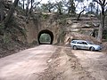 | Nattai National Park | Wombeyan Caves Road | Road | 22 | 72 | |
| Busby's Bore |  | From Centennial Parklands to Hyde Park | Sydney water supply | Water | 3,600 | 11,800 | Built from 1827 to 1837 and remains in limited use [6] |
| Bylong Rail Tunnel | Bylong | Sandy Hollow to Maryvale Line, No 3 of 5 | Rail | 1,975 | 6,480 | At the time of its construction, it was the longest rail tunnel[ citation needed ] | |
| Boronia Tunnels |  | Cowan | Main North line | Rail | 1,313 | 4,308 | 1-4 in use, 5 deviated; double track; longest tunnel is 602 metres (1,975 ft) |
| Bungendore - Queanbeyan rail | Bombala line | Rail | Brooks Bank tunnel and two Pine Range tunnels | ||||
| Carcoar Tunnel | Carcoar | Blayney–Demondrille railway line | Rail | 281 | 922 | No longer in use | |
| City Circle |  | Sydney central business district | Sydney underground railways | Rail | 5,000 | 16,000 | Estimate of tunnel length from Central to Circular Quay and return. Two tunnels |
| Clarence Tunnel | Clarence, Blue Mountains | Main Western line | Rail | 493 | 1,617 | Replaced by Ten Tunnels Deviation; used by Zig Zag tourist railway | |
| Colinton rail tunnel | Colinton | Bombala line | Rail | 161 | 528 | No longer in use | |
| Cooks River Tunnel | Between Sydney Airport and Tempe | M5 Motorway | Road | Under Cooks River | |||
| Cougal Spiral |  | Richmond Valley | North Coast line | Rail | 369 | 1,211 | Two tunnels (See also Border Tunnel) |
| Cross City Tunnel |  | Sydney central business district | Cross City Tunnel | Road | 2,100 | 6,900 | Two tunnels [7] |
| Cudgen Road Tunnel | Tweed Valley | Pacific Motorway | Road | 134 | 440 | Twin tunnels; opened in 2002 [8] | |
| Devonshire Street Tunnel | 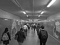 | Sydney central business district | Railway Square to Surry Hills | Pedestrian | 300 | 980 | [9] |
| Dorrigo railway line | Dorrigo | Dorrigo railway line | Rail | Two tunnels of unknown length between Glenreagh and Timber Top | |||
| Eastern Distributor Tunnel |  | Between Woolloomooloo and Surry Hills | Eastern Distributor | Road | 1,700 | 5,600 | Completed in 2000; tolled on exit, northbound only; unique 'piggyback' design with three lanes, northbound, stacked on top of three lanes, southbound [10] [11] |
| Eastern Suburbs railway line | Sydney | Eastern Suburbs railway line | Rail | Erskineville to Bondi Junction | |||
| Epping to Chatswood railway line | Sydney | Metro North West & Bankstown Line | Rail | 13,000 | 43,000 | ||
| Fernleigh Tunnel | Rail | Rail trail-cycleway | |||||
| Gib tunnel | between Mittagong & Bowral | Main South line | Rail | 516 | 1,693 | Two tunnels; original single-track line now replaced; and one double-track line adjacent | |
| Glenbrook Tunnel (1892) |  | Glenbrook | Main Western Line (since deviated) | Heritage | 634 | 2,080 | |
| Glenbrook Tunnel (1913) | Between Lapstone and Glenbrook | Main Western line | Rail | 283 | 928 | Double-track line, in use | |
| Glowworm Tunnel Rd Tunnel | Wollemi National Park | Glowworm Tunnel Road | Road | 160 | 520 | ||
| Helensburgh Tunnels including the Helensburgh Glow Worm, Lilyvale and Otford tunnels | 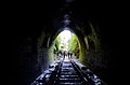 | Illawarra escarpment | Illawarra railway line | Rail | 3,257 | 10,686 | Seven disused tunnels; previous use between 1884 and 1920 [12] [13] [14] plus Seven in use dual line tunnels plus one single tunnel |
| Kings Cross Tunnel | Kings Cross | Road | 274 | 899 | |||
| Lane Cove Tunnel | Lane Cove | M2 Motorway | Road | 3,600 | 11,800 | ||
| Long Island | Hawkesbury River station | Main North line | Rail | 263 | 863 | Two tunnels; one Disused single track tunnel used for storage and a Double track, in use, adjacent | |
| Malaita Point | Katoomba | Rail | through post of a coal mine | ||||
| Marrangaroo | Lithgow | Main Western line | Rail | 974 | 3,196 | Former single-track line; since deviated as double-track line, in use. Only double-track line length shown | |
| Merewether Bluff | Merewether | Rail | Disused, Australia's first two railway tunnels, 1861 & 1862, privately operated [15] | ||||
| M4 East Tunnel |  | Between Haberfield and Homebush | M4 Motorway | Road | 5,500 | 18,000 | Dual tunnels [16] |
| M4-M5 Link (WestConnex) | Between Haberfield and St Peters | M4/M5 | Road | 9,200 | 30,200 | Australia's longest road tunnel [16] | |
| M5 East Tunnel | Between Beverly Hills and Arncliffe | M5 Motorway | Road | ||||
| M8 Motorway | Between Beverly Hills and St Peters | M8 Motorway | Road | 9,000 | 30,000 | ||
| Moore Park Tunnel | Moore Park | CBD and South East Light Rail | Light rail | from Eastern Distributor to Anzac Parade | |||
| Mount Alexandra | Mittagong | Fitzroy Iron Works | short tunnel on horse drawn tramway replacement | ||||
| Mount Rennie | Katoomba | Narrow Neck | Rail | 395 | 1,296 | Disused; previous use shale transport | |
| Mullet Creek Tunnel | North of the Hawkesbury River in Wondabyne, Central Coast | Main North line | Rail | 456 | 1,496 | Double track, in use, from the Hawkesbury Bridge Platform and Jct (end Hawkesbury Bridge deviation) | |
| New Main Tunnel | Picton | Main South line | Rail | 183 | 600 | Double track, in use, between Picton station and Redback tunnel | |
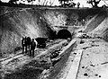
| Newnes Glowworm Tunnel |  | Between Newnes and Lithgow | Newnes railway line | Rail | 1,320 | 4,330 | Rail use between 1907 and 1932; converted to pedestrian and tourism use [17] |
| NorthConnex | Between Pennant Hills and Wahroonga | Pacific Motorway | Road | 9,000 | 30,000 | Opened 31 October 2020 [18] | |
| Old Main Tunnel | Picton | Main South line | Rail | 181 | 594 | Disused; previous use between 1867 and 1919 | |
| Pyrmont and Glebe Railway Tunnels | 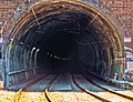 | Between Pyrmont and Glebe | Inner West Light Rail | Light rail | 1,500 | 4,900 | Two double-track tunnels; completed in 1922; estimated length [19] |
| Redbank Tunnel | Tahmoor | Main South line | Rail | 181 | 594 | Double-track, in use; [20] deviated, filled in [21] | |
| Red Hill Tunnels | Coffs Harbour | North Coast line | Rail | 955 | 3,133 | Five tunnels, opened in 1922 | |
| St Helena Tunnel |  | Ewingsdale, near Byron Bay, Tweed Valley | Pacific Highway | Road | 434 | 1,424 | Opened 18 December 2015 [22] |
| Stockrington | Maitland | Richmond Vale railway line | 3 tunnels | ||||
| Sydney Harbour Tunnel |  | Between Woolloomooloo and North Sydney under Sydney Harbour | Sydney Harbour Tunnel | Road | 2,800 | 9,200 | [23] |
| Sydney Harbour railway electricity tunnel |  | Between Birchgrove and Greenwich | Below Sydney Harbour | Power supply | 540 | 1,760 | Approximate distance [24] [25] |
| Sydney Metro Northwest | Between Bella Vista and Epping stations | Metro North West & Bankstown Line | Rail | 15,500 | 50,900 | Opened May 2019 [26] | |
| Sydney Metro City & Southwest |  | Between Chatswood and Sydenham stations in Sydney | Rail | 15,500 | 50,900 | Opened in August 2024 becoming Australia's longest tunnel. | |
| Tank Stream tunnel |  | Between Hyde Park and Circular Quay; Sydney central business district | Tank Stream | Storm water | 700 | 2,300 | Estimate of remnants of 1860s tunnel [27] |
| Ten Tunnels Deviation | Blue Mountains | Main Western line | Rail | 2,822 | 9,259 | Replaced the Lithgow Zig Zag; ten tunnels of ranging in length from 70 to 825 metres (230 to 2,707 ft) [28] | |
| Tickhole Tunnel | Between Cardiff and Kotara stations; Newcastle | Main North line | Rail | 370 | 1,210 | Dual tunnels ranging in length from 165 to 205 metres (541 to 673 ft) [29] [30] [31] [32] | |
| Tugun Bypass Tunnel | Tweed Heads | Gold Coast Airport | Road | 334 | 1,096 | [33] | |
| Upper Nepean Scheme | Campbelltown | Water | Two tunnels | ||||
| Woy Woy Tunnel |  | Between Wondabyne and Woy Woy stations, Central Coast | Main North line | Rail | 1,690 | 5,544 | Opened 15 August 1887; double track [34] |
| Wynyard Walk |  | Sydney central business district | Wynyard | Pedestrian | 180 | 590 | [35] |
| Name | Image | Locale | Carries | Type | Length | Notes | |
|---|---|---|---|---|---|---|---|
| m | ft | ||||||
| Airport Link | 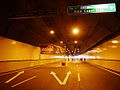 | Between Bowen Hills and Toombul; Brisbane | Airport Link | Road | 6,700 | 22,000 | Australia's longest road tunnel (at the time) [36] |
| Boolboonda Tunnel |  | Mount Perry Boolboonda, Bundaberg Region | Bundaberg to Mount Perry railway line | Rail heritage | 192 | 630 | [37] |
| Border Tunnel | | Richmond Gap, connecting New South Wales and Queensland | NSW North Coast line | Rail | 1,600 | 5,200 | On the border between New South Wales and Queensland (see New South Wales section above) |
| Cherry Gully Tunnel |  | Southern Downs Region | Warwick - Stanthorpe Line | Rail | 272 | 892 | Comprises two single-track tunnels [38] |
| Clem Jones Tunnel | 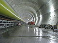 | Between Woolloongabba and Bowen Hills, Brisbane | Clem Jones Tunnel | Road | 4,800 | 15,700 | Two parallel tubes under the Brisbane River [39] |
| Cross River Rail | From Dutton Park rail to Boggo Road busway stations in Brisbane | Rail | 5,900 | 19,400 | Two bored tunnels under construction with one complete in 2021 but not operational [40] | ||
| Dalveen Tunnel |  | Dalveen, Southern Downs Region | Warwick to Wallangarra railway line | Rail | 140 | 460 | single line rail tunnel [41] |
| Dularcha Railway Tunnel |  | Mooloolah, Sunshine Coast Region | North Coast line | Rail | 100 | 330 | Disused line [42] |
| Eastern Busway |  | Dutton Park, Brisbane | Annerley Road | Road, busway | 640 | 2,100 | Built under Boggo Road Gaol [43] |
| George Bridges Tunnel | Nundah, Brisbane | Sandgate Road | Road | 285 | 935 | [44] | |
| Inner City Bypass tunnel |  | Breakfast Creek, Brisbane | Inner City Bypass | Road | 350 | 1,150 | [45] |
| Lahey's Canungra Tramway Tunnel |  | Canungra, Gold Coast | Pedestrians only | Rail heritage | 91 | 299 | c. 1900 [46] |
| Legacy Way |  | Toowong and Kelvin Grove, Brisbane | Linking the Western Freeway with the Inner City Bypass | Road | 4,600 | 15,100 | Two bored tunnels carrying two motorway grade lanes of traffic in each direction [47] |
| Leopard Street Tunnel | Brisbane | Stormwater | c. 1890 | ||||
| Main Range tunnels |  | Main Range | Main Line | Rail | 886 | 2,907 | A series of nine single-track or double-track tunnels that date from c. 1866 |
| Many Peaks - Monto loop line | Boyne Valley | Gladstone to Monto railway line | Rail heritage | 730 | 2,400 | Six tunnels on a disused railway line | |
| Muntapa rail tunnel | Cooyar, Toowoomba Region | Cooyar railway line | Rail heritage | 280 | 920 | [48] | |
| Victoria Tunnel |  | Grandchester | Main Line | Rail | 537 | 1,762 | [49] |
| Yimbun Railway Tunnel |  | Harlin, Somerset Region | Brisbane Valley railway line | Rail | 100 | 330 | Completed in 1910; line closed in 1993 [50] |
| Name | Image | Locale | Carries | Type | Length | Notes | |
|---|---|---|---|---|---|---|---|
| m | ft | ||||||
| Argent Tunnel | Near Melba Flats / Zeehan, West Coast | Emu Bay Railway (Melba line) | Rail | 508 | 1,666 | Documented on the Emu Bay Railway by 1900; historic photo shows the north portal and self-acting tramway. Coordinates recorded in Australian place-name data. [62] [63] [64] [65] | |
| Bellerive–Sorell railway tunnel (Tunnel Hill) | Meehan Range (Mount Rumney / Cambridge), Clarence | Former Bellerive–Sorell railway | Rail (disused) | 165 | 541 | Built 1891; heritage-listed; part used for mushroom cultivation and tours (Tunnel Hill Mushrooms). No general public access through-route. [66] [67] [68] [69] | |
| Derby Tunnel | Derby | Mining tailings / water diversion works | Mining (disused; now walk/ride-through) | 19th-century tunnel associated with tin-mining works on the Cascade River; incorporated into local trails and interpreted at the Schoolhouse Museum. [70] [71] | |||
| Duck Reach Supply Tunnel | Launceston | Deadmans Hollow → Duck Reach PS (historic) | Water | 850 | 2,790 | 1895 tunnel through dolerite for Australia’s first commercial hydro scheme (closed 1955). [72] | |
| Gordon Tailrace Tunnel | Southwest | Gordon PS (underground) → Gordon River | Water | 1,600 | 5,200 | Fed from Lake Gordon via ~137 metres (449 ft) vertical shaft. [73] | |
| John Butters Headrace Tunnel | West Coast Range (King–Yolande scheme) | Crotty Dam (Lake Burbury) → John Butters PS (underground) | Water | 6,500 | 21,300 | Plus 500 metres (1,600 ft) steel-lined power tunnel (≈7 kilometres (4.3 mi) total through West Coast Range). [74] | |
| Lemonthyme Headrace Tunnel | Mersey–Forth | Lake Parangana → Lemonthyme PS | Water | 6,500 | 21,300 | Followed by 1.6 kilometres (0.99 mi) surface penstock to station. [75] | |
| Liapootah Headrace Tunnel |  | Lower Derwent | Derwent R. (below Tarraleah/Tungatinah) → Liapootah PS | Water | 6,600 | 21,700 | Concrete-lined tunnel feeding three penstocks. [76] |
| North-Eastern Line tunnel |  | Tunnel (between Launceston and Scottsdale) | Former North-Eastern railway line | Rail (disused) | 704 | 2,310 | Late-1880s brick tunnel that gave the locality its name; now a popular short walk. [77] [78] |
| Poatina Headrace Tunnel | Central Highlands | Great Lake → Poatina PS | Water | 5,600 | 18,400 | Headrace to hilltop valve; then 105 m steel-lined pressure tunnel, 1.8 km surface penstock, 150 m shaft to underground station. [79] | |
| Poatina Tailrace Tunnel | Central Highlands | Poatina PS → Macquarie River | Water | 4,000 m | 10,000 ft | Approx. length reported in public sources. [79] | |
| Reece Intake Tunnels (×2) | Lower Pieman | Lake Pieman → Reece PS | Water | 250 | 820 | One tunnel per turbine unit. [80] | |
| Rhyndaston Tunnel | South of Oatlands; Southern Tasmania | Tasmanian Main Line (Hobart to Western Junction) | Rail | 955 | 3,133 | Completed in 1876; later enlarged in the 1960s to a “keyhole” profile to improve clearances. [81] | |
| Spray Tunnel (Silver Spray) |  | Near Zeehan, West Coast | Former mining tramway / access | Rail/mining (disused) | 100 | 330 | Keyhole-shaped tunnel to the former Spray silver mine; signed loop walk with glow-worms; not suitable for caravans on access road. [82] |
| Trevallyn Conveyance Tunnel | Launceston | South Esk R. → Trevallyn PS | Water | 3,200 | 10,500 | Run-of-river link from Trevallyn Dam to station. [83] | |
| Tribute Headrace Tunnel | Anthony/Pieman | Lake Plimsoll → Tribute PS (underground) | Water | 7,000 | 23,000 | Plus ~800 metres (2,600 ft) tailrace; >1 kilometre (0.62 mi) access tunnel. [84] | |
| Wayatinah Diversion Tunnel | Lower Derwent | Wayatinah Lagoon → woodstave mains → Wayatinah PS | Water | 2,000 | 6,600 | Plus two 1.3 kilometres (0.81 mi) low-pressure woodstave pipelines and penstocks. [85] | |
| Wilmot Conveyance Tunnel | Mersey–Forth | Lake Gairdner → Wilmot PS | Water | Combined tunnel + penstock route ~4.5 kilometres (2.8 mi) (tunnel-only length not published). [86] | |||
| Name | Image | Locale | Carries | Type | Length | Notes | |
|---|---|---|---|---|---|---|---|
| m | ft | ||||||
| Big Hill Tunnel | Bendigo | Deniliquin railway line | Rail | 390 | 1,280 | ||
| Bunbury Street Tunnel | Footscray, Melbourne | Rail | 420 | 1,380 | Both Broad Gauge and Standard Gauge entering and leaving Melbourne | ||
| Burnley Tunnel |  | Richmond, Melbourne | CityLink / Monash Freeway | Road | 3,400 | 11,200 | |
| City Loop Tunnels | 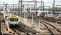 | La Trobe and Spring Streets, Melbourne | Melbourne Underground Rail Loop | Rail | 12,000 | 39,000 | Comprises:
|
| Domain Tunnel | 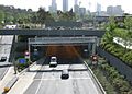 | Richmond, Melbourne | CityLink / Monash Freeway | Road | 1,600 | 5,200 | |
| Elphinstone Tunnel | Deniliquin railway line | Rail | 385 | 1,263 | Built double track, singled later | ||
| Geelong Tunnel | Geelong | Port Fairy railway line | Rail | 422 | 1,385 | Exit from Geelong to West coast railway line | |
| Melba Tunnel | 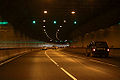 | Mitcham, Melbourne | Eastern Freeway to EastLink Ringwood | Road | 1,600 | 5,200 | |
| Metro Tunnel | South Yarra to | Cranbourne line Pakenham line Sunbury line | Rail | 9,000 | 29,500 | Once opened in 2025 the tunnel will cary the Pakenham, Cranbourne and Sunbury lines. [87] | |
| Mullum Mullum Tunnel |  | Mitcham, Melbourne | Eastern Freeway to EastLink Ringwood | Road | 1,600 | 5,200 | |
| Rosanna Tunnel | Rosanna, Melbourne | Hurstbridge railway line | Rail | 65 | 213 | ||
| West Richmond Tunnel | Richmond, Melbourne | Hurstbridge railway line | Rail | 115 | 377 | ||
| Jolimont Tunnel | East Melbourne, Melbourne | Hurstbridge railway line | Rail | 149 | 489 | ||
| Spotswood sewer tunnel | Fishermans Bend and Spotswood; Melbourne | Under Yarra River connecting Hobsons Bay Main with former Spotswood Sewerage Pumping Station | Sewer | 200 | 660 | Continues in use as part of Melbourne's Sewerage system | |
| West Gate Tunnel | Spotswood and Fishermans Bend; Melbourne | West Gate Bridge | Road | 3,000 | 9,800 | Proposed as part of the Western Distributor, construction commenced in 2018 [88] | |
| Name | Image | Locale | Address/Facility | Type | Length | Notes | |
|---|---|---|---|---|---|---|---|
| m | ft | ||||||
| Airport line tunnel |  | Bayswater, Redcliffe, Perth Airport, High Wycombe | Perth | Rail | 8,000 | 26,000 | Twin bored tunnels, part of the Airport line [89] |
| Canning Tunnel | Canning Dam to Perth | Darling Scarp | Water supply | 5,600 | 18,400 | [90] | |
| Northbridge Tunnel |  | Northbridge | Perth | Road | 1,600 | 5,200 | |
| Swan View Tunnel |  | Swan View | Perth; John Forrest National Park | Rail | 262 | 860 | Closed and now converted to a rail trail [91] |
| William Street tunnel |  | Perth Underground railway station to Elizabeth Quay railway station | Perth | Rail | 700 | 2,300 | Twin bored tunnels that were built as part of the New MetroRail City Project, [92] used by Yanchep and Mandurah line services |
| Wungong Tunnel | Wungong Dam to Perth | Darling Scarp | Water supply | 3,700 | 12,100 | ||
{{cite book}}: CS1 maint: multiple names: authors list (link){{cite web}}: CS1 maint: numeric names: authors list (link)[ self-published source? ]