| Overview | |
|---|---|
| Other name(s) | Kotara (Tickhole) Railway Tunnel |
| Line | Main Northern railway |
| Location | Hunter Region, New South Wales, Australia |
| Coordinates | 32°56′38″S151°41′11″E / 32.9440°S 151.6865°E Coordinates: 32°56′38″S151°41′11″E / 32.9440°S 151.6865°E |
| System | NSW Trains |
| Crosses |
|
| Start | Kotara |
| End | Cardiff |
| Operation | |
| Opened | 15 August 1887 |
| Owner | RailCorp |
| Technical | |
| Length |
|
| No. of tracks | 2 |
| Track gauge | 4 ft 8 1⁄2 in (1,435 mm) standard gauge |
| Electrified | 1984 |
New South Wales Heritage Database (Local Government Register) | |
| Official name | Kotara (Tickhole) Railway Tunnel |
| Designated | 28 May 2009 |
| Reference no. | s.170 |
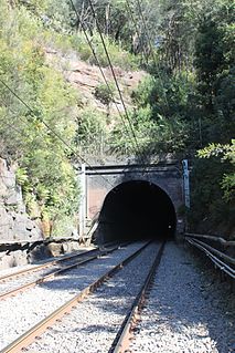
The Tickhole Tunnel, also called the Kotara (Tickhole) Railway Tunnel, is a heritage-listed double track railway tunnel that carries the Main Northern railway line beneath the Newcastle Inner City Bypass (A37) and is a diversion over the Tickhole Creek. The tunnel is located between Cardiff and Kotara stations in the City of Newcastle local government area of New South Wales, Australia. [1] [2]
The original 161-metre (176 yd) tunnel opened on 15 August 1887. It initially only had one track, but provision was made for the line to be duplicated which duly occurred in 1891. [3] [4] [5] [6] As part of the electrification of the line, in 1983 tenders were called for a second tunnel, of 205 metres (673 ft), completed in 1984. [7] This second tunnel is used by southbound services, while the original tunnel once again became single track for northbound services. [1] [2]
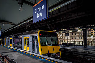
The City Circle is a mostly-underground railway line located in the Sydney central business district, in New South Wales, Australia, that forms the core of Sydney's passenger rail network. The lines are owned by RailCorp, a State government agency, and operated under Transport for NSW's Sydney Trains brand. Despite its name, the City Circle is of a horseshoe shape, with trains operating in a U-shaped pattern. The constituent stations of the Circle are (clockwise): Central, Town Hall, Wynyard, Circular Quay, St James, Museum and back to Central.

The Eastern Suburbs & Illawarra Line is a commuter railway line in the eastern and southern suburbs of Sydney and is a part of the Sydney Trains network. The line was constructed in the 1880s to Wollongong to take advantage of agricultural and mining potentials in the Illawarra area. In March 1926 it became the first railway in New South Wales to run electric train services.

Epping railway station is a railway station in Epping, in the Northern Suburbs region of Sydney. It is served by Sydney Trains T9 Northern Line, NSW TrainLink Central Coast & Newcastle Line, and Metro North West Line services.

The Airport & South Line is a suburban commuter rail line in Sydney, Australia. It connects the Sydney central business district with the southwestern suburbs via Sydney Airport. The line is part of the Sydney Trains network. The line began operating on 26 November 2017, when the T2 Airport, Inner West & South Line was split in two. Sydney Trains' predecessor CityRail operated the Airport & East Hills line over an identical route between 2000 and 2013.

The South Coast railway line is a commuter and goods railway line in New South Wales, Australia. Beginning at the Illawarra Junction, the line primarily services the Illawarra and South Coast regions of New South Wales, and connects Sydney and Bomaderry through Wollongong and Kiama.

Kotara is a suburb of Newcastle, New South Wales, Australia, located 9 kilometres (6 mi) from Newcastle's central business district. It is part of the City of Newcastle local government area.

Hawkesbury River railway station is a heritage-listed railway station located on the Main North and Central Coast–Newcastle lines in Brooklyn in the Hornsby Shire local government area of New South Wales, Australia. The station serves the town of Brooklyn and is located on the southern bank of the Hawkesbury River. It was designed and build by the Department of Railways New South Wales. It is also known as Hawkesbury River Railway Station group and Brooklyn Station. The property is owned by RailCorp, an agency of the Government of New South Wales. It was added to the New South Wales State Heritage Register on 2 April 1999.

Gerringong is a single-platform intercity train station located in Gerringong, New South Wales, Australia, on the South Coast railway line. The station serves NSW TrainLink diesel multiple unit trains travelling south to Bomaderry and north to Kiama. Early morning and late night services to the station are provided by train replacement bus services. In the past, the station precinct also catered to freight trains carrying dairy products.

Oak Flats is a single-platform intercity train station located in Oak Flats, New South Wales, Australia, on the South Coast railway line. The station serves NSW TrainLink trains travelling south to Kiama and north to Wollongong and Sydney. Together with the Dunmore and later Shellharbour Junction stations, Oak Flats has long served as the rail connection for the coastal suburbs of the City of Shellharbour.
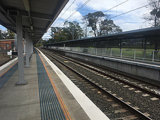
Dapto railway station is located on the South Coast railway line in the Wollongong suburb of Dapto, New South Wales, Australia.

Kembla Grange is a single-platform intercity train station located in Kembla Grange, New South Wales, Australia, on the South Coast railway line. The station serves NSW TrainLink trains travelling south to Kiama and north to Wollongong and Sydney. The station ranked equal last for patronage on the metropolitan network in 2012, and was one of 23 on the metropolitan rail network to record an average of fewer than one passenger per day in 2014.
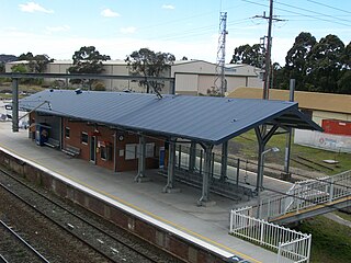
Unanderra railway station is located on the South Coast railway line in the Wollongong suburb of Unanderra, New South Wales, Australia.
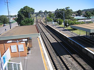
Adamstown railway station is located on the Main Northern line in New South Wales, Australia. It serves the southern Newcastle suburb of Adamstown, and was opened on 15 August 1887.

The Hawkesbury River railway bridge is a heritage-listed railway bridge that carries the Main North railway line across the Hawkesbury River, connecting just north of the town of Brooklyn, Hornsby Shire on the northern outskirts of Sydney with Cogra Bay, Central Coast Council, both in New South Wales, Australia. The railway bridge was to be the last link in a railway network that linked Adelaide, Melbourne, Sydney and Brisbane and was a major engineering feat at the time. The original railway bridge was build in 1899 and replaced by the current bridge in 1946. The 1946 bridge was added to the New South Wales State Heritage Register on 2 April 1999.
The Crookwell railway line is a disused branch railway line in the south of New South Wales, Australia. It has never officially been closed. It branched from the Main South line at North Goulburn and passed north through the localities of Kenmore and Roslyn to the town of Crookwell.

The Lake Cargelligo railway line is a railway line in Central Western New South Wales, Australia. The first sod was turned commencing construction on 8 June 1913 with the line opening on 13 November 1917. The line branches from the Main South line at Cootamundra and travels in a north-westerly direction to the small town of Lake Cargelligo. The line is used primarily for grain haulage, although passenger service was provided until 1983.
The Woy Woy railway tunnel is a heritage-listed railway tunnel located between Wondabyne and Woy Woy stations on the Main Northern railway line in New South Wales, Australia. The dual-track 1.69-kilometre tunnel was opened on 16 January 1888. It was added to the New South Wales State Heritage Register on 28 June 2013.
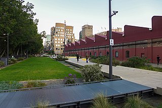
The Goods Line is an 800-metre-long (2,625 ft) linear park and shared pedestrian pathway and cycleway in the suburb of Ultimo, in the City of Sydney, New South Wales, Australia. The corridor connects Railway Square to Darling Harbour in the south and passes both the University of Technology Sydney Broadway campus and the Australian Broadcasting Corporation Sydney head office. The Goods Line terminates in the north at the corner of Sussex and Hay Streets, in the Sydney central business district.

The Queanbeyan railway bridges over Queanbeyan and Molonglo Rivers are two heritage-listed railway bridges that carry the Bombala railway line in the Queanbeyan-Palerang Region local government area of New South Wales, Australia. Both bridges were built between 1926 and 1927. The western-most bridge crosses the Queanbeyan River from Queanbeyan to Queanbeyan East at 35.3424°S 149.2317°E, while the eastern-most bridge crosses the Molonglo River at Burbong at 35.3371°S 149.3191°E. The two railway bridges are owned by RailCorp, an agency of the Government of New South Wales. Together, the two bridges were added to the New South Wales State Heritage Register on 2 April 1999.