
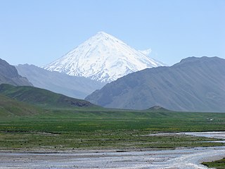
The Zagros Mountains are a long mountain range in Iran, northern Iraq and southeastern Turkey. This mountain range has a total length of 1,600 km (990 mi). The Zagros mountain range begins in northwestern Iran and roughly follows Iran's western border, while covering much of southeastern Turkey and northeastern Iraq. From this border region, the range continues to the southeast under also the waters of the Persian Gulf. It spans the whole length of the western and southwestern Iranian plateau, ending at the Strait of Hormuz. The highest point is Mount Dena, at 4,409 metres (14,465 ft).

The Karkas mountain chain is a mountain range which is located almost in central Iran. Having a northwest-southeast direction, it is stretched from Kashan to Ardestan for more than 100 kilometres. With an elevation of 3895 metres, the highest peak of the Karkas Mountains is Mount Karkas which is situated close to Natanz.

Dena is the name for a sub-range within the Zagros Mountains. Mount Dena, with 80 km (50 mi) length and 15 km (49,000 ft) average width, is situated on the boundary of the Isfahan, Kohgiluyeh and Boyer-Ahmad and Chaharmahal and Bakhtiari Provinces of Iran.

Damghan is the capital of Damghan County, Semnan Province, Iran. At the 2006 census, its population was 57,331, in 15,849 families. It is situated 342 km (213 mi) east of Tehran on the high-road to Mashad, at an elevation of 1,250 m (4,101 ft). It is one of the oldest cities on the Iranian plateau, stretching back 7,000 years, and boasts many sites of historic interest. The oldest of these is Tappeh Hessar, lying to the southeast of the city, which holds the ruins of a castle dating from the Sasanian Empire.
The Alborz range, also spelled as Alburz, Elburz or Elborz, is a mountain range in northern Iran that stretches from the border of Azerbaijan along the western and entire southern coast of the Caspian Sea and finally runs northeast and merges into the smaller Aladagh Mountains and borders in the northeast on the parallel mountain ridge Kopet Dag in the northern parts of Khorasan. All these mountains are part of the much larger Alpide belt. This mountain range is divided into the Western, Central, and Eastern Alborz Mountains. The Western Alborz Range runs south-southeastward almost along the western coast of the Caspian Sea. The Central Alborz runs from west to east along the entire southern coast of the Caspian Sea, while the Eastern Alborz Range runs in a northeasterly direction, toward the northern parts of the Khorasan region, southeast of the Caspian Sea. Mount Damavand, the highest mountain in Iran measuring 5,610.0 m, is located in the Central Alborz Mountains.

The Aladagh Mountains or the Aladagh Range refers to a mountain range situated in the southeastern section of North Khorasan Province in the northeastern part of Iran southeast of the Caspian Sea. The range is located almost 25 kilometres south of Bojnurd, the capital city of North Khorasan. The Aladagh Mountains merge with the Elburz or Alborz Mountains in the west and then run southeastwards in a northwest-southeast direction. The highest peak of the range is Mount Shahjahan with an elevation of 3032 metres. This peak is located about 35 kilometres east of Esfarayen almost in southeastern part of North Khorasan Province.

The Binalud Mountain Range or the Binalud Range is a mountain range that runs in a northwest-southeast direction between the Nishapur and Mashhad regions in Razavi Khorasan Province in northeastern Iran, to the southeast of the Caspian Sea. Although far from the Aladagh Mountains, which lie to the northwest in the Province of North Khorasan, the Binalud Mountains are located in such a way that both the Aladagh Mountains and the Binalud Range lie approximately in the same arc, curving from the northwest to the southeast. The city of Mashhad or Meshed is located in the northeastern part of the Binalud Range, and the city of Nishapur or Neyshabur lies on the southwestern section of the range. Situated somewhat to the west of the Binalud Range proper, and with an elevation of 3211 metres, Mount Binalud is the highest point both of the Binalud Mountains and of Razavi Khorasan Province as a whole.
Kuhbonan Mountains or Kuhbonan Highlands,, are a group of mountains that are located in the northern part of Kerman Province in Iran. Stretching in a northwest-southeast direction, the mountain range is situated in northwestern, eastern, and southeastern part of the city of Kerman, northeast of the town of Zarand, and southwest of the town of Ravar. With an elevation of 4233 metres, the highest point of the range is Mount Pelvar or Mount Palvar that is located southeast of the city of Kerman and about 25 kilometres east of the town of Mahan.

The main points that are discussed in the geology of Iran include the study of the geological and structural units or zones; stratigraphy; magmatism and igneous rocks; ophiolite series and ultramafic rocks; and orogenic events in Iran.
Mount Marshenan or Mount Mareshnan is a mountain that is located approximately 60 kilometres north-east of the city of Isfahan and 30 kilometres north of Kuhpayeh. With an elevation of 3330 metres, this mountain is about 15 kilometres south-east of Zefreh and 3 kilometres south of the village of Marshenan in Isfahan Province, almost in central Iran. Made chiefly of Eocene andesite and pyroclastic rocks, Mount Marshenan is situated in a central Iranian range, Sahand-Bazman volcanic range or belt, a mountain range which was formed mainly during Eocene volcanism and that stretches approximately from Sahand volcano in the north-west of Iran to Bazman volcano in the south-east of Iran.
Mount Soffeh or Kuh-e Soffeh is a mountain that is situated just south of the city of Isfahan, southeast of Mount Donbeh and south of the Zayanderud River in Iran.
Mount Donbeh or Kuh-e Donbeh is a mountain which is situated just southwest of the city of Isfahan in Isfahan Province in Iran. Stretching in a northwest-southeast direction, Mount Donbeh is located south of the Zayanderud River and northwest of Mount Soffeh in the Sanandaj-Sirjan geologic and structural zone of Iran. The mountain is mainly formed of Lower Cretaceous limestone. Only the southeastern part of the mountain is made of Jurassic shale.
Mount Kolah Qazi or Kuh-e Kolah Qazi is a mountain that is located about 30 kilometres southeast of the city of Isfahan in Isfahan Province in Iran. With an elevation of 2534 metres, the highest peak is in the north-central part of the mountain. Having a general northwest-southeast direction, this mountain is situated southeast of Mount Shah Kuh and west and almost parallel to Mount Qaruneh. With an average width of about 5 kilometres and a length of almost 20 kilometres, this mountain is a part of the Mount Kolah Qazi Protected Nature Reserve which covers an area of about 50,000 hectares of national park and 3,000 hectares of protected wildlife region.
Mount Qaruneh or Kuh-e Qaruneh is a mountain which is located about 30 kilometres southeast of the city of Isfahan in Isfahan Province in Iran. Situated southeast of Mount Shah Kuh and being almost parallel to Mount Kolah Qazi this mountain has an average width of about 2 kilometres and a length of around 25 kilometres. Mount Qaruneh has a general northwest southeast direction. With an elevation of 2030 metres, the highest peak is located in the southern section of the mountain. Mount Qaruneh is situated in the Sanandaj-Sirjan geologic and structural zone of Iran and is made mainly of Lower Cretaceous limestone.
Shah Kuh or Mount Shah Kuh is a mountain which is located about 15 kilometres south of the city of Isfahan in Isfahan Province in Iran. With an average width of about 3 kilometres and a length of almost 20 kilometres, this mountain has a general northwest-southeast direction and is situated almost northwest of Mount Kolah Qazi. The highest peak is located in the northern section of the mountain and has an elevation of 2418 metres. Mount Shah Kuh is situated in the Sanandaj-Sirjan geologic and structural zone of Iran, and except for a very small section of Jurassic rocks in its north-central part this mountain is mainly formed of Lower Cretaceous limestone.
Oshtorankuh is a mountain that is located in city of Azna, in Lorestan With an elevation of 4150 metres, the Oshtorankuh is the highest mountain in Lorestan Province. Stretched in a northwest-southeast direction, the Oshtorankuh is situated in the Zagros Mountains and is among the high mountains of this range. The ِDez Dam start in the Zagros mountains near the Oshtorankuh.
Shahankuh is a mountain which is located about 20 kilometres southwest of the city of Fereydunshahr in the western part of Isfahan Province in Iran. With an elevation of 4040 metres, the Shahankuh is the highest mountain in Isfahan Province. Situated in the Zagros Mountains and stretched in a general northwest-southeast direction and almost parallel to other Zagros mountains, the Shahankuh has an average width of about 3 kilometres and a length of almost 20 kilometres.
Qaflankuh or Qaflankuh Mountain Range is a mountain range that is located about 20 kilometres north of the city of Zanjan in Zanjan Province, Iran. With an average width of almost 20 kilometres and a length of about 100 kilometres, this mountain range is stretched in a northwest-southeast direction, beginning from northwest of Zanjan, passing north of Zanjan and ending southeast of Zanjan. The Qezel Owzan River flows in a valley that separates Qaflankuh Mountains on the south from Talish Mountains on the north. With an elevation of 2971 metres, Mount Sendan Dagh is the highest mountain of the range which is located in the southeast section of this mountain range. There are some mineral hot springs containing sulphur in different parts of this range. Geologically, Qaflankuh Mountain Range was formed during the Tertiary volcanism and plutonism and is made mainly of the Eocene volcanic rocks with very small sections of intrusive rocks in the northern and southern parts of the range.

Kashafrud or Kashafrud River is a river that flows from the Hezar Masjed Mountains in Razavi Khorasan Province in northeast of Iran. After passing from the vicinity of the cities of Radkan and Chenaran in Razavi Khorasan Province and then passing north and east of the city of Mashhad, the Kashfrud joins the Harirud River at the frontier of Iran and Turkmenistan.
The Sahand-Bazman Volcanic and Plutonic Belt or the Sahand-Bazman Igneous Arc or the Central Iranian Range is a mountain range that is made by igneous and pyroclastic rocks. Located East and almost parallel to the Zagros Mountains, the Central Iranian Range is stretched in a north-west-southeast direction from Mount Sahand in Azerbaijan in the north-west to Mount Bazman in Baluchistan in the Southeastern part of Iran. This range was mainly formed during the Tertiary volcanic and orogenic phase and especially in the Eocene volcanism and plutonism. The Central Iranian Range or the Sahand-Bazman Volcanic Belt includes famous mountains such as the Sahand in East Azerbaijan Province, Mount Karkas in the Karkas Mountains and Mount Marshenan in Isfahan Province, the Jebal Barez, Mount Hezar and Mount Lalehzar in Kerman Province, and the Bazman in the Sistan va Baluchestan Province of Iran.

