
Highbury Park is a street in Highbury, London, that runs from Blackstock Road in the north to Highbury Grove in the south.
Highbury Park is a street in Highbury, London, that runs from Blackstock Road in the north to Highbury Grove in the south.
The late nineteenth century Highbury Barn public house refers in its name to the 18th century tea gardens that became a "pleasure resort" in the nineteenth century. [1]

The London Borough of Islington is a London borough which forms part of Inner London, England. Islington has an estimated population of 215,667. It was formed in 1965, under the London Government Act 1963, by the amalgamation of the metropolitan boroughs of Islington and Finsbury.

Islington was a civil parish and metropolitan borough in London, England. It was an ancient parish within the county of Middlesex, and formed part of The Metropolis from 1855. The parish was transferred to the County of London in 1889 and became a metropolitan borough in 1900. It was amalgamated with the Metropolitan Borough of Finsbury to form the London Borough of Islington in Greater London in 1965.

Holloway Road is a road in London, 3 kilometres (1.9 mi) in length. It is one of the main shopping streets in North London, and carries the A1 road as it passes through Holloway, in the London Borough of Islington. The road starts in Archway, near Archway Underground station, then heads south-east, past Upper Holloway railway station, Whittington Park, past the North London campus of London Metropolitan University near Nag's Head, past Holloway Road Underground station, and the main campus of the university, and then becomes Highbury Corner, near Highbury & Islington station.

The New North Road is a road in northern central London, forming part of a link road from the A1 at Highbury into the City of London at Moorgate. It is 0.8 miles (1.3 km) in length and is part of the A1200. This link road consists of Canonbury Road and New North Road, before several smaller sections to the south leading into the city.

Islington North is a constituency in Greater London established for the 1885 general election. It has been represented in the House of Commons of the UK Parliament since 1983 by Jeremy Corbyn, who was Leader of the Labour Party and Leader of the Opposition from 2015 to 2020. Since 2020, Corbyn has represented the seat as an independent. He was re-elected to Islington North as an independent in the 2024 general election.

Finsbury Pavement is a short length of street in England connecting Moorgate with City Road in the London Borough of Islington. It forms a part of the London Inner Ring Road, and before the introduction of the ring of steel around the City of London it formed a major through-route towards London Bridge and south London.

Highbury Fields is an open space in Highbury, in the London Borough of Islington. At 11.75 hectares, it is the largest open space in the borough.

The Anglican Church of St Mary the Virgin, Ewell is the civic church of the borough of Epsom and Ewell in the county of Surrey in South East England.
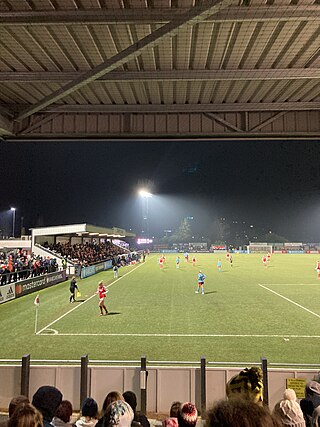
Meadow Park is a football ground in Borehamwood, Hertfordshire, England. It is the home ground of Boreham Wood F.C. and Arsenal youth teams. It is the former home ground of Arsenal W.F.C., who still play some matches there.

Mildmay Park railway station is a former railway station on the North London line, located between Canonbury and Dalston Kingsland stations. The station was located on Mildmay Park between Newington Green and Balls Pond Road.
Wessex Sound Studios was a recording studio located at 106a Highbury New Park, London, England. Many renowned popular music artists recorded there, including King Crimson, Queen, Sex Pistols, the Clash, Pete Townshend and the Pretenders. The property was sold to a residential development company in 2003.

Blackstock Road is a major road in North London, England, running from Seven Sisters Road south westerly to Highbury.
The Primrose Club was a short-lived political London gentlemen's club founded in 1886 and located at 4-5 Park Place, St. James's. It was aligned to the Conservative party, with members having to pledge support. It was launched as a bid to combine the explosion of the popularity of clubs in London at the end of the nineteenth century with the phenomenal success of the Conservative-aligned Primrose League.
Highbury Ward is an electoral ward in Hitchin, Hertfordshire. It covers 230.174 hectares. It is a largely residential area bounded roughly to the north by the A505, to the south west by the A602, and by the railway line to the east. Schools in the ward include Highbury JMI and Whitehill Junior School.

Victoria Recreation Ground is a public park in New Barnet in the London Borough of Barnet, United Kingdom. It is one of Barnet's 'Premier Parks'.
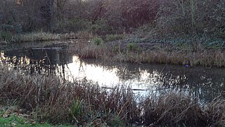
Gillespie Park is a 3.4 hectare Local Nature Reserve and Site of Metropolitan Importance for Nature Conservation in Highbury in the London Borough of Islington. It also hosts the Islington Ecology Centre, which provides environmental education for schools and organises walks and talks for adults. It is owned and managed by Islington Council. The site is protected by Fields in Trust through a legal "Deed of Dedication" safeguarding the future of the space as public recreation land for future generations to enjoy.

Sir Joseph Hood Memorial Wood is a 1.7 hectare Local Nature Reserve and a Site of Borough Importance for Nature Conservation, Grade I, in Motspur Park in the London Borough of Merton. It adjoins Sir Joseph Hood Memorial Playing Fields, and both are owned and managed by Merton Council.

The Flora, also known as The Flora Hotel, is a pub at 525 Harrow Road, Kensal Green, London W10. It backs onto the Grand Union Canal. It is a Taylor Walker pub.

Highbury New Park is a street in Highbury in the London Borough of Islington which runs from Highbury Quadrant in the north to Highbury Grove in the south.

The Neighbours is a sculpture by Siegfried Charoux. It was commissioned in 1957 using funds set aside by London County Council for public art in its housing projects and unveiled in 1959 at the Quadrant Estate in Islington, N5, London, near Clissold Park. It became Grade II listed building in April 1998.
![]() Media related to Highbury Park, London at Wikimedia Commons
Media related to Highbury Park, London at Wikimedia Commons
51°33′20.41″N0°5′53.19″W / 51.5556694°N 0.0981083°W
| | This London road or road transport-related article is a stub. You can help Wikipedia by expanding it. |