Related Research Articles

Highgate is a suburban area of north London at the northeastern corner of Hampstead Heath, 4.5 miles (7.2 km) north-northwest of Charing Cross.

Walsall is a market town and administrative centre in West Midlands County, England. Historically part of Staffordshire, it is located 9 miles (14 km) north-west of Birmingham, 7 miles (11 km) east of Wolverhampton and 9 miles (14 km) from Lichfield.

Smethwick is an industrial town in Sandwell, West Midlands, England, historically in Staffordshire. It lies four miles west of Birmingham city centre, and borders West Bromwich and Oldbury to the north and west. Formerly a Staffordshire county borough, Smethwick is situated near the edge of Sandwell metropolitan borough and borders the Birmingham districts of Handsworth, Winson Green, Harborne, Edgbaston and Quinton to the south and east, as well as the Black Country towns of West Bromwich and Oldbury in the north and west.

Sandwell is a metropolitan borough of the West Midlands county in England. The borough is named after the Sandwell Priory, and spans a densely populated part of the West Midlands conurbation. According to Sandwell Metropolitan Borough Council, the borough comprises the six amalgamated towns of Oldbury, Rowley Regis, Smethwick, Tipton, Wednesbury, and West Bromwich, although these places consist of numerous smaller settlements and localities. Sandwell's Strategic Town Centre is designated as West Bromwich, the largest town in the borough, while Sandwell Council House is situated in Oldbury. In 2019 Sandwell was ranked 12th most deprived of England's 317 boroughs.

North Finchley is a suburb of London in the London Borough of Barnet, situated 7 miles (11 km) north-west of Charing Cross.

Swiss Cottage is an area of Hampstead in the London Borough of Camden, England. It is centred on the junction of Avenue Road and Finchley Road and includes Swiss Cottage tube station. Swiss Cottage lies 3.25 miles (5.23 km) north-northwest of Charing Cross. The area was named after a public house in the centre of it, known as "Ye Olde Swiss Cottage".

Great Barr is now a large and loosely defined area to the north-west of Birmingham, England. The area was historically in Staffordshire, and the parts now in Birmingham were once known as Perry Barr, which is still the name of an adjacent Birmingham district. Other areas known as Great Barr are in the Metropolitan Boroughs of Walsall and Sandwell.

Shirley is an area of south London, England, within the London Borough of Croydon. It lies north of Spring Park and Addington, east of Addiscombe, south of Monks Orchard and west of West Wickham, and ten miles south-southeast of Charing Cross. Prior to the creation of Greater London in 1965, Shirley was in the administrative county of Surrey.

The smock mill is a type of windmill that consists of a sloping, horizontally weatherboarded, thatched, or shingled tower, usually with six or eight sides. It is topped with a roof or cap that rotates to bring the sails into the wind. This type of windmill got its name from its resemblance to smocks worn by farmers in an earlier period.

The Old Windmill is a heritage-listed tower mill in Observatory Park adjacent to Wickham Park at 226 Wickham Terrace, Spring Hill, City of Brisbane, Queensland, Australia. It was built in the 1820s by convict labour in the Moreton Bay penal settlement and is the oldest surviving building in Queensland. It is also known as Brisbane Observatory and Windmill Tower. It was added to the Queensland Heritage Register on 21 October 1992. Today it is the centrepiece of Observatory Park.

Newbold Verdon is a village and civil parish in the county of Leicestershire, England. The parish includes Newbold Heath to the north and Brascote to the south. Originally an agricultural centre Newbold Verdon grew in size during the 1850s with the expansion of coal mining in the area. That industry has now ceased leaving Newbold Verdon as a commuter village primarily serving Leicester and Hinckley. The 2001 census recorded a population of 3,193, which had reduced to 3,012 at the 2011 census.

Charlemont with Grove Vale is a political ward in the Metropolitan Borough of Sandwell, in the English Midlands constituency of West Bromwich East. This Sandwell ward population as taken at the 2011 census was 11,964.

Old Hill is a tiny village in the metropolitan borough of Sandwell in the West Midlands, England, situated around 2 miles (3.2 km) north of Halesowen and 2.5 miles (4.0 km) south of Dudley.

Green's Windmill is a restored and working 19th century tower windmill in Sneinton, Nottingham. Built in the early 1800s for the milling of wheat into flour, it remained in use until the 1860s. It was renovated in the 1980s and is now part of a science centre, which together have become a local tourist attraction.

Oare Mill is a Grade II listed house converted Tower mill in Oare, Kent, England that was built in the late eighteenth or early nineteenth century.

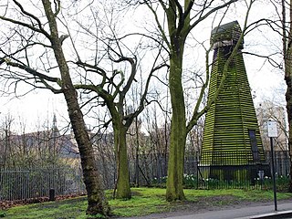
Wandsworth Common Windmill is a conserved grade II listed smock mill at Wandsworth Common, in the London Borough of Wandsworth in the United Kingdom.

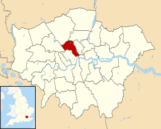
The London Borough of Camden is a London borough in Inner London, and historically a part of Middlesex. Camden Town Hall, on Euston Road, lies 1.4 mi (2.3 km) north of Charing Cross.

Elphin Windmill is a fully restored 18th-century tower mill in Elphin, County Roscommon, viewed as a rare piece of Irish industrial architectural heritage, and possibly the oldest operational windmill in Ireland.
The Walsall Silver Thread Tapestries are a set of eleven artworks, in the form of tapestries, designed by the artist Hunt Emerson in conjunction with the various communities of Walsall, England and hand stitched by local people there during 2016. They depict the people, places, history and wildlife of the towns and districts that, since 1974, have formed the Metropolitan Borough of Walsall.
References
- ↑ "Highgate Brewery Ltd". quaffale.org.uk. Retrieved 11 April 2010.
- ↑ "Mitchells & Butlers : About us : Our history". mbplc.com. Retrieved 11 April 2010.
- ↑ "Highgate". ratebeer.com. Retrieved 11 April 2010.
- ↑ "The Publican – Home – Highgate Brewery goes into administration". thepublican.com. Retrieved 11 April 2010.
- 1 2 3 4 5 Walsall Local History Centre (7 October 2004). "From the Earth to the Moon – Highgate Windmill". Walsall Metropolitan Borough Council. Archived from the original on 10 April 2005. Retrieved 2 December 2008.
- 1 2 Williams, Stuart (2002). "From the Earth to the Moon – Highgate Windmill, Walsall". Society for the History of Astronomy Newsletter . Society for the History of Astronomy. 1: 8–9. Bibcode:2002SHAN....1....8W. Archived from the original on 4 April 2016. Retrieved 23 March 2016.
- ↑ "View the statutory list of buildings". Walsall Metropolitan Borough Council. Retrieved 2 December 2008.