
The Richmond Parkway Transit Center or RPTC is a park and ride lot and bus terminal located in Richmond, California. It is named after the adjacent Richmond Parkway. It serves as a transfer point for the WestCAT and AC Transit. It is located on the corner of Richmond Parkway and Blume Drive near the Pinole border and adjacent to Interstate 80 and the Hilltop Plaza shopping center.

Temescal Regional Recreation Area (TRRA), formerly Lake Temescal Regional Park, is a regional park in the Berkeley Hills, in northeastern Oakland, California. The TRRA encompasses 48 acres (19 ha), abutting SR 24, SR13, and the interchange connecting the two highways, southwest of the Caldecott Tunnel.The park is part of the East Bay Regional Park District (EBRPD).

Arastradero Preserve, officially known as Enid W. Pearson–Arastradero Preserve, is a nature preserve that protects most of the Arastradero Creek watershed, including its ephemeral Mayfly Creek tributary. The preserve is owned and operated by the City of Palo Alto, California. The main parking lot hosts an interpretive center and is located at 1530 Arastradero Road.

Hilltop District, more commonly known simply as Hilltop, is a neighborhood located in the northeastern area of Richmond, California.
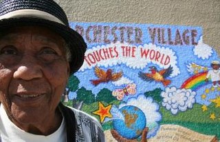
Parchester Village is a planned majority African-American village in northwestern Richmond, California that was the first in the state to sell to blacks.
The Iron Triangle, sometimes known as Central Richmond, is a neighborhood in Richmond, California. It is a largely residential area but includes the downtown Richmond business district along Macdonald Avenue. Commercial areas on Cutting Boulevard and near Interstate 580 are also in the neighborhood if the more extensive of two possible definitions of its area is used.

North & East is a historic neighborhood in central Richmond, California.

The Richmond Country Club is a private social gathering place and sports facility for golf in the Hilltop District of Richmond, California, United States.
Point Isabel is a promontory on the eastern shore of San Francisco Bay in the Richmond Annex neighborhood of Richmond, USA.

Downtown Richmond is the old center of Richmond, California. The area is roughly bordered by 6th street to the west, 23rd Street to the east, Barrett Avenue to the north, and Macdonald Avenue to the south. The area once featured major department stores and other chains such as J.C. Penney, Macy's, S. H. Kress & Co., and Sears before Hilltop Mall was built in the 1970s.The area is currently undergoing a revitalization effort by the city, which has included the Richmond Shopping Center anchored by a supermarket. The Richmond Transit Village—coined Metro Walk by the developers, the Olson Company—has also been built, along with remodeling of the Richmond BART and Amtrak station and a bus transit center served by AC Transit and Golden Gate Transit. A Kaiser Permanente hospital and a Social Security Administration processing center provide for a majority of the jobs in the area.

Sanborn County Park is a 3,453 acres (13.97 km2) public park situated in the Santa Cruz Mountains owned by the county of Santa Clara, California, adjacent to Castle Rock State Park and the Los Altos Rod and Gun Club Range and Santa Clara County Peace Officers Association gun range. The park is managed by the Santa Clara County Parks and Recreation Department. The park is heavily forested and offers hiking and other generally low intensity outdoor uses. The park lies between the town of Saratoga and the ridgetop road, Skyline Boulevard. In the summer months, Sanborn County Park hosts the only outdoor Shakespearean company in Silicon Valley.

West County Detention Center is a large coeducational adult medium security Contra Costa County jail in Richmond, California opened in 1991.

Downtown Oakland is the central business district of Oakland, California, United States; roughly bounded by both the Oakland Estuary and Interstate 880 on the southwest, Interstate 980 on the northwest, Grand Avenue on the northeast, and Lake Merritt on the east.
Fluvius Innominatus or Central Creek is a creek in Richmond and El Cerrito, California, in western Contra Costa County. There is one main source and a secondary unnamed tributary. The creek drains into Hoffman Marsh and then flows into the bay through Point Isabel Regional Shoreline's Hoffman Channel. However, before the area was developed and as early as 1899 the creek had 11 sources which stretched far higher into the Berkeley Hills.
Hilltop Green or "The Green"is a neighborhood in Richmond, California bordering the city of Pinole, the census-designated place of El Sobrante, the neighborhood of Hilltop, and Hilltop Mall.
Stege Marsh, also known as the South Richmond Marshes, is a tidal marshland wetlands area in Richmond, California in western Contra Costa County.
Hoffman Marsh is a wetlands on San Francisco Bay in Richmond, California. The marsh has been protected within Eastshore State Park, and adjacent to Point Isabel Regional Shoreline. The marsh is an important nesting ground for wildfowl and stopping ground on the Pacific Flyway, as it is one of only a handful of undestroyed wetlands in the Bay Area. It borders Point Isabel Regional Shoreline and Interstate 80.

Hercules Transit Center is a major commuter hub in the western Contra Costa County city of Hercules, California. It is anchored by WestCAT bus services. The center was originally on San Pablo Avenue. In August 2009, the transit center was relocated to the other side of I-80 with additional paid parking.
Point Molate Beach Park is a city-owned park in Richmond, California, accessible only via a narrow road from the Richmond-San Rafael Bridge toll plaza exit "Western Drive", and separate from the rest of the city. The park is adjacent to the present day ghost town of Winehaven.
Abella Center formerly International Marketplace and originally El Portal Shopping Center is a mixed-use city services, business, shopping center and housing village transit-oriented development that was formerly a mall in San Pablo, California.