Hindol, Odisha

Last updated

Hindol State established in 1554 HINDOL MAP.jpg
Hindol State established in 1554

Hindol is a town and subdivision in Dhenkanal district of the Indian state of Odisha.

Contents

Geography

It is located 29 kilometres (18 mi) from NH 55 to Gudiakateni, 11 kilometres (6.8 mi) from NH 655 to Satamaili Chowk and is surrounded by reserve forest on the East, South, and West. It was a part of the Hindol princely state before independence. It is 60 kilometres (37 mi) from Dhenkanal.

History

Hindol was founded from Dudurkote (established before 800 AD) in 1554 by two brothers named Lakshman Mahratta and Bharat Mahratta. They belonged to the family of the Khimedi Raja of Ganjam district, which also ruled over areas in the Madras region. After the East India Company occupied Odisha in September–October 1803, treaties were signed with estates of the region, including Hindol.

Rulers

TenureName
1691–1701Achyuta Singh Narendra
1701–1733Bhagabat Singh Narendra
1733–1770Damodar Singh Narendra
1770–1781Radhakant Singh Mardraj Jagadeb
1781–1786Ram Chandra Singh Mardraj Jagadeb
1786–1829Kishan Chandra Mardraj Jagadeb
1829–1841Harihar Singh Mardraj Jagadeb
1841–1874Ishwar Singh Mardraj Jagadeb
1874–1877Phokar Singh Mardraj Jagadeb
18 Jul 1877 – 10 Feb 1906Janardan Mardraj Jagadeb (b. 1853 - d. ....)
10 Feb 1906 – 15 Aug 1947Naba Kishor Chandra Mardraj Jagadeb (b. 1891 - d. 19...)

Sarbarakar & Royal Responsibilities

TenureName & Details
800–1800Father and Forehead grandfather of Satyabadi Pratap Singh Garnaik
1800–1840Satyabadi Pratap Singh Garnaik
1840–1875Madhu Sardar Singh Garnaik son of Satyabadi Pratap Singh Garnaik
1875–1890Ghasia Sardar Singh Garnaik son of Satyabadi Pratap Singh Garnaik
1890 - 1906Champettra Sardar Singh Garnaik son of Madhu Sardar Singh Garnaik
1906–1938Sana Adhyaksh Senapati Nakula Samant Sinhar son of Ghasia Sardar Singh Garnaik
1920–1961Sarbarakar Fakira Charan Garnaik son of Ghasia Sardar Singh

Sadananda Garnaik son of Nakula Samant Sinhar

Baikuntha Garnaik son of Sarbarakar Fakira Charan Garnai

Kedar Kishor Garnaik son of Sarbarakar Fakira Charan Garnaik

Hindol was the home to the Hindol princely state with the Odisha States Agency during the British Raj. After the East India Company occupied Odisha from September to October in 1803, treaties were signed with estates of the region, including Hindol. After Independence, the state merged into the Republic of India in 1947. [1] Thereafter in 1948, when all the princely states including Dhenkanal, Talcher, Athmallik, Pal Lahara and Hindol formally merged with the province of Odisha, the present-day Dhenkanal district was created. [2]

Festivals

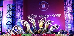
Hindol hosts five festivals every year, of which three are major. The most important of these is the Rath Yatra.

Harihat Mahotsav

Harihat Mahotsav 2016.jpg

Harihat Mahotsav is the oldest carnival of Hindol. The original name Harihat Mela was converted to Harihat Mahotsav in 2016. But Harihat Mela was an ancient traditional carnival of Hindol that was started many years before the Twentieth Yatra.

Hindol Laxmi Puja Committee

Hindol Town 15 Laxmi Puja Committees.

  • Radhakrushna Laxmi Puja Committee, Nutanpatana
  • Bus Stand Laxmi Puja Committee, Amalapada
  • Maudamani Laxmi Puja Committee, Post Office
  • Medical Choka Laxmi Puja Committee
  • Kalapana Bazar Laxmi Puja Committee, Nizigarhapatana
  • Mera Bazar Laxmi Puja Committee
  • Karigar Sahi Laxmi Puja Committee
  • Satya Sahi Laxmi Puja Committee, Nutanpatana-A
  • Gopala Sahi Laxmi Puja Committee, Nutanpatana-B
  • Banamalipur Laxmi Puja Committee
  • Pitabali Laxmi Puja Committee
  • Gopalapur Laxmi Puja Committee-A
  • Gopalapur Laxmi Puja Committee-B
  • Radhanathapura Laxmi Puja Committee
  • Champati Sahi Laxmi Puja Committee

Politics

Hindol is a part of Hindol Assembly constituency and Dhenkanal Parliamentary constituency. [3] [4]

Related Research Articles

<span class="mw-page-title-main">Bhadrak district</span> District of Odisha in India

Bhadrak is a district of Odisha state in eastern India. Bhadrak city is the headquarters and the largest city of the district.

<span class="mw-page-title-main">Rairangpur</span> City in Odisha, India

Rairangpur is a city and a tehsil in the Mayurbhanj district of the state of Odisha, India. It is located 287 kilometres from the state capital Bhubaneswar, 82 kilometres from the district headquarters of Baripada, and about 73 kilometres from Jamshedpur. Rairangpur is the second largest city in the Mayurbhanj district, a notable mining area of Odisha, producing iron-ore from the Gorumahisani, Badampahar, and Suleipat mines.

<span class="mw-page-title-main">Puri district</span> District of Odisha in India

Puri district is a coastal district of the Odisha state of India. It has one sub-division, 11 tahasils and 11 blocks and comprises 1722 revenue villages. Puri is the only municipality of the district. Konark, Pipili, Satyabadi, Gop, Kakatpur and Nimapada are the NACs in this district while Brahmagiri being a semi-urban town.

<span class="mw-page-title-main">Jharsuguda</span> Town in Odisha, India

Jharsuguda is a city and district headquarters of Jharsuguda district of Odisha, India. It is an industrial hub, consisting mainly of metallurgical industries. It is well connected to major cities of India through the rail network, and a recently inaugurated Jharsuguda Airport, now renamed as Veer Surendra Sai Airport. It is popularly known as the "Powerhouse of Odisha" due to its Mega Steel, Aluminium & Power Projects. Its First Industrialist in SSI Steel Sector of the Region was Jayprakash Badhan. Jharsuguda has often been referred as "Little India" as well because of its diverse demography, language and culture. One of the oldest bar and hotel in region is Kalinga Bar.

<span class="mw-page-title-main">Paralakhemundi</span> Place in Odisha, India

Paralakhemundi shortly known as Parala is district Headquarter of Gajapati district and one of the oldest Municipality established in 1885, in the Indian state of Odisha. Majority of the people in the town speak Odia. The city and the District share its boundaries with Andhra Pradesh. The adjacent town of Pathpatnam is separated by the River Mahendra Tanaya.In later medieval period it became capital of Paralakhemundi Estate of Eastern Ganga dynasty kings of Khemundi Branch. The town is well known for being an ancient cultural center of Odisha and birthplace of noted personalities including poet Gopalakrusna Pattanayaka, statesman Krushna Chandra Gajapati Narayan Deo, lexicographer Gopinatha Nanda Sharma and historian Satyanarayana Rajguru. This town is also known for its century old temples, monasteries, palaces and heritage buildings.

<span class="mw-page-title-main">Sambalpur</span> City in Odisha, India

Sambalpur is the fourth largest city in the Indian State of Odisha. It is located on the banks of river Mahanadi, with a population of 335,761. Prehistoric settlements have been recorded there. It is the home of the Sambalpuri sari.

<span class="mw-page-title-main">Belaguntha</span> Town in Odisha, India

Belaguntha or Bellaguntha is a town and a Notified Area Council (N.A.C.) in Odisha, India. It's famously known as The Brass Fish Town.

<span class="mw-page-title-main">Bhanjanagar</span> Town in Odisha, India

Bhanjanagar is a town and Municipality in Ganjam district in the state of Odisha, India.

This article lists the traditional festivals and other cultural events in the Odisha region of India. Odisha celebrates 13 festivals in 12 months as the saying goes Bāra Māsare Tera Parba.

Dhenkanal Lok Sabha constituency is one of the 21 Lok Sabha (parliamentary) constituencies in Odisha state in eastern India.

<span class="mw-page-title-main">Dashapalla</span> Town in Odisha, India

Dashapalla, also known as Daspalla, is an archaeologically important site situated in Nayagarh district, Odisha, India.

Sambalpur, in Western Odisha, is a region that has a distinct cultural identity. The songs, clothing, dances, language, Food and festivals celebrated in Sambalpur and Western Odisha are unique. This distinct cultural identity arises from the strong association of the tribal and folk communities which have been coexisting in Sambalpur and Other Districts Of Western Odisha Region for centuries.

Itamati is a village located in Nayagarh district of Odisha, India. It is 6 km from Nayagarh Town. Itamati is known as the major business centre of Nayagarh, Also known as the second largest village of Odisha.

<span class="mw-page-title-main">Hindol State</span>

Hindol State was one of the princely states of India during the British Raj. Its former territory is now part of Dhenkanal district. The state's former capital was the town of Hindol, Odisha. Until 1947, it was not part of British India but was subject to the suzerainty of the British crown, under the Orissa States Agency.

<span class="mw-page-title-main">Hindol Assembly constituency</span> Assembly constituency in Odisha

Hindol is a Vidhan Sabha constituency of Dhenkanal district, Odisha.

<span class="mw-page-title-main">Sunadhar</span> Village in Odisha, India

Sunadhar is a coastal village situated near the bank of the Devi River in the Jagatsinghpur district of Odisha, India. It is a part of the Gandakula region, which is divided into two villages, Bairakha and Sunadhar.

Dudurkote is a small town in the subdivision of Hindol in the Dhenkanal District of Orissa state. It is located 18 kilometres (11 mi) from NH 55 to Gudiakateni and NH 655 is passed through Dudurkote. It is surrounded by reserve forest from the East, South and West. It was a part of the Hindol princely State before independence. It is 60 kilometres (37 mi) from Dhenkanal.

<span class="mw-page-title-main">Kalingapal</span> Village in Odisha, India

Kalingapal is a twin/composite village consisting of two revenue villages known as Kalinga and Palachakada. It also includes a hamlet known as Bandhanali. This village is in Dhenkanal district, Odisha, India. It is about 40 kilometres (25 mi) from district headquarter Dhenkanal. It falls under Rasol Police station, which is 2 kilometres (1.2 mi) from the village.

Rasol is a village/Panchayat in Dhenkanal district, Odisha, India. It is about 40 kilometres (25 mi) from the district center of Dhenkanal, India. It is a focal point for nearby villages due to its important commercial market area. Rasol is surrounded by villages such as Kalingapal, Naukiari, Bahalunda, and Bankatia. The National Highway 655 (India) passes through Rasol.

References

  1. Dr. Bhagyalipi Malla (August 2007). "Amalgamation of Princely States" (PDF). Orissa Review. p. 94,98. Retrieved 18 July 2013.
  2. Subrata K. Mitra (31 January 2002). Power, Protest and Participation: Local Elites and Development in India. Taylor & Francis. pp. 63–. ISBN   978-0-203-22168-6 . Retrieved 18 July 2013.
  3. Assembly Constituencies and their EXtent
  4. Seats of Odisha

20°36′N85°12′E / 20.600°N 85.200°E / 20.600; 85.200