
Cyganka is a village in the administrative district of Gmina Dębe Wielkie, within Mińsk County, Masovian Voivodeship, in east-central Poland. It lies approximately 4 kilometres (2 mi) north-east of Dębe Wielkie, 6 km (4 mi) north-west of Mińsk Mazowiecki, and 35 km (22 mi) east of Warsaw.
Rysie is a village in the administrative district of Gmina Dębe Wielkie, within Mińsk County, Masovian Voivodeship, in east-central Poland. It lies approximately 3 kilometres (2 mi) north-east of Dębe Wielkie, 8 km (5 mi) north-west of Mińsk Mazowiecki, and 32 km (20 mi) east of Warsaw.
Antonina is a village in the administrative district of Gmina Dobre in Mińsk County, Masovian Voivodeship, east-central Poland. It lies approximately 3 kilometres (2 mi) northeast of Dobre, 20 km (12 mi) northeast of Mińsk Mazowiecki, and 51 km (32 mi) east of Warsaw.
Brzozowica is a village in the administrative district of Gmina Dobre, within Mińsk County, Masovian Voivodeship, in east-central Poland. It lies approximately 2 kilometres (1 mi) north of Dobre, 19 km (12 mi) north-east of Mińsk Mazowiecki, and 49 km (30 mi) east of Warsaw.

Walentów is a village in the administrative district of Gmina Dobre, within Mińsk County, Masovian Voivodeship, in east-central Poland. It lies approximately 3 kilometres (2 mi) north-east of Dobre, 20 km (12 mi) north-east of Mińsk Mazowiecki, and 51 km (32 mi) east of Warsaw.

Brzeziny is a village in the administrative district of Gmina Halinów, within Mińsk County, Masovian Voivodeship, in east-central Poland. It lies approximately 4 kilometres (2 mi) south of Halinów, 14 km (9 mi) west of Mińsk Mazowiecki, and 26 km (16 mi) east of Warsaw.
Chobot is a village in the administrative district of Gmina Halinów, within Mińsk County, Masovian Voivodeship, in east-central Poland. It lies approximately 4 kilometres (2 mi) north-east of Halinów, 14 km (9 mi) north-west of Mińsk Mazowiecki, and 28 km (17 mi) east of Warsaw.
Desno is a village in the administrative district of Gmina Halinów, within Mińsk County, Masovian Voivodeship, in east-central Poland. It lies approximately 5 kilometres (3 mi) east of Halinów, 12 km (7 mi) north-west of Mińsk Mazowiecki, and 29 km (18 mi) east of Warsaw.
Długa Kościelna is a village in the administrative district of Gmina Halinów, within Mińsk County, Masovian Voivodeship, in east-central Poland. It lies approximately 1 kilometre (1 mi) 16 km (10 mi) west of Mińsk Mazowiecki and 24 km (15 mi) east of Warsaw.
Długa Szlachecka is a village in the administrative district of Gmina Halinów, within Mińsk County, Masovian Voivodeship, in east-central Poland. It lies approximately 3 kilometres (2 mi) north-west of Halinów, 19 km (12 mi) north-west of Mińsk Mazowiecki, and 22 km (14 mi) east of Warsaw.
Grabina is a village in the administrative district of Gmina Halinów, within Mińsk County, Masovian Voivodeship, in east-central Poland. It lies approximately 3 kilometres (2 mi) west of Halinów, 19 km (12 mi) west of Mińsk Mazowiecki, and 22 km (14 mi) east of Warsaw.
Królewskie Brzeziny is a village in the administrative district of Gmina Halinów, within Mińsk County, Masovian Voivodeship, in east-central Poland. It lies approximately 3 kilometres (2 mi) west of Halinów, 18 km (11 mi) west of Mińsk Mazowiecki, and 22 km (14 mi) east of Warsaw.

Michałów is a village in the administrative district of Gmina Halinów, within Mińsk County, Masovian Voivodeship, in east-central Poland. It lies approximately 5 kilometres (3 mi) north-east of Halinów, 16 km (10 mi) north-west of Mińsk Mazowiecki, and 27 km (17 mi) east of Warsaw.
Mrowiska is a village in the administrative district of Gmina Halinów, within Mińsk County, Masovian Voivodeship, in east-central Poland. It lies approximately 2 kilometres (1 mi) east of Halinów, 15 km (9 mi) west of Mińsk Mazowiecki, and 26 km (16 mi) east of Warsaw.
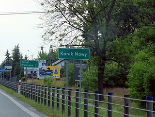
Nowy Konik is a village in the administrative district of Gmina Halinów, within Mińsk County, Masovian Voivodeship, in east-central Poland. It lies approximately 4 kilometres (2 mi) south-west of Halinów, 19 km (12 mi) west of Mińsk Mazowiecki, and 21 km (13 mi) east of Warsaw.
Okuniew is a village in the administrative district of Gmina Halinów, within Mińsk County, Masovian Voivodeship, in east-central Poland. It lies approximately 6 kilometres (4 mi) north-west of Halinów, 21 km (13 mi) north-west of Mińsk Mazowiecki, and 22 km (14 mi) east of Warsaw.
Wielgolas Brzeziński is a village in the administrative district of Gmina Halinów, within Mińsk County, Masovian Voivodeship, in east-central Poland. It lies approximately 5 kilometres (3 mi) south-east of Halinów, 13 km (8 mi) west of Mińsk Mazowiecki, and 27 km (17 mi) east of Warsaw.
Sulki is a village in the administrative district of Gmina Wierzbno, within Węgrów County, Masovian Voivodeship, in east-central Poland. It lies approximately 3 kilometres (2 mi) north-west of Wierzbno, 14 km (9 mi) south-west of Węgrów, and 60 km (37 mi) east of Warsaw.
Julia is a village in the administrative district of Gmina Ślesin, within Konin County, Greater Poland Voivodeship, in west-central Poland. It lies approximately 6 kilometres (4 mi) south-east of Ślesin, 15 km (9 mi) north-east of Konin, and 98 km (61 mi) east of the regional capital Poznań.


