
Tasmania is an island state of Australia. It is located 240 kilometres (150 miles) to the south of the Australian mainland, separated from it by the Bass Strait, with the archipelago containing the southernmost point of the country. The state encompasses the main island of Tasmania, the 26th-largest island in the world, and the surrounding 1000 islands. It is Australia's least populous state, with 569,825 residents as of December 2021. The state capital and largest city is Hobart, with around 40 percent of the population living in the Greater Hobart area.

The Aboriginal Tasmanians are the Aboriginal people of the Australian island of Tasmania, located south of the mainland. For much of the 20th century, the Tasmanian Aboriginal people were widely, and erroneously, thought of as being an extinct cultural and ethnic group that had been intentionally exterminated by white settlers. Contemporary figures (2016) for the number of people of Tasmanian Aboriginal descent vary according to the criteria used to determine this identity, ranging from 6,000 to over 23,000.

Lake Pedder, once a glacial outwash lake, is a man-made impoundment and diversion lake located in the southwest of Tasmania, Australia. In addition to its natural catchment from the Frankland Range, the lake is formed by the 1972 damming of the Serpentine and Huon rivers by the Hydro Electric Commission of Tasmania for the purposes of hydroelectric power generation.

Bruny Island is a 362-square-kilometre (140 sq mi) island located off the south-eastern coast of Tasmania, Australia. The island is separated from the Tasmanian mainland by the D'Entrecasteaux Channel, and its east coast lies within the Tasman Sea. Storm Bay is located to the island's northeast. Both the island and the channel are named after French explorer, Antoine Bruni d'Entrecasteaux. Its traditional Aboriginal name is lunawanna-allonah, which survives as the name of two island settlements, Alonnah and Lunawanna.

Huonville is a town on the Huon River, in the south-east of Tasmania, Australia. It is the seat of the Huon Valley Council area and lies 38 km south of Hobart on the Huon Highway. At the 2016 census, Huonville had a population of 2,714 and at the 2011 census had a population of 1,741.
The Midlands is a region of Tasmania between Launceston and Hobart. It also refers to the relatively flat, dry agricultural area, so named because it covers the region between the two cities. Its name is probably also influenced from the Midlands in the United Kingdom. It lends its name to the Southern Midlands Council, Northern Midlands Council, and the Midland Highway. The region is sometimes conflated or confused with the adjacent region of the Central Highlands—with the added term Tasmania's heartland.

The North Mount Lyell Railway was built to operate between the North Mount Lyell mine in West Coast Tasmania and Pillinger in the Kelly Basin of Macquarie Harbour.

The Central Highlands is a region in Tasmania, Australia where geographical and administrative boundaries closely coincide. It is also known as The Lake Country of Tasmania.
Richard Jones was one of the co-founders of the United Tasmania Group (UTG), the world's first Green party and the predecessor of the Tasmanian Greens. He was the UTG's first president when it formed in March 1972, through to the middle 1970s. At the time Jones was an academic biologist working at the University of Tasmania. He helped form the Centre for Environmental Studies Unit at the University of Tasmania and was active in transforming the Australian Conservation Foundation from an apolitical to a political force.
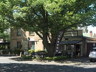
Cygnet is a town in the Huon Valley, south of Huonville, Tasmania.

The D'Entrecasteaux Channel is a body of water located between Bruny Island and the south-east of the mainland of Tasmania, Australia. The channel is the mouth for the estuaries of the Derwent and the Huon Rivers and empties into the Tasman Sea of the South Pacific Ocean. It was sighted by Abel Tasman in 1642 and surveyed in 1792 by Bruni d'Entrecasteaux.

Alonnah is a rural locality on Bruny Island in the local government area (LGA) of Kingborough in the Hobart LGA region of Tasmania. The locality is about 60 kilometres (37 mi) south of the town of Kingston. The 2021 census recorded a population of 164 for Alonnah.
Lunawanna is a small township on the western side of Bruny Island, Tasmania, facing the D'Entrecasteaux Channel. It is named after part of the Tasmanian Aboriginal name for Bruny Island, Lunawanna-alonnah, a nearby township about 5 kilometres (3.1 mi) to its north being named Alonnah.

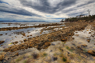
Kettering is a coastal town on the D'Entrecasteaux Channel opposite Bruny Island, Tasmania, Australia. At the 2011 census, Kettering had a population of 984.
The Companion to Tasmanian History was a book produced in 2005 by the Centre for Tasmanian Historical Studies at the University of Tasmania, in conjunction with the Tasmanian Government celebrations of the Bicentenary of Tasmania.

Mount Anne is a mountain located in the Southwest National Park in south-west region of Tasmania, Australia. The mountain lies within the UNESCO World Heritage-listed Tasmanian Wilderness.

The Partridge Island, part of the Partridge Island Group, is an 103-hectare (250-acre) island that lies close to the south-eastern coast of Tasmania, Australia. The island is situated in the D'Entrecasteaux Channel, between Bruny Island and the mainland of Tasmania and is part of the South Bruny National Park.
The Lake Pedder Action Committee was a Tasmanian environmental group.
Garden Island is a small stony island that is part of the Partridge Island Group, lying close to the south-eastern coast of Tasmania, Australia, in the D'Entrecasteaux Channel between Bruny Island and the mainland. The D'Entrecasteaux Channel is the mouth for the Huon River.
In the Australian state of Tasmania, there are many areas which are commonly known by regional names. Regions are areas that share similar characteristics. These characteristics may be natural such as the Furneaux Islands, the coastline, or the Central Highlands. Alternatively, the characteristics may be cultural, such as a viticulture land use. Tasmania is divided by numerous regional boundaries, based on different characteristics. In many cases boundaries defined by different government agencies are coterminous and are often cited by the Australian and local media that tend to distinguish between North West, West Coast, Southern, and East Coast.