History of Tasmania

Last updated

The history of Tasmania begins at the end of the Last Glacial Period (approximately 12,000 years ago) when it is believed that the island was joined to the Australian mainland. Little is known of the human history of the island until the British colonisation of Tasmania in the 19th century.

Contents

Indigenous people

Tasmania was inhabited by an Indigenous population, the Aboriginal Tasmanians, and evidence indicates their presence in the territory, later to become an island, at least 35,000 years ago.[ citation needed ] At the time of the British occupation and colonisation in 1803 the Indigenous population was estimated at between 3000 and 10,000. Historian Lyndall Ryan's analysis of population studies led her to conclude that there were about 7000 spread throughout the island's nine nations; [1] Nicholas Clements, citing research by N.J.B. Plomley and Rhys Jones, settled on a figure of 3000 to 4000. [2]

The combination of the so-called Black War, internecine conflict and, from the late 1820s, the spread of infectious diseases to which they had no immunity, [3] reduced the population to about 300 by 1833. Almost all of the Indigenous population was relocated to Flinders Island by George Augustus Robinson. Until the 1970s, most people thought that the last surviving Tasmanian Aboriginal person was Truganini, [4] who died in 1876. However, this "extinction" was a myth, as documented by Lyndall Ryan in 1991. [5]

European arrival

Seventeenth century map of Tasmania, showing the parts seen by Tasman. Tasmania 1644.png
Seventeenth century map of Tasmania, showing the parts seen by Tasman.
Melchisedech Thevenot (1620?-1692): Map of New Holland 1644, based on a map by the Dutch cartographer Joan Blaeu. Thevenot - Hollandia Nova detecta 1644.png
Melchisedech Thevenot (1620?–1692): Map of New Holland 1644, based on a map by the Dutch cartographer Joan Blaeu.

The first reported sighting of Tasmania by a European was on 24 November 1642 by the Dutch explorer Abel Tasman, who named the island Anthoonij van Diemenslandt, after his sponsor, the Governor of the Dutch East Indies. The name was later shortened to Van Diemen's Land by the British. In 1772, a French expedition led by Marc-Joseph Marion du Fresne landed on the island. Captain James Cook also sighted the island in 1777, and numerous other European seafarers made landfalls, adding a colourful array to the names of topographical features.

The first settlement was by the British at Risdon Cove on the eastern bank of the Derwent estuary in 1803, by a small party sent from Sydney, under Lt. John Bowen. An alternative settlement was established by Capt. David Collins 5 km to the south in 1804 in Sullivans Cove on the western side of the Derwent, where fresh water was more plentiful. The latter settlement became known as Hobart Town, later shortened to Hobart, after the British Colonial Secretary of the time, Lord Hobart. The settlement at Risdon was later abandoned.

The early settlers were mostly convicts and their military guards, with the task of developing agriculture and other industries. Numerous other convict settlements were made in Van Diemens Land, including secondary prisons, such as the particularly harsh penal colonies at Port Arthur in the south-east and Macquarie Harbour on the West Coast. The Aboriginal resistance to this invasion was so strong, that troops were deployed across much of Tasmania to drive the Aboriginal people into captivity on nearby islands.

Timeline

Pre-1800

1800–1809

Group of natives of Tasmania Robert Dowling - Group of natives of Tasmania - Google Art Project.jpg
Group of natives of Tasmania

1810–1819

Hobart Town chain gang Hobart Town chain gang.tif
Hobart Town chain gang
Proclamation issued in 1816 to promote friendship between Aboriginal and white people , though it had little effect Governor davies of van diemans land proclamation to aborigines.jpg
Proclamation issued in 1816 to promote friendship between Aboriginal and white people , though it had little effect

1820–1829

In 1820, Tasmanian roads were first macadamised and carthorses began to replace bullocks. In the same year, the first substantial jail was completed on the corner of Macquarie Street and Murray Street; and merino sheep arrived from John Macarthur's stud in New South Wales. 1820 also saw the first Wesleyan (Methodist) meeting in the colony. The following year marked the arrival of the first Catholic clergyman, Father Phillip Conolly; and on his second visit, Governor Lachlan Macquarie chose sites for Perth, Campbell Town, Ross, Oatlands, Sorell and Brighton. In 1821, officials and convicts left Port Dalrymple to establish Macquarie Harbour penal settlement at Sarah Island.

1822 was the first year Van Diemen's Land Agricultural Society held a meeting in Hobart. In 1823 the Presbyterian Church's first official ministry in Australia occurred in Hobart and the first Tasmanian bank, Bank of Van Diemen's Land, was established.

The inauguration of the Supreme Court occurred in 1824, as did the opening of Cascade Brewery, Australia's longest continuously operating Brewery. Convict Alexander Pearce was hanged after escaping twice from Macquarie Harbour and surviving by eating his companions. Convict Matthew Brady began his bushranging career after escaping from Macquarie Harbour.

On 3 December 1825, Van Diemen's Land became independent from New South Wales with an appointed Executive Council, its own judicial establishment, and Legislative Council. Also in that year, the Richmond Bridge, Australia's oldest existing bridge, was opened; and a party of soldiers and convicts established Maria Island penal settlement

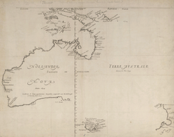
In 1826, Van Diemen's Land Company launched the North-West pastoral and agricultural development at Circular Head; and the Tasmanian Turf Club was established. Settler John Batman, later one of Melbourne's founders, helped capture bushranger Matthew Brady near Launceston. Hobart experienced a disease epidemic which was blamed on rivulet pollution. A courthouse was built on the corner of Macquarie Street and Murray Street; and street lighting with oil lamps was introduced. 1826 was also the year that the Legislative Council met formally for the first time.

1827 saw the first regatta-style events on Derwent River; and Van Diemen's Land Company began settlement at Emu Bay (now Burnie).

A proclamation made in 1828 by Lieutenant-Governor George Arthur excluded Aboriginal people from settled areas and was the year of the Cape Grim massacre. In 1828, martial law was also declared against Aboriginal people in settled areas after Van Diemen's Land Company shepherds killed 30 Aboriginal people at Cape Grim. Regular mail services to and from Sydney began. That year also saw widespread floods. The following year a jail for women convicts ("female factory") opened at Cascades; "Protector" George Augustus Robinson started an Aboriginal mission at Bruny Island, convicts seized the brig Cyprus at Recherche Bay and sailed to China; Van Diemen's Land Scientific Society was formed under patronage of Lieutenant-Governor George Arthur; and a Hobart-New Norfolk coach service began.

1830–1839

A map of Tasmania from 1837. 1837 Dower Map of Van Dieman's Land or Tasmania - Geographicus - Tazmania-dower-1837.jpg
A map of Tasmania from 1837.

1840–1849

1850–1859

1860–1869

1870–1879

1880–1889

1890–1899

1900–1909

Horace Watson recording the songs of Fanny Cochrane Smith, considered to be the last fluent speaker of a Tasmanian language, 1903. Fanny Cochrane Smith recording.jpg
Horace Watson recording the songs of Fanny Cochrane Smith, considered to be the last fluent speaker of a Tasmanian language, 1903.

1910–1919

1920–1929

1930–1939

1940–1949

1950–1959

1960–1969

1970–1979

A video by the ABC about the introduction of daylight saving time.

1980–1989

1990–1999

2000–present

See also

References and sources

References
  1. Ryan, Lyndall (2012), Tasmanian Aborigines, Sydney: Allen & Unwin, pp. 4, 43, ISBN   978-1-74237-068-2
  2. Clements, Nicholas (2013), Frontier Conflict in Van Diemen's Land (Ph.D. thesis) (PDF), University of Tasmania, pp. 324, 325
  3. Clements, Nicholas (2013), Frontier Conflict in Van Diemen's Land (Ph.D. thesis) (PDF), University of Tasmania, pp. 329–331
  4. Bonwick, James: The Last of the Tasmanians, p 270-295
  5. Ryan, Lyndall: The Aboriginal Tasmanians, 1991
  6. Baker, W. T (1961), Adventure Bay - explorers landfall , retrieved 17 March 2020
  7. Van Diemen's Land. Legislative Council; Barnard, James, fl. 1839-1880., (printer.); Tasmania Laws, etc (1838), [Collection of Acts passed by the Legislative Council of Van Diemen's Land concerning prisoners and prisons] , retrieved 17 March 2020{{citation}}: CS1 maint: multiple names: authors list (link) CS1 maint: numeric names: authors list (link)
  8. Farrell, David M. The Australian Electoral System. p. 27.
Sources

Related Research Articles

<span class="mw-page-title-main">Hobart</span> Capital city of Tasmania, Australia

Hobart is the capital and most populous city of the island state of Tasmania, Australia. Home to almost half of all Tasmanians, it is the southernmost and least-populated Australian state capital city, and second-smallest if territories are taken into account, before Darwin, Northern Territory. Hobart is located in Tasmania's south-east on the estuary of the River Derwent, making it the most southern of Australia's capital cities. Its skyline is dominated by the 1,271-metre (4,170 ft) kunanyi/Mount Wellington, and its harbour forms the second-deepest natural port in the world, with much of the city's waterfront consisting of reclaimed land. The metropolitan area is often referred to as Greater Hobart, to differentiate it from the City of Hobart, one of the seven local government areas that cover the city. It has a mild maritime climate.

<span class="mw-page-title-main">Tasmania</span> State of Australia

Tasmania is an island state of Australia. It is located 240 kilometres (150 miles) to the south of the Australian mainland, separated from it by the Bass Strait, with the archipelago containing the southernmost point of the country. The state encompasses the main island of Tasmania, the 26th-largest island in the world, and the surrounding 1000 islands. It is Australia's least populous state, with 569,825 residents as of December 2021. The state capital and largest city is Hobart, with around 40 percent of the population living in the Greater Hobart area. Tasmania is the most decentralised state in Australia, with the lowest proportion of it residents living within its capital city.

<span class="mw-page-title-main">Van Diemen's Land</span> British colony, later called Tasmania

Van Diemen's Land was the colonial name of the island of Tasmania used by the British during the European exploration and colonisation of Australia in the 19th century. A British settlement was established in Van Diemen's Land in 1803 before it became a separate colony in 1825. Its penal colonies became notorious destinations for the transportation of convicts due to the harsh environment, isolation and reputation for being inescapable. Macquarie Harbour and Port Arthur are among the most well-known penal settlements on the island.

<span class="mw-page-title-main">River Derwent (Tasmania)</span> River in south east Tasmania, Australia

The River Derwent is a river located in Tasmania, Australia. It is also known by the palawa kani name timtumili minanya. The river rises in the state's Central Highlands at Lake St Clair, and descends more than 700 metres (2,300 ft) over a distance of more than 200 kilometres (120 mi), flowing through Hobart, the state's capital city, before emptying into Storm Bay and flowing into the Tasman Sea. The banks of the Derwent were once covered by forests and occupied by Aboriginal Tasmanians. European settlers farmed the area and during the 20th century many dams were built on its tributaries for the generation of hydro-electricity.

<span class="mw-page-title-main">Black War</span> Period of violent conflict between British colonists and Aboriginal Australians in Tasmania

The Black War was a period of violent conflict between British colonists and Aboriginal Tasmanians in Tasmania from the mid-1820s to 1832. The conflict, fought largely as a guerrilla war by both sides, claimed the lives of 600 to 900 Aboriginal people and more than 200 British colonists. The near-destruction of the Aboriginal Tasmanians and the frequent incidence of mass killings have sparked debate among historians over whether the Black War should be defined as an act of genocide.

<span class="mw-page-title-main">Risdon Cove</span> Cove near Hobart, Tasmania, Australia

Risdon Cove is a cove located on the east bank of the Derwent River, approximately 7 kilometres (4 mi) north of Hobart, Tasmania. It was the site of the first British settlement in Van Diemen's Land, now Tasmania, the island state of Australia. The cove was named by John Hayes, who mapped the river in the ship Duke of Clarence in 1794, after his second officer William Bellamy Risdon.

<span class="mw-page-title-main">City of Clarence</span> Local government area in Tasmania, Australia

Clarence City Council is a local government body in Tasmania, and one of the five municipalities that constitutes the Greater Hobart Area. The Clarence local government area has a population of 61,531, covering the eastern shore of the Derwent River from Otago to the South Arm Peninsula and the smaller localities of Cambridge, Richmond, and Seven Mile Beach.

<span class="mw-page-title-main">George Town, Tasmania</span> Town in Tasmania, Australia

George Town is a large town in north-east Tasmania, on the eastern bank of the mouth of the Tamar River. The Australian Bureau of Statistics records the George Town Municipal Area had a population of 6,764 as of 30 June 2016.

<span class="mw-page-title-main">New Norfolk</span> Town in Tasmania, Australia

New Norfolk is a town on the River Derwent, in the south-east of Tasmania, Australia. With a population of 6,153 in 2021, New Norfolk is the principal township of the Derwent Valley region. Located within the Derwent Valley Council, New Norfolk is situated 32 kilometres (20 mi) north-west of the state capital Hobart on the Lyell Highway and classified as part of the Greater Hobart statistical area.

<span class="mw-page-title-main">Geilston Bay, Tasmania</span> Suburb of Hobart, Tasmania, Australia

Geilston Bay is a largely residential suburb of Hobart between Risdon Vale, Shag Bay, and Lindisfarne, in the City of Clarence located on the Eastern Shore of the Derwent River, taking its name from an inlet of that river of the same name. The inlet and locality were sometimes known by the alternative name "Limekiln Bay" on account of lime kilns which operated there between approximately the 1830s and the 1920s, the remains of which remained visible for some decades thereafter; another early name for the Bay was "James's Bay". The present suburb name derives from an early land holding "Geils Town" in the region purchased by Andrew Geils, Commandant of Van Diemen's Land (Tasmania) for a brief period in 1812-1813, who subsequently left his Australian holdings behind when he moved back to Scotland.

<span class="mw-page-title-main">Convicts on the West Coast of Tasmania</span>

The West Coast of Tasmania has a significant convict heritage. The use of the west coast as an outpost to house convicts in isolated penal settlements occurred in the eras 1822–33, and 1846–47.

<span class="mw-page-title-main">Convicts in Australia</span> Transportation of convicts to Australia

Between 1788 and 1868 the British penal system transported about 162,000 convicts from Great Britain and Ireland to various penal colonies in Australia.

The modern history of the Australian city of Hobart in Tasmania dates to its foundation as a British colony in 1804. Prior to British settlement, the area had been occupied definitively for at least 8,000 years, and possibly for as long as 35,000 years, by the semi-nomadic Mouheneener tribe, a sub-group of the Nuenonne, or South-East tribe. The descendants of theses indigenous Tasmanians now refer to themselves as 'Palawa'. Little is known about the region from prehistoric times. As with many other Australia cities, urbanisation has destroyed much of the archaeological evidence of indigenous occupation, although aboriginal middens are often still present in coastal areas.

The following lists events that happened during 1804 in Australia.

<span class="mw-page-title-main">Campbell Town, Tasmania</span> Town in Tasmania, Australia

Campbell Town is a town in Tasmania, Australia, on the Midland Highway. At the 2021 census, the town had a population of 823.

The Lieutenant Governor's Court was a court established in the early 19th century in the colony of Van Diemen's Land which subsequently became Tasmania, a state of Australia. The court had jurisdiction to deal with civil disputes where the amount in dispute was not more than £50 sterling in the colony. The establishment of the court was the first practical civil court in the settlement. This was an important first step in improving the resolution of civil disputes in the settlement. The Supreme Court of Van Diemen's Land eventually replaced it in 1823 when the court's charter was revoked by the Third Charter of Justice.

Mount Heemskirk is a mountain in Western Tasmania, west of the West Coast Range. It has an elevation of 751 metres (2,464 ft) above sea level. The closest town is Zeehan, about 14 kilometres (9 mi) away.

<span class="mw-page-title-main">Colony of Tasmania</span> British colony (1856–1901)

The Colony of Tasmania was a British colony that existed on the island of Tasmania from 1856 until 1901, when it federated together with the five other Australian colonies to form the Commonwealth of Australia. The possibility of the colony was established when the Parliament of the United Kingdom passed the Australian Constitutions Act in 1850, granting the right of legislative power to each of the six Australian colonies. The Legislative Council of Van Diemen's Land drafted a new constitution which they passed in 1854, and it was given royal assent by Queen Victoria in 1855. Later in that year the Privy Council approved the colony changing its name from "Van Diemen's Land" to "Tasmania", and in 1856, the newly elected bicameral parliament of Tasmania sat for the first time, establishing Tasmania as a self-governing colony of the British Empire. Tasmania was often referred to as one of the "most British" colonies of the Empire.

<span class="mw-page-title-main">William Buelow Gould</span> English and Van Diemonian painter

William Buelow Gould was an English and Van Diemonian (Tasmanian) painter. He was transported to Australia as a convict in 1827, after which he would become one of the most important early artists in the colony, despite never really separating himself from his life of crime.

The British colonisation of Tasmania took place between 1803 and 1830. Known as Van Diemen's Land, the name changed to Tasmania, when the British government granted self-governance in 1856. It was a colony from 1856 until 1901, at which time it joined five other colonies to form the Commonwealth of Australia. By the end of the colonisation in 1830 the British Empire had annexed large parts of mainland Australia, and all of Tasmania.