History of Harringay

Last updated

The history of Harringay tells the story of the development of the district of London five miles from its centre, affected by, but not always part of, the great city's history.

Contents

Toponymy

It is very probable that the name Harringay has its origin in the Saxon period, most likely derived from the name of a Saxon person, probably a local chieftain, called HeringHeringes-hege in Old English means the enclosure of "Hering". The earliest written form was Harenhg in about 1195. It gave rise to the names Harringay (the district of London), the London Borough of Haringey, and Hornsey (a nearby district of London). Its development into these three forms was complex and included at least 162 variations. Since the history of Hornsey is mostly common with that of present-day Harringay and the etymology is shared, both are covered in this section. The name of the London Borough of Haringey is included to explain spelling differences.

In 1243, the name was recorded as Haringesheye, an intermediate form between the Saxon Heringes-hege and its three present-day forms. With the second ‘g’ pronounced as ‘y’ in Old English, it can be seen how close the two versions were. In 1371 Haryngeay was recorded, and 16 years later Haringey appeared for the first time, making it the oldest of the three present-day forms. Haryngay appeared in 1393 and Harringay in 1569. The variant that became Hornsey developed the addition of an 's' in the middle with the use of Harnsey, recorded in 1392, and Hornsey appeared in 1646. [1]

Until the close of the eighteenth century all variants referred to the same area, around present-day Harringay and Hornsey, but from the late Tudor period Hornsey took precedence in common usage: Harringay survived more as a legal entity and in the records of the Manor of Harringay.

The building of the large mansion of Harringay House in 1792 at the top of the hill between present-day Hewitt and Allison Roads saw the divergence of meaning of the names. Hornsey referred to the present-day district and subsequently the parish and Middlesex borough; Harringay to the house, its surrounding park and finally the present-day district, and continued as the common name in manorial records.

Whilst the early residents of Harringay continued to use that name, in official documents from the early twentieth century the Borough of Hornsey referred to it as Haringey, which became the name of the London Borough of Haringey, created in 1964 when the Boroughs of Hornsey, Wood Green and Tottenham merged. A letter from a council officer in 1983 said, "When Tottenham and Hornsey were joined to form the new borough in 1964, the choice of name rested with a special panel which, after public consultation, opted for one of the spellings of the modern Borough of Hornsey. We are not aware of the reasons for that choice". [2] Pupils in local schools at the time were taught that the new borough's name should be pronounced with the same ending as Finchley, Hackney and Hornsey. [3]

Prehistory to 1750

In the Ice Age, Harringay was at the edge of a huge glacial mass that reached as far south as Muswell Hill. [4] There is evidence of both Stone Age and Bronze Age activity in the immediate vicinity. [5] In the 5th and 6th centuries the Saxon invasions brought Haering, the chieftain whose name still lives on today in local placenames. At the time of Domesday, the western part of modern Harringay was within the Manor of Harengheie and part of the Bishop of London's principal Manor of Stepney. [4] The eastern part was within the Manor of Tottenham held by Waltheof II, Earl of Northumbria, the last of the great Anglo-Saxon Earls. [6]

From Domesday to the middle of the eighteenth century, Harringay was transformed from a mainly forested area to a pastoral one. It remained sparsely inhabited. Beyond the clearance of the forests, few incursions were made into Harringay lands save for the New River, the building of which presaged the more drastic developments to come.

1750 to 1880

In 1750 the area that was to become Harringay was almost all agricultural land with only a few buildings. Over the 130 years to 1880, significant parts were brought into a more modern use, either as comfortable houses or as parkland. Most notably, Harringay House was built at the top of the hill between the present-day Hewitt and Allison Roads. At the southern end of Green Lanes, a large tile kiln and pottery was developed. But by 1880, fewer than two dozen buildings existed. Finsbury Park and nearby Alexandra Park were laid out during this period. And, perhaps most significantly, two railways were built, which, more than anything, presaged the next chapter in Harringay's history.

1880 – present day

The last 20 years of the nineteenth century saw the disappearance of Harringay House with the surrounding parkland and farmland under the advance of late Victorian urbanisation.

From 1900, Harringay was spread across the borders of the urban districts, later municipal boroughs, of Hornsey and Tottenham in Middlesex.

Following the Second World War, Harringay began to change as immigration altered the character of the district.

In 1965 it was unified under one local authority with the creation of the London Borough of Haringey.

Harringay and entertainment

From 1750 until the second half of the twentieth century Harringay gained fame as an entertainment centre. In the second half of the eighteenth century Hornsey Wood House was developed as a private leisure park and became one of the most popular places for Londoners to escape from the city at the weekends. Finsbury Park, the development of which swept the old tavern away, was the first major metropolitan park in England and was hugely popular in its heyday. In the early twentieth century Harringay Stadium and Harringay Arena drew crowds to the area.

Economic history

Relying on agriculture for most of its recorded history, Harringay had a busy tile kiln, pottery and brickfields from the late eighteenth to the early twentieth century. [7]

Transport & communications history

The history of transport and communications through Harringay had a significant effect on shaping it today.

Early roadways

In Roman times, a great road to the north was established. [8] This endured as a great line of communication and brought much activity through the heart of the area. It also acted as the rough dividing line for land ownership, identifying Harringay's position on the edge of manorial and subsequently borough boundaries.

Rail

In the mid-nineteenth century, the arrival of the Great Northern Railway (GNR) cleaved Harringay from the rest of its ancient borough. The subsequent arrival of the Tottenham and Hampstead Junction Railway (THJR) almost defined its present-day southern boundary. Harringay's development in the late nineteenth century was of a markedly different nature from what occurred to the west of the GNR and to the south of the THJR.

The Tube

On two occasions in the early twentieth century, a Tube station was almost built in Harringay.

References & notes

  1. Madge, Stephen J. (1936). The Origin of the Name of Hornsey. Public Libraries Committee Hornsey., The writer is much indebted to the enormously scholarly work of Stephen Madge whose exhaustive and painstaking research conducted over a period of 35 years should be regarded as the definitive text on the origins of the name Harringay. The first part of this section is entirely based on his work.
  2. Pout, Richard (2004). Hornsey Historical Society Journal, 45.
  3. Valerie Crosby, Archivist, Bruce Castle Archives, London Borough of Haringey, 2007
  4. 1 2 Madge, Stephen J. (1938). The Early Records of Harringay alias Hornsey. Public Libraries Committee Hornsey.
  5. T. F. T. Baker & C. R. Elrington (Editors) (1985). A History of the County of Middlesex, Volume 8: Islington and Stoke Newington Parishes. Victoria County History.{{cite book}}: |last= has generic name (help)
  6. T. F. T. Baker & R.B. Pugh (Editors) (1976). A History of the County of Middlesex, Volume 5: Hendon, Kingsbury, Great Stanmore, Little Stanmore, Edmonton Enfield, Monken Hadley, South Mimms, Tottenham. Victoria County History.{{cite book}}: |last= has generic name (help)
  7. Cryer, Pat (2006). "The Tile Kilns, Tottenham, Green Lanes: Overview". Archived from the original on 1 July 2007. Retrieved 14 July 2007.
  8. See Early history page.

Related Research Articles

<span class="mw-page-title-main">Hornsey</span> Area of London, England

Hornsey is a district of north London, England, in the London Borough of Haringey. It is an inner-suburban, for the most part residential, area centred 10 km (6.2 mi) north of Charing Cross. It adjoins green spaces Queen's Wood to the west and Alexandra Park to the north, and lies in the valley of the now-culverted Moselle river. Known locally as Hornsey Village it is present-day London's oldest-recorded village, first recorded in 1202, according to the Place Names of Middlesex.

<span class="mw-page-title-main">Muswell Hill</span> Suburb in north London, England

Muswell Hill is a suburban district of the London Borough of Haringey, north London. The hill, which reaches over 100 m (330 ft) above sea level, is situated 5.5 miles (8.9 km) north of Charing Cross.

<span class="mw-page-title-main">Wood Green</span> District in England

Wood Green is a suburban district in the borough of Haringey in London, England. Its postal district is N22, with parts in N8 or N15. The London Plan identifies it as one of the metropolitan centres in Greater London, and today it forms a major commercial district of north London.

<span class="mw-page-title-main">London Borough of Haringey</span> Borough in United Kingdom

The London Borough of Haringey is a London borough in North London, classified by some definitions as part of Inner London, and by others as part of Outer London. It was created in 1965 by the amalgamation of three former boroughs. It shares borders with six other London boroughs. Clockwise from the north, they are: Enfield, Waltham Forest, Hackney, Islington, Camden, and Barnet.
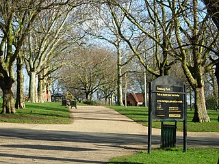
<span class="mw-page-title-main">Finsbury Park</span> Public park in Haringey, London, England

Finsbury Park is a public park in the London neighbourhood of Harringay. It is in the area formerly covered by the historic parish of Hornsey, succeeded by the Municipal Borough of Hornsey. It was one of the first of the great London parks laid out in the Victorian era. The park borders the neighbourhoods of Harringay, Finsbury Park, Stroud Green, and Manor House.

Seven Sisters is a district of Tottenham, north London, England, at the eastern end of Seven Sisters Road, which runs from Tottenham High Road to join the A1 in Holloway.

<span class="mw-page-title-main">Crouch End</span> Human settlement in England

Crouch End is an area of North London, approximately five miles (8 km) from the City of London in the western half of the borough of Haringey. It is within the Hornsey postal district (N8). It has been described by the BBC as one of "a new breed of urban villages" in London. It was recently voted the best place to live in London by the Sunday Times, who said, "A creative edge and friendly neighbours give this lofty northern enclave social capital in the capital".

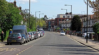
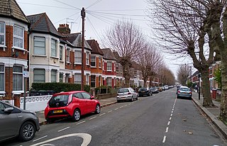
Harringay is a district of north London, England, within the London Borough of Haringey. It is centred on the section of Green Lanes running between the New River, where it crosses Green Lanes by Finsbury Park, and Duckett's Common, near Turnpike Lane.

<span class="mw-page-title-main">Tottenham (UK Parliament constituency)</span> Parliamentary constituency in the United Kingdom, 1950 onwards

Tottenham is a constituency in Greater London represented in the House of Commons of the UK Parliament since 2000 by David Lammy of the Labour Party. Lammy has served as Shadow Secretary of State for Foreign, Commonwealth and Development Affairs since 2021 in the Shadow Cabinet of Keir Starmer, in which he previously served as Shadow Secretary of State for Justice and Shadow Lord Chancellor from 2020 to 2021. Tottenham was re-created as a parliamentary constituency in 1950, having previously existed from 1885 to 1918.

<span class="mw-page-title-main">Municipal Borough of Hornsey</span>

The Municipal Borough of Hornsey was a local government district in east Middlesex from 1867 to 1965.

Hornsey was an ancient parish in the county of Middlesex. It was both a civil parish, used for administrative purposes, and an ecclesiastical parish of the Church of England.

<span class="mw-page-title-main">Lordship Lane, Haringey</span>

Lordship Lane connects Wood Green (N22) with Tottenham High Road (N17). It lies in the London Borough of Haringey and forms part of the A109 road.

<span class="mw-page-title-main">West Green, London</span> Sub-district of Tottenham, north London

West Green is an area of north London, England, in the United Kingdom and part of the London Borough of Haringey. It is located 5.7 miles (9.22 km) north of Charing Cross.

During this period Harringay emerged from the mist of prehistory as a thickly forested area of southern England. By 1750 most of the forest had been cleared for agriculture, although settlement was still sparse.

This significant period in Harringay's history witnessed the transition from a purely pastoral society and set the stage for the upheavals of the late 19th century.

The advance of late Victorian urbanisation during the last twenty years of the 19th century swept away the 18th and early 19th-century houses, their grounds and the farmland. By 1900 Harringay was completely urbanised.

<span class="mw-page-title-main">Tottenham</span> Human settlement in England

Tottenham is a town in north London, England, within the London Borough of Haringey. It is located in the ceremonial county of Greater London. Tottenham is centred 6 mi (10 km) north-northeast of Charing Cross, bordering Edmonton to the north, Walthamstow, across the River Lea, to the east, and Stamford Hill to the south, with Wood Green and Harringay to the west.

St Ann's is a neighbourhood in Tottenham, north London, England, in the London Borough of Haringey. It is located to the east of Harringay and West Green and is within, but distinct from, St Ann's ward.

<span class="mw-page-title-main">Duckett's Green</span> Human settlement in England

Duckett's Green is an area of north London, England in the United Kingdom and part of the London Borough of Haringey. It is an inner-suburban area located 5.8 miles (9.4 km) north of Charing Cross.