
Oakham is a market town and civil parish in Rutland in the East Midlands of England. The town is located 25 miles (40.2 km) east of Leicester, 28 miles (45.1 km) south-east of Nottingham and 23 miles (37.0 km) north-west of Peterborough. It had a population of 12,149 in the 2021 census. Oakham is to the west of Rutland Water and in the Vale of Catmose. Its height above sea level ranges from 325 to 400 ft.

Frisby on the Wreake is a village and civil parish on the River Wreake about 3.5 miles (5.6 km) west of Melton Mowbray, Leicestershire, England. The 2011 Census recorded the parish's population as 557.

Melton is a local government district with borough status in north-eastern Leicestershire, England. It is named after its only town, Melton Mowbray. The borough also includes numerous villages and surrounding rural areas. The north of the district includes part of the Vale of Belvoir. Melton is the least populous district of its type and the fourth least populous district in England overall.

Bottesford is a village and civil parish in the Borough of Melton in the ceremonial county of Leicestershire, England. It lies close to the borders of Nottinghamshire and Lincolnshire.
Bitteswell is a small village and former civil parish, now in the parish of Bitteswell with Bittesby, in the Harborough district of Leicestershire in England. It is situated just north of the town of Lutterworth, and in the 2001 census had a population of 454. The population had increased to 554 at the 2011 census. It was recorded in the Domesday Book as Betmeswelle. The village's name means 'the spring/stream in the broad valley'.

Elmesthorpe is a village and civil parish in the Blaby district of Leicestershire, England. It is situated to the south-east of Earl Shilton, near to Hinckley on the A47 road. In 2004, the parish had an estimated population of 520, reducing to 509 at the 2011 census.

Thrussington is a village and civil parish in the Charnwood district of Leicestershire, England. The population of the civil parish at the 2011 census was 587. It is on the River Wreake, near to Rearsby, Ratcliffe on the Wreake, Hoby and Brooksby, and not far from the path of the Fosse Way.

Charley is a civil parish located in the North West Leicestershire district of Leicestershire, England. According to the 2001 census, it had a population of 203, increasing to 236 at the 2011 census. It is set within the Charnwood Forest.

Great Easton is a village and civil parish in the Harborough district of Leicestershire, England. The parish had a population of 558 according to the 2001 census, increasing to 671 at the 2011 census.

Garthorpe is a village and civil parish in Leicestershire, England, in the Melton district. It is about five miles east of Melton Mowbray. The parish includes the villages of Garthorpe and Coston, and is near Saxby, Wymondham, Buckminster and Sproxton.

Freeby is a village and civil parish in the Melton district of Leicestershire, England, about 3 miles (5 km) east of Melton Mowbray. As well as the village of Freeby the civil parish includes the villages of Brentingby, Saxby, Stapleford and Wyfordby. The 2011 Census recorded the parish population as 244.
Croxton Kerrial is a village and civil parish in the Melton borough of Leicestershire, England, 6.6 miles (10.6 km) south-west of Grantham, 7.9 miles (12.7 km) north-east of Melton Mowbray, and 0.5 miles (0.8 km) west of Leicestershire's border with Lincolnshire. The civil parish includes the village of Branston and had a population of 530 at the 2011 census.
Hallaton is a village and civil parish in the Harborough district of Leicestershire, England. According to the 2001 census the parish had a population of 523, which had increased to 594 at the 2011 census.

Great Dalby is a village and former civil parish, now in the parish of Burton and Dalby, in the Melton district, in the county of Leicestershire, England, with a population of between 300 and 400. It is referred to in some UK census records as Dalby Magna. It is 3 miles south of Melton Mowbray.

Gaddesby is a village and civil parish in the Melton borough of Leicestershire, England. The population of the civil parish at the 2011 census was 762. It is located around 5.5 miles (8.9 km) southwest of Melton Mowbray and 8 miles (13 km) northeast of Leicester.
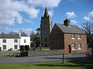
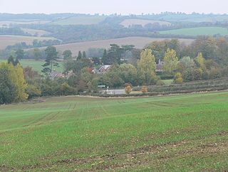
Brooksby is a deserted village and former civil parish, now in the parish of Hoby with Rotherby, in the Melton district, in Leicestershire, England. It was the ancestral home of the Villiers family. Brooksby and surrounding villages were served by Brooksby railway station. In 1931 the parish had a population of 69.
East Norton is a small village and parish located in the east of Leicestershire, adjoining the A47 Leicester to Uppingham road. According to the 2001 Census, it had a population of 94 in 37 households. The population remained less than 100 at the 2011 census and details are included in the civil parish of Loddington. East Norton is situated in the Tilton Ward in the Rural East area of the Harborough District, and the Launde Electoral Division of the Leicestershire County Council. Nationally it is in the Rutland and Melton Parliamentary Constituency and the Three Cities Sub-Area of the East Midlands Region.

Grimston is a village and civil parish in the Melton district, in the English county of Leicestershire. The parish includes the village of Saxelbye and the hamlet of Shoby. The population of the civil parish at the 2011 census was 294. On 1 April 1936 the parishes of Saxelby and Shoby were merged with Grimston. Although the current civil parish is called "Grimston" its parish council is called "Grimston, Saxelbye and Shoby Parish Council".

Rotherby is a village and former civil parish, 9 miles (14 km) north east of Leicester, now in the parish of Hoby with Rotherby, in the Melton district, in the county of Leicestershire, England. In 1931 the parish had a population of 133.

The Church of St Michael and All Angels is a church in Brooksby, Leicestershire. It is a Grade II* listed building.


