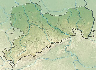
Hohburg Hills

Last updated
Hohburg Hills
Saxony relief location map.jpg
Red triangle with thick white border.svg
Hohburg Hills
Relief Map of Germany.svg
Red triangle with thick white border.svg
Hohburg Hills
Hohburg Hills (Germany)
Highest point
Peak Löbenberg
Elevation 240.0 m (787.4 ft)
Coordinates 51°26′N12°48′E / 51.433°N 12.800°E / 51.433; 12.800 Coordinates: 51°26′N12°48′E / 51.433°N 12.800°E / 51.433; 12.800
Geography
Location Hohburg, Nordsachsen, Lossatal, Saxony, Germany

The Hohburg Hills (German : Hohburger Berge), also called Hohburg Switzerland (Hohburger Schweiz), are located in the district of Nordsachsen near the eponymous village of Hohburg in the municipality of Lossatal in the German state of Saxony.

Contents

Geography

These quartz-porphyry hills rise prominently up to 120 metres out of the surround plain of the Leipzig Bay, east of the River Mulde. Their highest point is the Löbenberg at (240 m above  sea level (NN) ). Other high points are the Gaudlitzberg (219 m above NN), the Burzelberg (217 m above NN) and the Galgenberg ("Gallows Hill", 213 m above NN). South of Hohburg is the Kleine Berg ("Little Hill") with a height of 206 m above NN.

In the valley lying amongst the Hohburg Hills, the stream of the Lossabach flows through Müglenz, Hohburg, Klein- and Großzschepa to empty into the Mulde near Thallwitz.

History

The Hohburg Hills were shaped by decades of intensive stone quarrying. This produced steep rock faces and several lakes in the hollows that were left behind. The rock faces, up to forty meters high, have been used for climbing since 1925. Climbers from the area, such as Felix Simon, made use of the terrain as a training ground for the Alps. Many of the climbs used in those days fell victim to ongoing quarry operations. From 1965, the Schwarze Wand ("Black Wall") has been used for Alpine training (aid climbing). Since the mid-1990s, many, new, very difficult routes have emerged as part of a further wave of development. Currently, there are over 500 climbing routes in various quarries. [1]

Lake formed as a result of quartz porphyry quarrying near Hohburg Steinbruchsee.jpg
Lake formed as a result of quartz porphyry quarrying near Hohburg

Related Research Articles

<span class="mw-page-title-main">Mountaineering</span> Sport of mountain climbing

Mountaineering, mountain climbing, or alpinism, is a set of outdoor activities that involves ascending mountains. Mountaineering-related activities include traditional outdoor climbing, skiing, and traversing via ferratas that have become sports in their own right. Indoor climbing, sport climbing, and bouldering are also considered variants of mountaineering by some, but are part of a wide group of mountain sports.

<span class="mw-page-title-main">Grade (climbing)</span> Degree of difficulty of a climbing route

In rock climbing, mountaineering, and other climbing disciplines, climbers give a grade to a climbing route or boulder problem, intended to describe concisely the difficulty and danger of climbing it. Different types of climbing each have their own grading systems, and many nationalities developed their own, distinctive grading systems.

<span class="mw-page-title-main">Harz</span> Low mountain range in northern Germany

The Harz is a highland area in northern Germany. It has the highest elevations for that region, and its rugged terrain extends across parts of Lower Saxony, Saxony-Anhalt, and Thuringia. The name Harz derives from the Middle High German word Hardt or Hart. The name Hercynia derives from a Celtic name and could refer to other mountain forests, but has also been applied to the geology of the Harz. The Brocken is the highest summit in the Harz with an elevation of 1,141.1 metres (3,744 ft) above sea level. The Wurmberg is the highest peak located entirely within the state of Lower Saxony.

<span class="mw-page-title-main">Snowdon</span> Highest mountain in Wales

Snowdon or Yr Wyddfa, is the highest mountain in Wales, at an elevation of 1,085 metres (3,560 ft) above sea level, and the highest point in the British Isles outside the Scottish Highlands. It is located in Snowdonia National Park in Gwynedd.

<span class="mw-page-title-main">Ore Mountains</span> Mountain range in Central Europe

The Ore Mountains lie along the Czech–German border, separating the historical regions of Bohemia in the Czech Republic and Saxony in Germany. The highest peaks are the Klínovec in the Czech Republic, which rises to 1,244 metres (4,081 ft) above sea level and the Fichtelberg in Germany.

<span class="mw-page-title-main">Matterhorn</span> Mountain in the Swiss and Italian Alps

The Matterhorn is a mountain of the Alps, straddling the main watershed and border between Switzerland and Italy. It is a large, near-symmetric pyramidal peak in the extended Monte Rosa area of the Pennine Alps, whose summit is 4,478 metres (14,692 ft) high, making it one of the highest summits in the Alps and Europe. The four steep faces, rising above the surrounding glaciers, face the four compass points and are split by the Hörnli, Furggen, Leone/Lion, and Zmutt ridges. The mountain overlooks the Swiss town of Zermatt, in the canton of Valais, to the northeast; and the Italian town of Breuil-Cervinia in the Aosta Valley to the south. Just east of the Matterhorn is Theodul Pass, the main passage between the two valleys on its north and south sides, which has been a trade route since the Roman Era.

<span class="mw-page-title-main">Penmaenmawr</span> Human settlement in Wales

Penmaenmawr is a town and community in Conwy County Borough, Wales, which was formerly in the parish of Dwygyfylchi and the traditional county of Caernarfonshire. It is on the North Wales coast between Conwy and Llanfairfechan and was an important quarrying town, though quarrying is no longer a major employer. The population of the community was 4,353 in 2011, including Dwygyfylchi and Capelulo. The town itself having a population of 2,868 (2011).

<span class="mw-page-title-main">Fair Head</span> Dolerite mountain cliff, Northern Ireland

Fair Head or Benmore is a 5-kilometre (3.1 mi) long, 200-metre (660 ft) high, mountain cliff, close to the sea, at the north-eastern corner of County Antrim, Northern Ireland. The cliff's sheer and vertical 100-metre (330 ft) high dolerite rock face is shaped into distinctive vertical columns like organ pipes, which formed 60 million years ago when a sill of igneous rock was injected between horizontal Carboniferous sediments.

<span class="mw-page-title-main">Via ferrata</span> Protected alpine climbing route

A via ferrata is a protected climbing route found in the Alps and certain other Alpine locations. The protection includes steel fixtures such as cables and railings to arrest the effect of any fall, which the climber can either hold onto or clip into using climbing protection. Some via ferrata can also include steel fixtures that provide aid in overcoming the obstacles encountered, including steel ladders and steel steps. The term "via ferrata" is used in most countries and languages except notably in German-speaking regions, which use Klettersteig—"climbing path".

<span class="mw-page-title-main">Dow Crag</span> Fell in the Lake District, Cumbria, England

Dow Crag is a fell in the English Lake District near Coniston, Cumbria. The eastern face is one of the many rock faces in the Lake District used for rock climbing.

<span class="mw-page-title-main">Lingmoor Fell</span> Fell in the Lake District, Cumbria, England

Lingmoor Fell is a fell in the English Lake District, situated eight kilometres west of Ambleside. The fell reaches a height of 469 m (1,540 ft) and divides the valleys of Great Langdale and Little Langdale. The fell's name originates from the Old Norse word lyng meaning “heather covered”. The actual summit of the fell is named as Brown How on Ordnance Survey maps.

<span class="mw-page-title-main">Allgäu Alps</span> Mountain range in the Northern Limestone Alps

The Allgäu Alps are a mountain range in the Northern Limestone Alps, located in Bavaria and Baden-Württemberg in Germany and Tyrol and Vorarlberg in Austria. The range lies directly east of Lake Constance.

<span class="mw-page-title-main">Staunton (near Coleford)</span> Human settlement in England

Staunton is a village and civil parish in the Forest of Dean in west Gloucestershire, England, close to the border with Wales.

<span class="mw-page-title-main">Ith</span>

The Ith is a ridge in Germany's Central Uplands which is up to 439 m high. It lies about 40 km southwest of Hanover and, at 22 kilometres, is the longest line of crags in North Germany.

<span class="mw-page-title-main">Süntel</span>

The Süntel  is a massif in the German Central Uplands that is up to 437.5 m above sea level (NN). It forms part of the Weser Uplands in Lower Saxony southwest of Hanover and north of Hamelin.

<span class="mw-page-title-main">Bückeberg</span> Hill range in Germany

The Bückeberg is a small hill range, up to 375 metres (1,230 ft) high, in the Calenberg Uplands between the Harrl and the Deister in central Germany, and is often considered part of the Weser Uplands. It lies in the district of Schaumburg, and stretches for some 20 km (12 mi) from west to east from Bückeburg and the village of Bad Eilsen towards Bad Nenndorf.

<span class="mw-page-title-main">Kästeklippen</span>

The Kästeklippen, often shortened to Käste, is a rocky tor above the Oker valley in the Upper Harz mountains of central Germany. It lies at a height of 602 m above NN.

<span class="mw-page-title-main">Rochlitzer Berg</span> Mountain in Germany

Rochlitzer Berg is a mountain of volcanic origin in Saxony, southeastern Germany. It is situated south-west of the town of Rochlitz on the river Zwickauer Mulde. Its elevation is variously given as 348.9 m NHN, 348 m HN or 353 m NN. The mountain is also known as Rochlitzer Collm.

<span class="mw-page-title-main">Rehburg Hills</span>

The Rehburg Hills are a hill range, up to 161.4 m above sea level (NN), in the districts of Nienburg and Schaumburg in Lower Saxony, Germany.

<span class="mw-page-title-main">Beckum Hills</span> Hill range in Germany

The Beckum Hills, named after the town of Beckum, are a range of low hills, up to 174.4 m above sea level (NN), in the region of Münsterland in the German state of North Rhine-Westphalia (Germany). Along with the Baumberge and its foothills and the Haltern Hills they are among the few prominent elevations in the otherwise gently rolling Münsterland, the River Werse passes the ridge at 100 m to the east and the Lippe passing it at a height of 60 m near Hamm-Uentrop at some distance away from their highest point.

References

  1. "Hohburger Berge". the Crag. Archived from the original on August 16, 2019. Retrieved August 16, 2019.