Hohensaaten

Last updated
Hohensaaten
Location of Hohensaaten
Hohensaaten
Germany adm location map.svg
Red pog.svg
Hohensaaten
Brandenburg location map.svg
Red pog.svg
Hohensaaten
Coordinates: 52°52′N14°09′E / 52.867°N 14.150°E / 52.867; 14.150
Country Germany
State Brandenburg
District Märkisch-Oderland
Town Bad Freienwalde
Area
  Total21.90 km2 (8.46 sq mi)
Elevation
2 m (7 ft)
Population
 (2006-12-31)
  Total784
  Density36/km2 (93/sq mi)
Time zone UTC+01:00 (CET)
  Summer (DST) UTC+02:00 (CEST)
Postal codes
16248
Dialling codes 033368
Website www.hohensaaten.de

Hohensaaten is a village and a former municipality in Brandenburg in Germany. Since 1 January 2009, it is part of the municipality Bad Freienwalde. [1]

History

Hohensaaten was first mentioned in 1258. The village belonged to Barnim district.

From 1815 to 1947, Hohensaaten was part of the Prussian Province of Brandenburg, from 1947 to 1952 of the State of Brandenburg, from 1952 to 1990 of the Bezirk Frankfurt of East Germany and since 1990 again of Brandenburg.

After a year-long dispute between municipal board and citizens, partly because of averse to the Barnim district, the treaty of mergence with city of Bad Freienwalde was signed on 14 November 2008. [2] Since 1 January 2009, it is part of the municipality Bad Freienwalde, hence part of Märkisch-Oderland district.

Related Research Articles

<span class="mw-page-title-main">Bad Freienwalde</span> Town in Brandenburg, Germany

Bad Freienwalde is a spa town in the Märkisch-Oderland district in Brandenburg, Germany.

<span class="mw-page-title-main">Panketal</span> Municipality in Brandenburg, Germany

Panketal is a municipality in the district of Barnim, in Brandenburg, Germany. It is situated 15 km northeast of Berlin (centre).

<span class="mw-page-title-main">Ahrensfelde</span> Municipality in Brandenburg, Germany

Ahrensfelde is a municipality in the district of Barnim, in Brandenburg, Germany. It is situated on the Barnim Plateau at the city limits of Berlin, about 13 km (8.1 mi) northeast of the city centre. The municipal area comprises the villages of Ahrensfelde, Blumberg, Eiche, Lindenberg, and Mehrow.

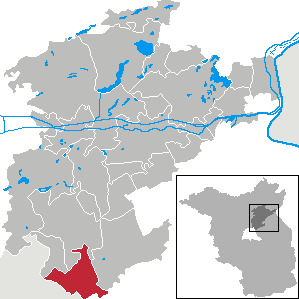
Hohenwutzen is a small village in the German state of Brandenburg, located on the Oder river. Since 2003, Hohenwutzen is part of Bad Freienwalde. It was part of It is one of the few villages of the historic Neumark region still in Germany after 1945.

<span class="mw-page-title-main">Wriezen</span> Town in Brandenburg, Germany

Wriezen is a town in the district Märkisch-Oderland, in Brandenburg, Germany. It is situated 11 km southeast of Bad Freienwalde.

<span class="mw-page-title-main">Schorfheide, Brandenburg</span> Municipality in Brandenburg, Germany

Schorfheide is a municipality in the Barnim district of Brandenburg, Germany. It was established in 2003 by the merger of Finowfurt and Groß Schönebeck.

<span class="mw-page-title-main">Althüttendorf</span> Municipality in Brandenburg, Germany

Althüttendorf is a municipality in the district of Barnim in Brandenburg in Germany.

<span class="mw-page-title-main">Breydin</span> Municipality in Brandenburg, Germany

Breydin is a municipality in the Barnim district of Brandenburg in Germany.

<span class="mw-page-title-main">Britz, Brandenburg</span> Municipality in Brandenburg, Germany

Britz is a municipality in the district of Barnim in Brandenburg in Germany.

<span class="mw-page-title-main">Chorin</span> Municipality in Brandenburg, Germany

Chorin is a municipality in the district of Barnim in Brandenburg, Germany. It is most famous for its cloister and for being situated within the Schorfheide-Chorin Biosphere Reserve. It is famous for its medieval Brick Gothic Chorin Abbey and the Choriner Musiksommer music festival held there.

<span class="mw-page-title-main">Hohenfinow</span> Municipality in Brandenburg, Germany

Hohenfinow is a municipality in the Barnim district in Brandenburg, Germany. It is part of the Amt Amt Britz-Chorin-Oderberg.

<span class="mw-page-title-main">Liepe</span> Municipality in Brandenburg, Germany

Liepe is a municipality in the district of Barnim in Brandenburg in Germany.

<span class="mw-page-title-main">Lunow-Stolzenhagen</span> Municipality in Brandenburg, Germany

Lunow-Stolzenhagen is a municipality in the district of Barnim in Brandenburg in Germany.

<span class="mw-page-title-main">Melchow</span> Municipality in Brandenburg, Germany

Melchow is a municipality in the district of Barnim in Brandenburg in Germany.

<span class="mw-page-title-main">Niederfinow</span> Municipality in Brandenburg, Germany

Niederfinow is a municipality in the district of Barnim in Brandenburg in Germany.

<span class="mw-page-title-main">Rüdnitz</span> Municipality in Brandenburg, Germany

Rüdnitz is a municipality in the district of Barnim in the state of Brandenburg, Germany.

<span class="mw-page-title-main">Sydower Fließ</span> Municipality in Brandenburg, Germany

Sydower Fließ is a municipality in the district of Barnim in Brandenburg in Germany.

<span class="mw-page-title-main">Ziethen, Brandenburg</span> Municipality in Brandenburg, Germany

Ziethen is a municipality in the district of Barnim in Brandenburg in Germany.

<span class="mw-page-title-main">Friedrichswalde</span> Municipality in Brandenburg, Germany

Friedrichswalde is a municipality in the district of Barnim in Brandenburg in Germany. It is situated in the Schorfheide nature reserve.

<span class="mw-page-title-main">Märkisch-Oderland – Barnim II</span>

Märkisch-Oderland – Barnim II is an electoral constituency represented in the Bundestag. It elects one member via first-past-the-post voting. Under the current constituency numbering system, it is designated as constituency 59. It is located in eastern Brandenburg, comprising the Märkisch-Oderland district and southern parts of the Barnim district.

References