Hoher Stoppelkopf

Last updated
Hoher Stoppelkopf

Steinmann als Wegzeichen im Pfalzer-Wald P1000426.jpg

Wayside cairn marking a track near the Stoppelkopf
Highest point
Elevation 566.2 m above  sea level (NN) (1,857 ft) [1]
Coordinates 49°23′50″N8°04′25″E / 49.3972°N 8.0737°E / 49.3972; 8.0737 Coordinates: 49°23′50″N8°04′25″E / 49.3972°N 8.0737°E / 49.3972; 8.0737
Geography
Rhineland-Palatinate relief location map.svg
Red triangle with thick white border.svg
Hoher Stoppelkopf
Parent range Palatine Forest
Geology
Mountain type Bunter sandstone

The Hohe Stoppelkopf, locally just called the Stoppelkopf, is a 566.2-metre-high hill [1] in the Palatine Forest in the German state of Rhineland-Palatinate. It lies 3 km north of the small town of Lambrecht.

Rhineland-Palatinate State in Germany

Rhineland-Palatinate is a state of Germany.

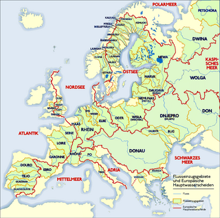
Together with the Drachenfels (577 m) to the northwest and the Stabenberg (496 m) to the east, the Stoppelkopf lies on the watershed between the catchment areas of two Palatine Rhine tributaries, the Speyerbach (south) and the Isenach (north). The two longest tributaries of the Mußbach rise on the Stoppelkopf; both later empty into the left mouth branch of the Speyerbach, the Rehbach.

Drachenfels (Central Palatinate Forest) mountain in the northern Palatine Forest, Germany

The Drachenfels is a hill in the northern part of the Palatine Forest in the German state of Rhineland-Palatinate) on the forest estate of the county town of Bad Dürkheim. At 570.8 m above sea level (NHN), it is the highest point of the Palatine Forest north of the Hochspeyerbach - Speyerbach line. The Drachenfels area has been designated as a nature reserve.

Drainage divide Elevated terrain that separates neighbouring drainage basins

A drainage divide, water divide, divide, ridgeline,, watershed, water parting or height of land is elevated terrain that separates neighbouring drainage basins. On rugged land, the divide lies along topographical ridges, and may be in the form of a single range of hills or mountains, known as a dividing range. On flat terrain, especially where the ground is marshy, the divide may be harder to discern.

Palatinate (region) geographic region

The Palatinate, historically also Rhenish Palatinate, is a region in southwestern Germany. It occupies roughly the southernmost quarter of the German federal state of Rhineland-Palatinate (Rheinland-Pfalz), covering an area of 5,451 square kilometres (2,105 sq mi) with about 1.4 million inhabitants. Its residents are known as Palatines.

Attractions

About 110 metres north-northeast of the summit of the Hoher Stoppfelkopf a hunting lodge was built in 1900, the Hermannshütte (also called the Emil Leidner Hut), [2] [3] which is unmanaged. At the top a summit cross was erected in 2003 by the Deidesheim Branch of the Palatine Forest Club. [2] About 2 km northeast of the Stoppelkopf lies the deer conservation park, the Kurpfalz Park, [4] which is accessible from Wachenheim on a well-developed tarmac road (8 km).

Summit cross

A summit cross is a cross on the summit of a mountain or hill that marks the top. Often there will be a summit register (Gipfelbuch) at the cross, either in a container or at least a weatherproof case.

Palatine Forest Club organization

The Palatine Forest Club is a hiking club in the former Bavarian Palatinate, i.e. the southern part of the German state of Rhineland-Palatinate and the Saarland county of Saarpfalz-Kreis. In 2011 it had 221 local branches with around 27,000 members.

Deer A family of mammals belonging to even-toed ungulates

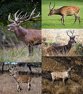
Deer are the hoofed ruminant mammals forming the family Cervidae. The two main groups of deer are the Cervinae, including the muntjac, the elk (wapiti), the fallow deer, and the chital; and the Capreolinae, including the reindeer (caribou), the roe deer, and the moose. Female reindeer, and male deer of all species except the Chinese water deer, grow and shed new antlers each year. In this they differ from permanently horned antelope, which are part of a different family (Bovidae) within the same order of even-toed ungulates (Artiodactyla).

Related Research Articles

Palatinate Forest low mountain range in Germany

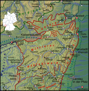
The Palatinate Forest, sometimes also called the Palatine Forest, is a low-mountain region in southwestern Germany, located in the Palatinate in the state of Rhineland-Palatinate. The forest is a designated nature park covering 1,771 km2 and its highest elevation is the Kalmit.

Kalmit highest peak in the Palatinate Forest, Germany

The Kalmit is the highest peak in the Palatinate Forest and the second highest in the Palatinate region of Germany. It is 672.6 m above sea level (NHN) and located 5.5 kilometres (3.4 mi) south of the town of Neustadt an der Weinstraße.

North Palatine Uplands mountains in Germany

The North Palatine Uplands, sometimes incorrectly shortened to Palatine Uplands, is a low mountain range and landscape unit in the German state of Rhineland-Palatinate and belongs mainly to the Palatinate region. It is part of the Saar-Nahe Uplands.

Speyerbach river in Germany

The Speyerbach is a left tributary of the Rhine in the Palatinate part of Rhineland-Palatinate. In Speyer, the river split into Gießhübelbach and Woogbach. The Woogbach changes its name to Nonnenbach, then flows into Gießhübelbach shortly before the latter flows into the Rhine.

Mußbach stream in Germany

The Mußbach is a stream, nearly 12 kilometres (7.5 mi) long, in the eastern Palatinate Forest and in the Anterior Palatinate region in the south of German state of Rhineland-Palatinate. The former village of Mußbach was named after it.

Palatine Watershed

The Palatine Watershed forms the main drainage divide in the Palatinate between the Upper Rhine and the Middle Rhine, the two successive sections of the river Rhine that flow through the German state of Rhineland-Palatinate.

Diemerstein Forest forest

Diemerstein Forest is a part of the Palatine Forest, a mountainous region within the German state of Rhineland-Palatinate. It has an area of about 50 km².

Blättersberg mountain

The Blättersberg near Rhodt unter Rietburg in the Rhenish-Palatine county of Südliche Weinstraße is a mountain, 613.2 m above sea level (NHN), in the Palatine Forest in the German state of Rhineland-Palatinate.

Roßberg (Haardt) mountain in Germany

The Roßberg near Ramberg in the county of Südliche Weinstraße in the German state of Rhineland-Palatinate is, at 637 m above sea level (NHN), the third highest mountain in the Palatine Forest.
Schindhübel mountain in Rhineland-Palatinate Germany

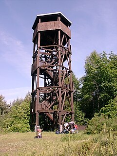
The Schindhübel is a hill, 571 m above sea level (NN), that rises in the middle of the Palatine Forest in Germany, 5 kilometres southwest of Elmstein.

Steigerkopf Mountain in Germany

The Steigerkopf, also colloquially called the Schänzel, near Edenkoben in the county of Südliche Weinstraße in the German state of Rhineland-Palatinate, is a mountain, 613.6 m above sea level (NHN), in the Palatine Forest. At the summit, which lies on the territory of Gommersheim, is the Schänzel tower.

Weinbiet mountain in Germany

The Weinbiet is a hill, 554 m above sea level (NHN), in the borough of Neustadt an der Weinstraße in the German state of Rhineland-Palatinate and is one of the highest hills in the Haardt, the line of mountains and hills forming the eastern edge of the Palatine Forest and facing the Upper Rhine Plain. On the summit is an inn, the Weinbiethaus, a stone-built panorama tower with a weather station and a radio transmission mast.

Peterskopf (Haardt) mountain

The Peterskopf, near the Palatine county town of Bad Dürkheim in the German state of Rhineland-Palatinate, is a 487-metre-high hill in the Haardt mountains. On its summit is the Bismarck tower.
Queitersberg mountain

The Queitersberg, more rarely spelt Quaidersberg, Quaitersberg or Queidersberg, is a 394-metre-high hill in the northern Palatine Forest in the German state of Rhineland-Palatinate. On a subpeak is the natural monument of the Felsplatt, a rock formation.

Modenbach river in Germany

The Modenbach is a stream, just under 30 kilometres (19 mi) long, and a right-hand tributary of the Speyerbach in the German state of Rhineland-Palatinate.

Drei Buchen mountain pass

Drei Buchen is a hill pass in the central Palatine Forest in the German state of Rhineland-Palatinate. It lies in the estate of the village of Ramberg at a height of 403 metres above sea level (NHN). The L 506 state road runs over the pass from Ramberg to Weyher. At the top of the pass is an inn, the Waldhaus Drei Buchen. The name Drei Buchen means "Three Beeches".

Idarkopf mountain in Germany

The Idarkopf near Stipshausen in the Hunsrück is a mountain, 745.7 m above sea level (NHN), within the Idar Forest in the German counties of Birkenfeld and Bernkastel-Wittlich. It is one of the highest mountains in the state of Rhineland-Palatinate.

Hochstein (Eifel) mountain

The Hochstein is a volcanic cone, 563 m above sea level (NHN), in the Eifel near Obermendig in the German state of Rhineland-Palatinate and county ofMayen-Koblenz.

Trödelsteine (mountain) mountain in Germany

The Trödelsteine is the name of a mountain, 613 m above sea level (NHN), in the Heller Upland near Emmerzhausen in the county of Altenkirchen in the German state of Rhineland-Palatinate and in the county of Siegen-Wittgenstein in the state of North Rhine-Westphalia with its summit area in Rhineland-Palatinate.

References

  1. 1 2 Map service of the Landscape Information System of the Rhineland-Palatinate Nature Conservation Office (Naturschutzverwaltung Rheinland-Pfalz)
  2. 1 2 "Nachtwanderung des PWV Esthal". mittelpfalz.de. Retrieved 2014-09-17.
  3. "„Hermanns-Hütte" am Hinteren Stoppelkopf". tourenwelt.info. Retrieved 2014-09-17.
  4. "Wild und Natur erleben". Kurpfalz-Park. Archived from the original on 2014-09-16. Retrieved 2014-09-16.