Kawakami is a district in north-central Kushiro Subprefecture, Hokkaido, Japan.

MBK Center, also known as Mahboonkrong, is a large shopping mall in Bangkok, Thailand. At eight storeys, the center contains around 2,000 shops, restaurants and service outlets.
Samish Island is an unincorporated community in Skagit County, Washington, United States. It lies on an island 48°34′25″N122°31′48″W with the same name, which is located off the northwest coast of the Washington mainland. It is connected to the mainland by land reclaimed through a system of dikes created in the early 20th century.

Kakata District is one of four districts located in Margibi County, Liberia. Kakata, the capital city of Margibi County, is located in the district.

The Northern Great Plain is a statistical region of Hungary. It is part of the Great Plain and North region. The Northern Great Plain includes the counties of Hajdú-Bihar, Jász-Nagykun-Szolnok, and Szabolcs-Szatmár-Bereg, with a total area of 17,749 km2 (6,853 sq mi) and a population of around 1.5 million.
Muć is a village and a municipality in Croatia. It is part of the Split-Dalmatia County, located in the Zagora region near Sinj. The total population of the municipality is 4,074, and it is made up of 17 villages.

Úhořilka is a small village in the Havlíčkův Brod District, Vysočina Region of the Czech Republic. 51 people live in Úhořilka and it has 2,52 km². It was first documented in 1454.

Turar Ryskulov is a district of Jambyl Region in south-eastern Kazakhstan. The administrative center of the district is auyl of Kulan.
Mostki is a village in the administrative district of Gmina Narewka, within Hajnówka County of Podlaskie Voivodeship in north-eastern Poland. This village is close to the border with Belarus. It lies approximately 10 kilometres (6 mi) north of Narewka, 26 km (16 mi) north-east of Hajnówka, and 48 km (30 mi) south east of the regional capital of Białystok.

The Pashleth Glacier is a glacier south of the Machmell River and west of the Klinaklini Glacier in southwestern British Columbia, Canada.
Ayıbasar is a village in the Lachin District of Azerbaijan.
Suchodoły is a settlement in the administrative district of Gmina Kętrzyn, within Kętrzyn County, Warmian-Masurian Voivodeship, in northern Poland.

Glückauf-Kampfbahn is a multi-use stadium in Gelsenkirchen, North Rhine-Westphalia, Germany. It was initially used as the stadium of FC Schalke 04 matches. It was replaced by Parkstadion in 1973. The capacity of the stadium is 11,000 spectators.
Gornje Peulje is a village in the Municipality of Bosansko Grahovo, Canton 10 of the Federation of Bosnia and Herzegovina, an entity of Bosnia and Herzegovina.
Lamwo is a town in the Northern Region of Uganda and the political and administrative center of Lamwo District.

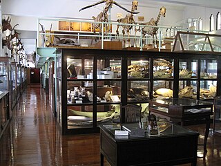
The Chulalongkorn University Museum of Natural History, founded in 1954, is operated by the Chulalongkorn University's Faculty of Science in the Biology Building at the university's main campus in Bangkok, Thailand. The museum features exhibits of various organisms, including mounts of the endangered white-eyed river martin. The majority of the museum's exhibits are housed in its main hall, with dedicated rooms featuring Thai turtles and softshells, insects and land snails.
Fifteen is an unincorporated community in Washington County, in the U.S. state of Ohio.
Tenmile Creek is a stream in Butler and Carter counties in the U.S. state of Missouri. It is a tributary of Cane Creek.
Bolgarka is a selo in Alga District, Aktobe Region, west Kazakhstan. It lies at an altitude of 241 m (791 ft). Population: 480 ; 922.
Metalton is an unincorporated community in southern Carroll County, Arkansas United States. The community is located on Arkansas Highway 21 between Cabanal to the north and Omega to the south. The communities of Rudd and Gobbler lie to the southeast along Arkansas Highway 103. The community lies near the intersection of Piney Creek with its tributary Cedar Creek. The community sits at an elevation of 1,345 ft (410 m).


